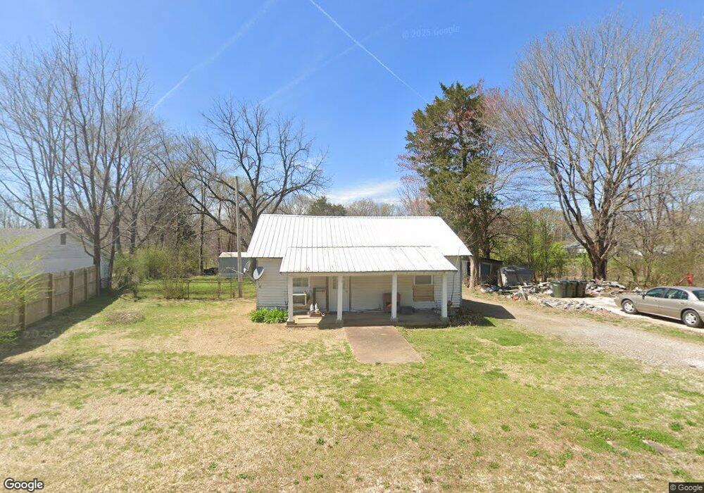
9125 Highway 70 Cedar Grove, TN 38321
Estimated Value: $60,596 - $152,000
--
Bed
1
Bath
886
Sq Ft
$113/Sq Ft
Est. Value
About This Home
This home is located at 9125 Highway 70, Cedar Grove, TN 38321 and is currently estimated at $100,149, approximately $113 per square foot. 9125 Highway 70 is a home located in Carroll County with nearby schools including West Carroll Primary School, West Carroll Elementary School, and West Carroll Junior/Senior High School.
Ownership History
Date
Name
Owned For
Owner Type
Purchase Details
Closed on
Feb 27, 2019
Sold by
Fry Mary Elizabeth
Bought by
Tart Robert Miles
Current Estimated Value
Purchase Details
Closed on
Feb 1, 2000
Sold by
Hamilton Howard
Bought by
Fry Mary Elizabeth
Purchase Details
Closed on
May 8, 1995
Sold by
Carroll Bank & Trust
Bought by
Hamilton Howard
Purchase Details
Closed on
Mar 15, 1995
Sold by
Carroll Bank & Trust
Bought by
Carroll Bank & Trust
Purchase Details
Closed on
Nov 10, 1989
Bought by
Rummage Richard Allen
Purchase Details
Closed on
Dec 26, 1987
Bought by
Reynolds Daniel and Paul T Denise M
Create a Home Valuation Report for This Property
The Home Valuation Report is an in-depth analysis detailing your home's value as well as a comparison with similar homes in the area
Home Values in the Area
Average Home Value in this Area
Purchase History
| Date | Buyer | Sale Price | Title Company |
|---|---|---|---|
| Tart Robert Miles | -- | -- | |
| Fry Mary Elizabeth | $17,000 | -- | |
| Hamilton Howard | $13,000 | -- | |
| Carroll Bank & Trust | $14,500 | -- | |
| Rummage Richard Allen | $11,900 | -- | |
| Reynolds Daniel | -- | -- |
Source: Public Records
Tax History Compared to Growth
Tax History
| Year | Tax Paid | Tax Assessment Tax Assessment Total Assessment is a certain percentage of the fair market value that is determined by local assessors to be the total taxable value of land and additions on the property. | Land | Improvement |
|---|---|---|---|---|
| 2024 | $203 | $7,700 | $1,575 | $6,125 |
| 2023 | $203 | $7,700 | $1,575 | $6,125 |
| 2022 | $203 | $7,700 | $1,575 | $6,125 |
| 2021 | $109 | $7,700 | $1,575 | $6,125 |
| 2020 | $203 | $7,700 | $1,575 | $6,125 |
| 2019 | $129 | $4,450 | $1,575 | $2,875 |
| 2018 | $129 | $4,450 | $1,575 | $2,875 |
| 2017 | $129 | $4,450 | $1,575 | $2,875 |
| 2016 | $189 | $4,450 | $1,575 | $2,875 |
| 2015 | $133 | $4,450 | $1,575 | $2,875 |
| 2014 | $121 | $4,450 | $1,575 | $2,875 |
| 2013 | $121 | $3,920 | $0 | $0 |
Source: Public Records
Map
Nearby Homes
- 9115 Highway 70 E
- 9100 Highway 70 E
- 392 Howley Ln
- 80 Water Tower Rd
- 10533 Highway 70
- 10533 Highway 70 E
- 9173 Tennessee 104
- 670 Jones Ln
- 233 Zara Spook Dr
- 297 Zara Spook Dr
- 398 War Eagle Dr
- 102 Excalibur Trail
- 100 Excalibur Trail
- 139 Zara Spook Dr
- 188 Strike King Dr
- 234 Excalibur Trail
- 237 Excalibur Trail
- 240 War Eagle Dr
- 239 Excalibur Trail
- 191 Strike King Dr
- 9115 Highway 70
- 9161 Highway 70
- 9150 Highway 70
- 9095 Highway 70
- 9175 Highway 70
- 9215 Highway 70
- 9045 Highway 70
- 9006 Highway 70
- 57 Parker Store Rd
- 9240 Highway 70
- 9290 Highway 70
- 9310 Highway 70
- 8890 Highway 70
- 300 Howley Ln
- 8805 Highway 70
- 242 Howley Ln
- 8800 Highway 70
- 0 Howley Ln
- 180 Howley Ln
- 9490 Highway 70