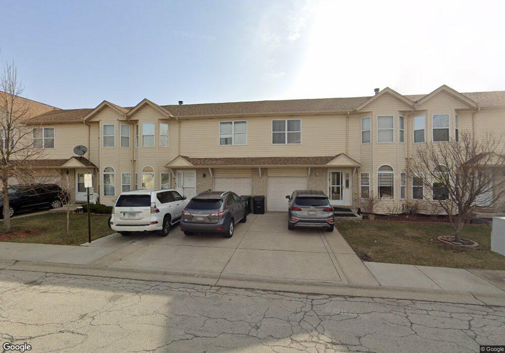
9127 Falcon Ridge Dr Bridgeview, IL 60455
Little Palestine NeighborhoodEstimated Value: $296,000 - $343,000
3
Beds
3
Baths
1,860
Sq Ft
$172/Sq Ft
Est. Value
About This Home
This home is located at 9127 Falcon Ridge Dr, Bridgeview, IL 60455 and is currently estimated at $319,670, approximately $171 per square foot. 9127 Falcon Ridge Dr is a home located in Cook County with nearby schools including Dorn Elementary School, Glen Oaks Elementary School, and H H Conrady Jr High School.
Ownership History
Date
Name
Owned For
Owner Type
Purchase Details
Closed on
Dec 14, 2020
Sold by
Ibrahim Mohamed and Hijazi Hadia
Bought by
Monasar Abdulrehman S
Current Estimated Value
Home Financials for this Owner
Home Financials are based on the most recent Mortgage that was taken out on this home.
Original Mortgage
$216,000
Interest Rate
2.99%
Mortgage Type
New Conventional
Purchase Details
Closed on
May 11, 2001
Sold by
Gazda Arthur
Bought by
Ibrahim Mohamed and Hijazi Hadia
Home Financials for this Owner
Home Financials are based on the most recent Mortgage that was taken out on this home.
Original Mortgage
$159,100
Interest Rate
7.07%
Create a Home Valuation Report for This Property
The Home Valuation Report is an in-depth analysis detailing your home's value as well as a comparison with similar homes in the area
Home Values in the Area
Average Home Value in this Area
Purchase History
| Date | Buyer | Sale Price | Title Company |
|---|---|---|---|
| Monasar Abdulrehman S | $240,000 | Citywide Title Corporation | |
| Ibrahim Mohamed | $167,500 | -- |
Source: Public Records
Mortgage History
| Date | Status | Borrower | Loan Amount |
|---|---|---|---|
| Previous Owner | Monasar Abdulrehman S | $216,000 | |
| Previous Owner | Ibrahim Mohamed | $159,100 |
Source: Public Records
Tax History
| Year | Tax Paid | Tax Assessment Tax Assessment Total Assessment is a certain percentage of the fair market value that is determined by local assessors to be the total taxable value of land and additions on the property. | Land | Improvement |
|---|---|---|---|---|
| 2025 | $7,902 | $24,000 | $1,378 | $22,622 |
| 2024 | $7,902 | $24,000 | $1,378 | $22,622 |
| 2023 | $7,134 | $24,000 | $1,378 | $22,622 |
| 2022 | $7,134 | $17,685 | $1,771 | $15,914 |
| 2021 | $6,972 | $17,685 | $1,771 | $15,914 |
| 2020 | $5,653 | $17,685 | $1,771 | $15,914 |
| 2019 | $7,676 | $22,677 | $1,574 | $21,103 |
| 2018 | $7,495 | $22,677 | $1,574 | $21,103 |
| 2017 | $7,170 | $22,677 | $1,574 | $21,103 |
| 2016 | $7,309 | $20,766 | $1,377 | $19,389 |
| 2015 | $6,911 | $20,766 | $1,377 | $19,389 |
| 2014 | $6,716 | $20,766 | $1,377 | $19,389 |
| 2013 | $6,551 | $21,889 | $1,377 | $20,512 |
Source: Public Records
Map
Nearby Homes
- 9237 S 77th Ave
- 9420 S 77th Ct Unit 2E
- 9417 S 78th Ave
- 9435 S 78th Ave
- 7117 W 93rd St Unit 306
- 7932 W 93rd St Unit 2A
- 8800 S Harlem Ave Unit 19
- 8800 S Harlem Ave Unit 2300
- 8800 S Harlem Ave Unit 2111
- 8800 S Harlem Ave Unit 1127
- 7100 W 95th St Unit 111
- 9407 S Roberts Rd Unit 3SE
- 6932 W 91st St
- 9645 S 78th Ct
- 8808 Cranbrook Ln
- 8111 W 91st St
- 9236 Pembroke Ln
- 6906 W 91st St
- 9645 S Harlem Ave Unit 1H
- 7329 W 85th Place Unit 2A
- 9129 Falcon Ridge Dr
- 9125 Falcon Ridge Dr
- 9125 Falcon Ridge Dr Unit 8125
- 9131 Falcon Ridge Dr
- 9123 Falcon Ridge Dr
- 9133 Falcon Ridge Dr
- 9133 Falcon Ridge Dr Unit 2
- 9134 Beloit Ave
- 9132 Beloit Ave
- 9136 Beloit Ave
- 9138 Beloit Ave
- 9121 Falcon Ridge Dr
- 9130 Beloit Ave
- 9130 Beloit Ave
- 9140 Beloit Ave
- 9128 Beloit Ave Unit 9128
- 9119 Falcon Ridge Dr
- 9160 Falcon Ridge Dr
- 9166 Falcon Ridge Dr Unit 2
- 9126 Beloit Ave
Your Personal Tour Guide
Ask me questions while you tour the home.