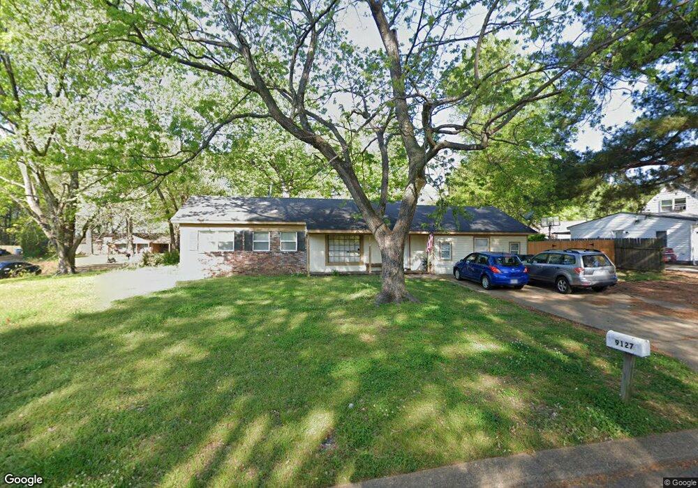
9127 Forrest Dr Southaven, MS 38671
Estimated Value: $162,283 - $184,000
3
Beds
--
Bath
1,521
Sq Ft
$115/Sq Ft
Est. Value
About This Home
This home is located at 9127 Forrest Dr, Southaven, MS 38671 and is currently estimated at $175,321, approximately $115 per square foot. 9127 Forrest Dr is a home located in DeSoto County with nearby schools including Southaven Elementary School, Southaven Middle School, and Southaven High School.
Ownership History
Date
Name
Owned For
Owner Type
Purchase Details
Closed on
Dec 5, 2018
Sold by
Holt Roger Andrew
Bought by
Todd Jerry E and Todd Nivine
Current Estimated Value
Purchase Details
Closed on
Aug 27, 2015
Sold by
Todd Jerry E and Todd Nivine
Bought by
Holt Roger Andrew
Home Financials for this Owner
Home Financials are based on the most recent Mortgage that was taken out on this home.
Original Mortgage
$50,000
Interest Rate
4.16%
Mortgage Type
New Conventional
Purchase Details
Closed on
Feb 9, 2015
Sold by
Todd Jerry Eugene and Todd Nivine
Bought by
Holt Roger Andrew
Home Financials for this Owner
Home Financials are based on the most recent Mortgage that was taken out on this home.
Original Mortgage
$69,500
Interest Rate
4.17%
Mortgage Type
Unknown
Create a Home Valuation Report for This Property
The Home Valuation Report is an in-depth analysis detailing your home's value as well as a comparison with similar homes in the area
Home Values in the Area
Average Home Value in this Area
Purchase History
| Date | Buyer | Sale Price | Title Company |
|---|---|---|---|
| Todd Jerry E | $68,000 | None Available | |
| Holt Roger Andrew | -- | None Available | |
| Holt Roger Andrew | -- | None Available |
Source: Public Records
Mortgage History
| Date | Status | Borrower | Loan Amount |
|---|---|---|---|
| Previous Owner | Holt Roger Andrew | $50,000 | |
| Previous Owner | Holt Roger Andrew | $69,500 |
Source: Public Records
Tax History Compared to Growth
Tax History
| Year | Tax Paid | Tax Assessment Tax Assessment Total Assessment is a certain percentage of the fair market value that is determined by local assessors to be the total taxable value of land and additions on the property. | Land | Improvement |
|---|---|---|---|---|
| 2024 | $1,422 | $9,767 | $2,250 | $7,517 |
| 2023 | $1,422 | $9,767 | $0 | $0 |
| 2022 | $1,392 | $9,767 | $2,250 | $7,517 |
| 2021 | $1,392 | $9,767 | $2,250 | $7,517 |
| 2020 | $1,307 | $9,165 | $2,250 | $6,915 |
| 2019 | $1,307 | $9,165 | $2,250 | $6,915 |
| 2017 | $560 | $9,370 | $5,435 | $3,935 |
| 2016 | $560 | $8,151 | $2,250 | $5,901 |
| 2015 | $1,161 | $14,052 | $8,151 | $5,901 |
| 2014 | $1,169 | $8,151 | $0 | $0 |
| 2013 | $1,169 | $8,151 | $0 | $0 |
Source: Public Records
Map
Nearby Homes
- 1728 Forrest Dr
- 1400 Staunton Dr
- 1279 Eason Ave
- 1456 Eason Ave
- 9154 Haleville St
- 1383 Ranger Dr
- 1382 Mary Jane Ave
- 1242 Brandywine Dr
- 8505 Southaven Cir W
- 1639 Kilarney Ave
- 1502 Mary Jane Ave
- 1821 Tad Cove
- 5387 Loch Lomond Rd
- 8493 Cedarbrush Dr
- 5449 Millbranch Rd
- 8699 Chesterfield Dr
- 8341 Whitehead Dr
- 8667 Chesterfield Dr
- 1763 Buxton Rd
- 5245 Villa Del Rey Dr
- 1746 Forrest Cove
- 560 Forest Down Cove
- 558 Forest Down Cove
- 566 Forest Down Cove
- 564 Forest Down Cove
- 562 Forest Down Cove
- 9155 Forrest Dr
- 1723 Forrest Cove
- 561 Forest Down Cove
- 559 Forest Down Cove
- 565 Forest Down Cove
- 1747 Forrest Dr
- 9128 Forrest Dr
- 9144 Forrest Dr
- 1723 Forrest Cove
- 1761 Forrest Dr
- 9116 Forrest Dr
- 1766 Forrest Cove
- 1741 Forrest Cove
- 9156 Forrest Dr