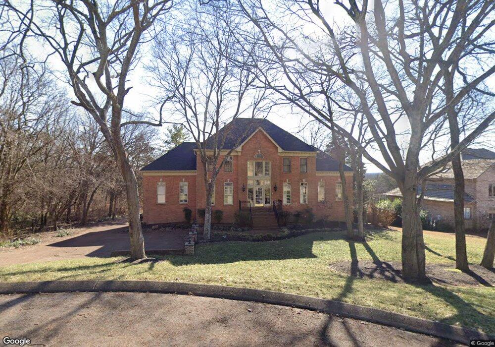
9129 Brentmeade Blvd Brentwood, TN 37027
Estimated Value: $1,498,000 - $1,935,000
5
Beds
5
Baths
4,700
Sq Ft
$353/Sq Ft
Est. Value
About This Home
This home is located at 9129 Brentmeade Blvd, Brentwood, TN 37027 and is currently estimated at $1,656,801, approximately $352 per square foot. 9129 Brentmeade Blvd is a home located in Williamson County with nearby schools including Edmondson Elementary School, Brentwood Middle School, and Brentwood High School.
Ownership History
Date
Name
Owned For
Owner Type
Purchase Details
Closed on
Jun 8, 2016
Sold by
Brooks Fincher Catherine and Fincher Ronald M
Bought by
Li Xiaoting
Current Estimated Value
Purchase Details
Closed on
Apr 26, 2012
Sold by
Fincher Ronald Morgan and Brooks Fincher Catherine
Bought by
Brooks Fincher Catherine
Purchase Details
Closed on
Jul 2, 2003
Sold by
Hatmaker Billy Lawrence and Hatmaker Barbara Mallory
Bought by
Fincher Ronald Morgan and Brooks Fincher Catherine
Home Financials for this Owner
Home Financials are based on the most recent Mortgage that was taken out on this home.
Original Mortgage
$399,200
Interest Rate
5.3%
Mortgage Type
Purchase Money Mortgage
Create a Home Valuation Report for This Property
The Home Valuation Report is an in-depth analysis detailing your home's value as well as a comparison with similar homes in the area
Home Values in the Area
Average Home Value in this Area
Purchase History
| Date | Buyer | Sale Price | Title Company |
|---|---|---|---|
| Li Xiaoting | $854,900 | Windmill Title Llc | |
| Brooks Fincher Catherine | -- | Windmill Title Llc | |
| Fincher Ronald Morgan | $499,000 | -- |
Source: Public Records
Mortgage History
| Date | Status | Borrower | Loan Amount |
|---|---|---|---|
| Previous Owner | Fincher Ronald Morgan | $399,200 |
Source: Public Records
Tax History Compared to Growth
Tax History
| Year | Tax Paid | Tax Assessment Tax Assessment Total Assessment is a certain percentage of the fair market value that is determined by local assessors to be the total taxable value of land and additions on the property. | Land | Improvement |
|---|---|---|---|---|
| 2025 | -- | $358,125 | $150,000 | $208,125 |
| 2024 | -- | $195,800 | $50,000 | $145,800 |
| 2023 | $0 | $195,800 | $50,000 | $145,800 |
| 2022 | $4,249 | $195,800 | $50,000 | $145,800 |
| 2021 | $4,249 | $195,800 | $50,000 | $145,800 |
| 2020 | $4,283 | $165,975 | $45,000 | $120,975 |
| 2019 | $4,283 | $165,975 | $45,000 | $120,975 |
| 2018 | $4,166 | $165,975 | $45,000 | $120,975 |
| 2017 | $4,133 | $165,975 | $45,000 | $120,975 |
| 2016 | $4,083 | $165,975 | $45,000 | $120,975 |
| 2015 | -- | $143,650 | $37,500 | $106,150 |
| 2014 | $632 | $143,650 | $37,500 | $106,150 |
Source: Public Records
Map
Nearby Homes
- 9211 Fox Run Dr
- 820 Coxboro Dr
- 9232 Queensboro Ct
- 1136 Haverhill Dr
- 9209 Cherokee Ln
- 810 Steeplechase Dr
- 9305 Atherton Dr
- 9266 Chevoit Dr
- 1236 Monarch Way
- 1115 Wilson Pike
- 703 Ben Nevis Ct
- 8210 Halford Place
- 712 Wilson Pike
- 691 Green Hill Blvd
- 1302 Twin Springs Dr
- 739 Rolling Fork Dr
- 9227 Old Smyrna Rd
- 613 Thetford Alley
- 439 Portsdale Dr
- 455 Portsdale Dr
- 1035 Maycroft Knoll
- 9123 Brentmeade Blvd
- 1031 Maycroft Knoll
- 1038 Maycroft Knoll
- 9128 Brentmeade Blvd
- 9119 Brentmeade Blvd
- 1069 Wilshire Way
- 9200 Prestmoor Place
- 9120 Brentmeade Blvd
- 1073 Wilshire Way
- 1065 Wilshire Way
- 9174 Radrick Ridge
- 1034 Maycroft Knoll
- 9117 Brentmeade Blvd
- 1030 Maycroft Knoll
- 9204 Prestmoor Place
- 9116 Brentmeade Blvd
- 1061 Wilshire Way
- 9170 Radrick Ridge
- 9208 Prestmoor Place