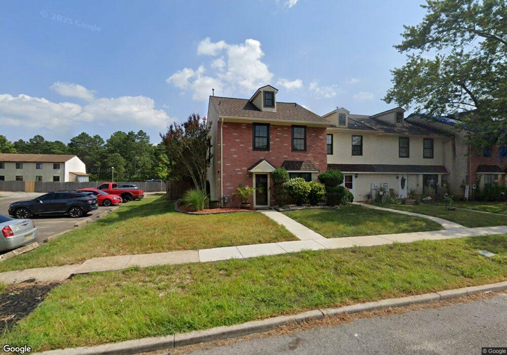
913 Blake Dr Mays Landing, NJ 08330
Estimated Value: $216,323 - $235,000
--
Bed
--
Bath
1,408
Sq Ft
$160/Sq Ft
Est. Value
About This Home
This home is located at 913 Blake Dr, Mays Landing, NJ 08330 and is currently estimated at $224,581, approximately $159 per square foot. 913 Blake Dr is a home located in Atlantic County with nearby schools including Weymouth Twp Elementary School, St. Vincent de Paul Regional School, and Mays Landing Baptist Academy.
Ownership History
Date
Name
Owned For
Owner Type
Purchase Details
Closed on
Jul 26, 2001
Sold by
Hughes Charles H and Hughes Stella M
Bought by
Gayle Jennifer
Current Estimated Value
Home Financials for this Owner
Home Financials are based on the most recent Mortgage that was taken out on this home.
Original Mortgage
$74,575
Outstanding Balance
$29,069
Interest Rate
7.14%
Estimated Equity
$195,512
Purchase Details
Closed on
Aug 31, 1990
Sold by
Maione Joseph and Maione Grace,Lisa A
Bought by
Hughes Charles H
Create a Home Valuation Report for This Property
The Home Valuation Report is an in-depth analysis detailing your home's value as well as a comparison with similar homes in the area
Home Values in the Area
Average Home Value in this Area
Purchase History
| Date | Buyer | Sale Price | Title Company |
|---|---|---|---|
| Gayle Jennifer | $78,500 | Fidelity National Title Ins | |
| Hughes Charles H | $75,000 | -- |
Source: Public Records
Mortgage History
| Date | Status | Borrower | Loan Amount |
|---|---|---|---|
| Open | Gayle Jennifer | $74,575 |
Source: Public Records
Tax History Compared to Growth
Tax History
| Year | Tax Paid | Tax Assessment Tax Assessment Total Assessment is a certain percentage of the fair market value that is determined by local assessors to be the total taxable value of land and additions on the property. | Land | Improvement |
|---|---|---|---|---|
| 2025 | $3,624 | $128,100 | $51,000 | $77,100 |
| 2024 | $3,624 | $128,100 | $51,000 | $77,100 |
| 2023 | $3,474 | $128,100 | $51,000 | $77,100 |
| 2022 | $3,474 | $128,100 | $51,000 | $77,100 |
| 2021 | $3,483 | $128,100 | $51,000 | $77,100 |
| 2020 | $3,382 | $128,100 | $51,000 | $77,100 |
| 2019 | $3,283 | $128,100 | $51,000 | $77,100 |
| 2018 | $3,237 | $128,100 | $51,000 | $77,100 |
| 2017 | $3,252 | $128,100 | $51,000 | $77,100 |
| 2016 | $3,115 | $128,100 | $51,000 | $77,100 |
| 2015 | $2,983 | $128,100 | $51,000 | $77,100 |
| 2014 | $2,465 | $68,600 | $14,000 | $54,600 |
Source: Public Records
Map
Nearby Homes
- 5 Camac Ave
- 1 Lafayette Ave
- 1404 Loretta Ave
- 1403 Loretta Ave
- 6140 Robin Dr
- 80 Mill St
- 246 Old River Rd
- 6015 Main St
- 6062 Main St
- 5739 Main St
- 5745 2nd St
- 0 3rd St
- 116 Post Rd
- 0 Harding Hwy Unit NJAC2019438
- 0 Harding Hwy Unit 597638
- 535 Park Rd
- 6206 Roberts Ave
- 6301 Roberts Ave
- 565 Park Rd
- 526 Bainbridge Ave