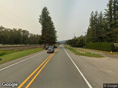
913 Croft Ave W Gold Bar, WA 98251
Estimated Value: $465,856
--
Bed
--
Bath
1,860
Sq Ft
$250/Sq Ft
Est. Value
About This Home
This home is located at 913 Croft Ave W, Gold Bar, WA 98251 and is currently estimated at $465,856, approximately $250 per square foot. 913 Croft Ave W is a home located in Snohomish County with nearby schools including Sultan Senior High School.
Ownership History
Date
Name
Owned For
Owner Type
Purchase Details
Closed on
Sep 2, 2021
Sold by
Syharsth Siamanth
Bought by
Syharsth Siamanth
Current Estimated Value
Purchase Details
Closed on
Mar 15, 2021
Sold by
Thomas Edward W and Thomas Julie L
Bought by
Syharath Sisamouth
Purchase Details
Closed on
Jun 11, 2015
Sold by
Coastal Community Bank
Bought by
Thomas Edward W and Thomas Julie L
Purchase Details
Closed on
Feb 1, 2013
Sold by
Carey Robert A
Bought by
Coastal Community Bank
Purchase Details
Closed on
Apr 13, 2007
Sold by
Minogue Harry
Bought by
Carey Robert A
Home Financials for this Owner
Home Financials are based on the most recent Mortgage that was taken out on this home.
Original Mortgage
$236,971
Interest Rate
6.1%
Mortgage Type
Commercial
Create a Home Valuation Report for This Property
The Home Valuation Report is an in-depth analysis detailing your home's value as well as a comparison with similar homes in the area
Home Values in the Area
Average Home Value in this Area
Purchase History
| Date | Buyer | Sale Price | Title Company |
|---|---|---|---|
| Syharsth Siamanth | -- | None Available | |
| Syharath Sisamouth | $360,000 | First American Title | |
| Thomas Edward W | $90,000 | Old Republic Title Ltd | |
| Coastal Community Bank | $254,417 | None Available | |
| Carey Robert A | $140,000 | Fidelity National Title |
Source: Public Records
Mortgage History
| Date | Status | Borrower | Loan Amount |
|---|---|---|---|
| Previous Owner | Carey Robert A | $2,104,319 | |
| Previous Owner | Carey Robert A | $236,971 |
Source: Public Records
Tax History Compared to Growth
Tax History
| Year | Tax Paid | Tax Assessment Tax Assessment Total Assessment is a certain percentage of the fair market value that is determined by local assessors to be the total taxable value of land and additions on the property. | Land | Improvement |
|---|---|---|---|---|
| 2025 | $3,189 | $397,800 | $210,200 | $187,600 |
| 2024 | $3,189 | $378,100 | $198,400 | $179,700 |
| 2023 | $2,048 | $270,200 | $111,200 | $159,000 |
| 2022 | $1,615 | $186,000 | $101,200 | $84,800 |
| 2020 | $1,632 | $177,400 | $101,200 | $76,200 |
| 2019 | $1,773 | $191,100 | $95,100 | $96,000 |
| 2018 | $1,955 | $168,500 | $63,100 | $105,400 |
| 2017 | $1,400 | $121,100 | $51,000 | $70,100 |
| 2016 | $1,262 | $104,500 | $56,100 | $48,400 |
| 2015 | $1,181 | $93,000 | $51,800 | $41,200 |
| 2013 | $1,439 | $105,500 | $65,000 | $40,500 |
Source: Public Records
Map
Nearby Homes
- 116 Lewis Ave W Unit 120
- 120 Lewis Ave
- 138 2nd St
- 222 2nd St
- 128 3rd St
- 130 3rd St
- 2 XX 5th St
- 501 Croft Ave W Unit 2
- 115 6th St
- 536 May Creek Place
- 1504 Alder Ln
- 1512 Alder Ln
- 1501 Alder Ln
- 1516 Alder Ln Unit B
- 1516 Alder Ln Unit A
- 200 10th St Unit 8
- 1525 Alder Ln
- 1615 Birch Ct
- 1618 Birch Ct
- 36810 144th St SE
- 913 Croft Ave W
- 110 Nugget Rd Unit B
- 110 Nugget Rd
- 112 Nugget Rd
- 114 Nugget Rd
- 114 Nugget Rd
- 116 Nugget Rd
- 205 Nugget Rd
- 206 Nugget Rd
- 207 Nugget Rd
- 208 Nugget Rd
- 38723 State Route 2
- 209 Nugget Rd
- 715 Croft Ave W
- 715 Croft Ave W Unit 3
- 210 Nugget Rd
- 211 Nugget Rd
- 212 Nugget Rd
- 213 Nugget Rd
- 214 Nugget Rd
