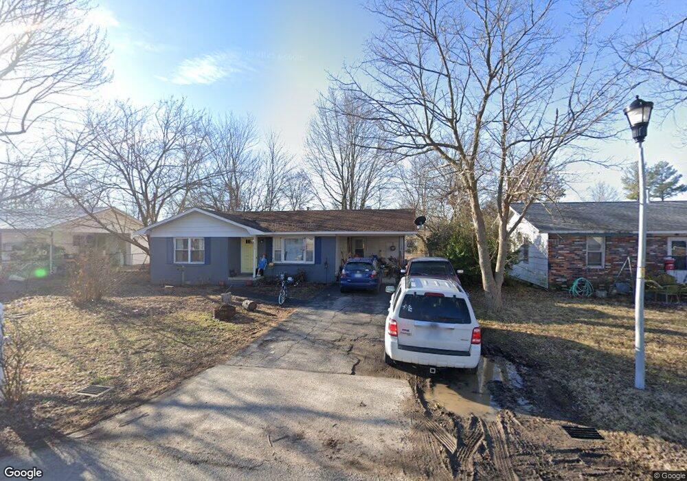
913 Daisy Dr Dexter, MO 63841
Estimated Value: $100,691 - $147,000
3
Beds
1
Bath
918
Sq Ft
$130/Sq Ft
Est. Value
About This Home
This home is located at 913 Daisy Dr, Dexter, MO 63841 and is currently estimated at $119,173, approximately $129 per square foot. 913 Daisy Dr is a home located in Stoddard County with nearby schools including Southwest Elementary School, Central Elementary School, and T.S. Hill Middle School.
Ownership History
Date
Name
Owned For
Owner Type
Purchase Details
Closed on
Feb 24, 2023
Sold by
Ledbetter Nicholas and Ledbetter Madeline
Bought by
Rains Noah
Current Estimated Value
Home Financials for this Owner
Home Financials are based on the most recent Mortgage that was taken out on this home.
Original Mortgage
$55,250
Outstanding Balance
$29,490
Interest Rate
5.42%
Mortgage Type
Construction
Estimated Equity
$89,683
Purchase Details
Closed on
Apr 24, 2017
Sold by
Corlew Norma J and Corlew David R
Bought by
Ledbetter Nicholas
Home Financials for this Owner
Home Financials are based on the most recent Mortgage that was taken out on this home.
Original Mortgage
$59,797
Interest Rate
4.21%
Mortgage Type
New Conventional
Create a Home Valuation Report for This Property
The Home Valuation Report is an in-depth analysis detailing your home's value as well as a comparison with similar homes in the area
Home Values in the Area
Average Home Value in this Area
Purchase History
| Date | Buyer | Sale Price | Title Company |
|---|---|---|---|
| Rains Noah | $69,062 | National Title & Escrow Inc | |
| Ledbetter Nicholas | $74,746 | -- |
Source: Public Records
Mortgage History
| Date | Status | Borrower | Loan Amount |
|---|---|---|---|
| Open | Rains Noah | $55,250 | |
| Previous Owner | Ledbetter Nicholas | $59,797 |
Source: Public Records
Tax History
| Year | Tax Paid | Tax Assessment Tax Assessment Total Assessment is a certain percentage of the fair market value that is determined by local assessors to be the total taxable value of land and additions on the property. | Land | Improvement |
|---|---|---|---|---|
| 2025 | $482 | $11,115 | $0 | $0 |
| 2024 | $5 | $10,412 | $0 | $0 |
| 2023 | $481 | $10,412 | $0 | $0 |
| 2022 | $454 | $9,842 | $0 | $0 |
| 2021 | $454 | $9,842 | $0 | $0 |
| 2020 | $426 | $9,158 | $0 | $0 |
| 2019 | $425 | $9,177 | $0 | $0 |
| 2018 | $422 | $9,158 | $0 | $0 |
| 2016 | $365 | $8,170 | $0 | $0 |
| 2015 | -- | $8,170 | $0 | $0 |
| 2014 | -- | $8,189 | $0 | $0 |
| 2013 | -- | $0 | $0 | $0 |
Source: Public Records
Map
Nearby Homes
- 2 S One Mile Rd
- 712 W Oak St
- 435 W Elk St
- 1101 N Sassafras
- 1306 Susan St
- 339 W Castor St
- 1308 Susan St
- 805 W Bain St
- 1029 N Woodland Dr
- 725 W Bain St
- 301 W Castor St
- 0 W Bus Hwy 60
- 502 Chautauqua Ln
- 1400 Scott Ave
- 727 W Fannetta St
- 1002 Cottage Ln
- 125 W Saint Francis St
- 32 Circle Dr
- 108 Lillian Ave
- 811 Houston St
- 911 Daisy Dr
- 915 Daisy Dr
- 914 W Saint Francis St
- 909 Daisy Dr
- 917 Daisy Dr
- 912 W Saint Francis St
- 916 W Saint Francis St
- 916 W Street Francis St
- 914 Daisy Dr
- 916 Daisy Dr
- 910 W Saint Francis St
- 907 Daisy Dr
- 918 W Saint Francis St
- 1003 Daisy Dr
- 918 Daisy Dr
- 910 Daisy Dr
- 908 W Saint Francis St
- 1004 W Saint Francis St
- 908 W Street Francis St
- 1004 Daisy Dr
Your Personal Tour Guide
Ask me questions while you tour the home.