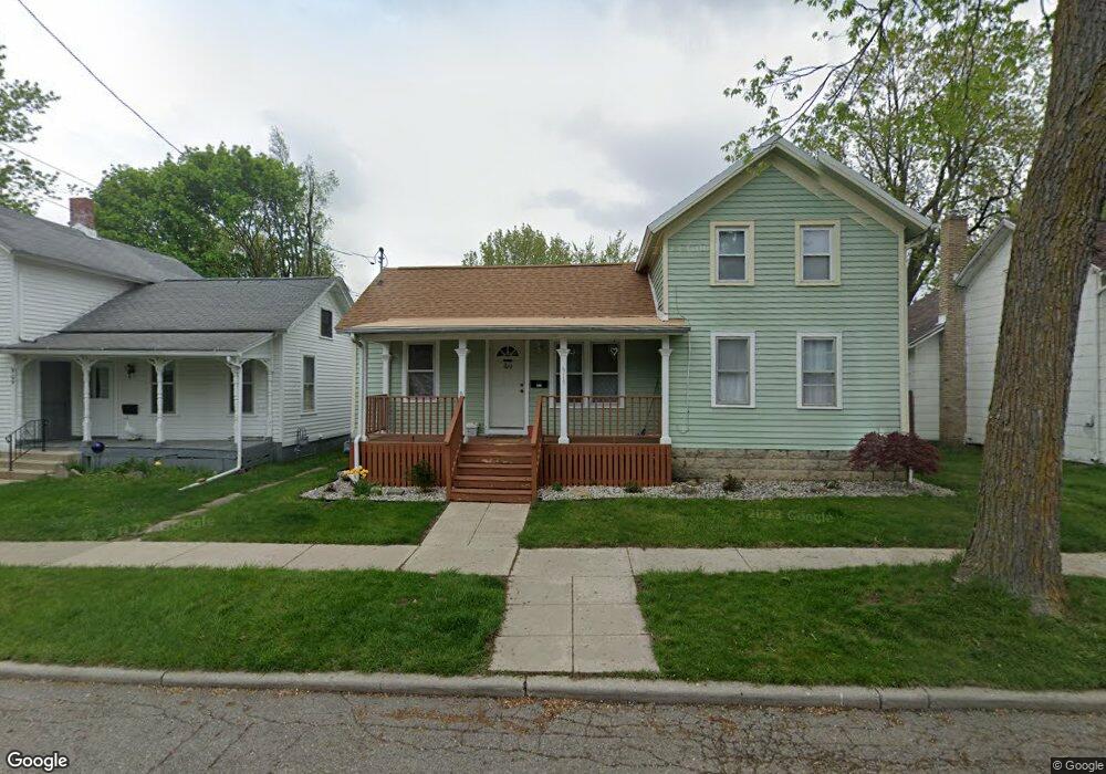
913 E Maple Ave Unit MAPLE Adrian, MI 49221
Estimated Value: $115,000 - $126,000
2
Beds
1
Bath
1,365
Sq Ft
$87/Sq Ft
Est. Value
About This Home
This home is located at 913 E Maple Ave Unit MAPLE, Adrian, MI 49221 and is currently estimated at $118,870, approximately $87 per square foot. 913 E Maple Ave Unit MAPLE is a home located in Lenawee County with nearby schools including Adrian High School, St. Joseph Academy, and St. Joseph's Academy.
Ownership History
Date
Name
Owned For
Owner Type
Purchase Details
Closed on
Mar 1, 2018
Sold by
Est Ramirez Nagera Mario and Cortes-Lopez Angelica
Bought by
Ramirez Angelica
Current Estimated Value
Purchase Details
Closed on
Oct 28, 2011
Sold by
Fannie Mae
Bought by
Ramirez Nagera Mano
Purchase Details
Closed on
Oct 4, 2011
Sold by
First Federal Bank
Bought by
Fannie Mae and Federal National Mortgage Association
Purchase Details
Closed on
Aug 14, 2011
Sold by
Speller Douglas L and Speller Jennifer C
Bought by
Fannie Mae
Purchase Details
Closed on
Jun 9, 2011
Sold by
Speller Douglas L and Speller Jennifer C
Bought by
First Federal Bank Of The Midwest
Create a Home Valuation Report for This Property
The Home Valuation Report is an in-depth analysis detailing your home's value as well as a comparison with similar homes in the area
Home Values in the Area
Average Home Value in this Area
Purchase History
| Date | Buyer | Sale Price | Title Company |
|---|---|---|---|
| Ramirez Angelica | -- | -- | |
| Ramirez Nagera Mano | -- | Attorneys Title Agency Llc | |
| Fannie Mae | -- | None Available | |
| Fannie Mae | $3,000 | None Available | |
| First Federal Bank Of The Midwest | $58,448 | None Available |
Source: Public Records
Tax History
| Year | Tax Paid | Tax Assessment Tax Assessment Total Assessment is a certain percentage of the fair market value that is determined by local assessors to be the total taxable value of land and additions on the property. | Land | Improvement |
|---|---|---|---|---|
| 2025 | $1,349 | $47,500 | $0 | $0 |
| 2024 | $12 | $43,500 | $0 | $0 |
| 2023 | $1,301 | $38,900 | $0 | $0 |
| 2022 | $1,980 | $35,200 | $0 | $0 |
| 2021 | $1,000 | $32,000 | $0 | $0 |
| 2020 | $996 | $29,800 | $0 | $0 |
| 2019 | $64,317 | $26,400 | $0 | $0 |
| 2018 | $963 | $31,177 | $0 | $0 |
| 2017 | $933 | $24,752 | $0 | $0 |
| 2016 | $925 | $23,014 | $0 | $0 |
| 2014 | -- | $23,600 | $0 | $0 |
Source: Public Records
Map
Nearby Homes
- 206 Ormsby St
- 924 Frank St
- 220 Comstock St
- 717 Bristol St
- 803 Ormsby St
- 417 E Hunt St
- 820 Mulberry St
- 418 E Church St
- 612 N Clinton St
- 229 Clinton St
- 603 S Center St
- 1635 Naomi Ave
- 632 Division St
- 228 W Church St
- 2751 Cloverdale Ave
- 140 Greenly St
- 218 Greenly St
- 306 Summer St
- 839 Dennis St
- 227 Greenly St
- 913 E Maple Ave
- 917 E Maple Ave
- 917 E Maple Ave Unit MAPLE
- 909 E Maple Ave
- 829 E Maple Ave
- 1003 E Maple Ave
- 918 E Maple Ave
- 910 E Butler St
- 912 E Maple Ave
- 1007 E Maple Ave
- 908 E Butler St
- 906 E Maple Ave
- 904 E Butler St
- 914 E Butler St
- 918 E Butler St
- 823 E Maple Ave
- 902 E Maple Ave
- 828 E Butler St
- 815 E Maple Ave
- 905 E Front St
Your Personal Tour Guide
Ask me questions while you tour the home.