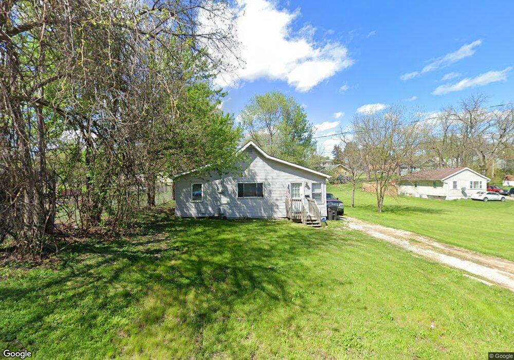
913 Emma Ave Des Moines, IA 50315
Watrous South NeighborhoodEstimated Value: $146,256 - $176,000
2
Beds
1
Bath
864
Sq Ft
$181/Sq Ft
Est. Value
About This Home
This home is located at 913 Emma Ave, Des Moines, IA 50315 and is currently estimated at $156,564, approximately $181 per square foot. 913 Emma Ave is a home located in Polk County with nearby schools including Wright Elementary School, Brody Middle School, and Lincoln High School.
Ownership History
Date
Name
Owned For
Owner Type
Purchase Details
Closed on
Aug 13, 2002
Sold by
Putbrese Keith
Bought by
Archer Randall and Archer Dawn
Current Estimated Value
Purchase Details
Closed on
Dec 16, 1998
Sold by
Putbrese Keith K
Bought by
Archer Randall and Archer Dawn
Home Financials for this Owner
Home Financials are based on the most recent Mortgage that was taken out on this home.
Original Mortgage
$15,000
Interest Rate
5%
Create a Home Valuation Report for This Property
The Home Valuation Report is an in-depth analysis detailing your home's value as well as a comparison with similar homes in the area
Home Values in the Area
Average Home Value in this Area
Purchase History
| Date | Buyer | Sale Price | Title Company |
|---|---|---|---|
| Archer Randall | $20,000 | -- | |
| Archer Randall | $20,000 | -- |
Source: Public Records
Mortgage History
| Date | Status | Borrower | Loan Amount |
|---|---|---|---|
| Previous Owner | Archer Randall | $15,000 |
Source: Public Records
Tax History Compared to Growth
Tax History
| Year | Tax Paid | Tax Assessment Tax Assessment Total Assessment is a certain percentage of the fair market value that is determined by local assessors to be the total taxable value of land and additions on the property. | Land | Improvement |
|---|---|---|---|---|
| 2025 | $1,978 | $115,100 | $45,700 | $69,400 |
| 2024 | $1,978 | $100,500 | $39,900 | $60,600 |
| 2023 | $1,924 | $100,500 | $39,900 | $60,600 |
| 2022 | $1,908 | $81,600 | $32,800 | $48,800 |
| 2021 | $1,892 | $81,600 | $32,800 | $48,800 |
| 2020 | $1,966 | $75,800 | $30,700 | $45,100 |
| 2019 | $1,800 | $75,800 | $30,700 | $45,100 |
| 2018 | $1,782 | $67,000 | $26,800 | $40,200 |
| 2017 | $1,682 | $67,000 | $26,800 | $40,200 |
| 2016 | $1,640 | $62,200 | $24,800 | $37,400 |
| 2015 | $1,640 | $62,200 | $24,800 | $37,400 |
| 2014 | $1,624 | $61,100 | $24,100 | $37,000 |
Source: Public Records
Map
Nearby Homes
- 930 Emma Ave
- . Herold Ave
- 936 Mckinley Ave Unit 14
- 1116 Herold Ave
- 1203 Herold Ave
- 1207 Emma Ave
- 612 Emma Ave
- 518 Maxwelton Dr
- 1204 Elder Ln
- 4204 SW 7th St
- 515 Emma Ave
- 1004 Titus Ave
- 1223 Emma Ave
- 1219 Elder Ln
- 1229 Evans St
- 4108 SW 12th St
- 4020 SW 12th St
- 304 Herold Ave
- 4916 SW 13th St
- 1243 Hackley Ave