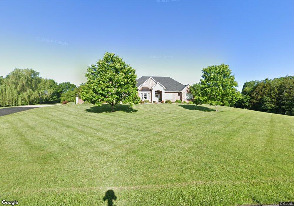
913 Huntington Ln Washington, MO 63090
Estimated Value: $563,421 - $703,000
3
Beds
3
Baths
2,587
Sq Ft
$247/Sq Ft
Est. Value
About This Home
This home is located at 913 Huntington Ln, Washington, MO 63090 and is currently estimated at $638,474, approximately $246 per square foot. 913 Huntington Ln is a home located in Franklin County with nearby schools including Washington High School, Immaculate Conception School, and St. John The Baptist School.
Ownership History
Date
Name
Owned For
Owner Type
Purchase Details
Closed on
Feb 1, 2016
Sold by
W V Investments Llc
Bought by
Walde Jeff and Walde Deb
Current Estimated Value
Purchase Details
Closed on
Nov 10, 2005
Sold by
Voss Kurt A and Voss Brenda G
Bought by
Voss Kurt A and Voss Brenda G
Home Financials for this Owner
Home Financials are based on the most recent Mortgage that was taken out on this home.
Original Mortgage
$130,400
Interest Rate
6.06%
Mortgage Type
New Conventional
Create a Home Valuation Report for This Property
The Home Valuation Report is an in-depth analysis detailing your home's value as well as a comparison with similar homes in the area
Home Values in the Area
Average Home Value in this Area
Purchase History
| Date | Buyer | Sale Price | Title Company |
|---|---|---|---|
| Walde Jeff | -- | -- | |
| Voss Kurt A | -- | None Available |
Source: Public Records
Mortgage History
| Date | Status | Borrower | Loan Amount |
|---|---|---|---|
| Previous Owner | Voss Kurt A | $130,400 |
Source: Public Records
Tax History Compared to Growth
Tax History
| Year | Tax Paid | Tax Assessment Tax Assessment Total Assessment is a certain percentage of the fair market value that is determined by local assessors to be the total taxable value of land and additions on the property. | Land | Improvement |
|---|---|---|---|---|
| 2024 | $4,114 | $74,267 | $0 | $0 |
| 2023 | $4,114 | $74,267 | $0 | $0 |
| 2022 | $4,840 | $87,119 | $0 | $0 |
| 2021 | $4,839 | $87,119 | $0 | $0 |
| 2020 | $4,541 | $78,668 | $0 | $0 |
| 2019 | $4,525 | $78,668 | $0 | $0 |
| 2018 | $3,928 | $71,913 | $0 | $0 |
| 2017 | $3,937 | $71,913 | $0 | $0 |
| 2016 | $3,665 | $66,587 | $0 | $0 |
| 2015 | $3,663 | $66,587 | $0 | $0 |
| 2014 | $3,717 | $67,564 | $0 | $0 |
Source: Public Records
Map
Nearby Homes
- 695 Clearview Heights Dr
- 6 Oak Ridge Dr
- 5646 Country Club Ln
- 397 Arvel Ln
- 4750 Log House Rd
- lot 2 Hilltop Dr
- 419 Gnarlyvine Ct
- 227 Cedar Berry Dr
- 952 Brookline Dr
- 371 Peaceful Hollow Dr
- 94 Fiddler's Close Unit 94 STB
- 2384 Fiddlers Close Rd Unit 91 STB
- 2377 Fiddler's Close Rd Unit 115 STB
- 2400 Fiddler's Close Unit 95 STB
- 2356 Fiddler's Close Rd Unit 84 STB
- 7 - Lot Valley Brook Ct
- 1 - Lot Valley Brook Ct
- 2316 Matthias Close Unit 20 STB
- 2787 Stonecrest Dr
- 2429 Fiddlers Close Rd Unit 106 STB
- 904 Huntington Ln
- 2206 Youngfield Cir Unit 33
- 2204 Youngfield Cir Unit 32
- 5104 Bethlehem Church Rd
- 923 Huntington Ln
- 0Lot 9B Bethlehem Church Rd
- 293 Moonlit Valley Dr
- 928 Huntington Ln
- 284 Moonlit Valley Dr
- 377 Brookfield Dr
- 5115 Bethlehem Church Rd
- 410 Brookfield Dr
- 940 Huntington Ln
- 302 Starlit Dr
- 941 Huntington Ln
- 4997 Bethlehem Church Rd
- 0Lot 7 Brookfield Dr
- 4990 Bethlehem Church Rd
- 5119 Bethlehem Church Rd
- 301 Starlit Dr