Estimated Value: $309,000 - $396,095
4
Beds
3
Baths
1,915
Sq Ft
$189/Sq Ft
Est. Value
About This Home
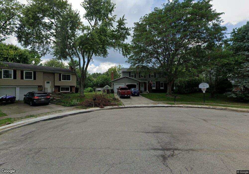
This home is located at 913 Leslie Ct, Mason, OH 45040 and is currently estimated at $362,774, approximately $189 per square foot. 913 Leslie Ct is a home located in Warren County with nearby schools including Mason Intermediate Elementary School, Mason Middle School, and William Mason High School.
Ownership History
Date
Name
Owned For
Owner Type
Purchase Details
Closed on
Jun 3, 2015
Sold by
Jones Stephen M and Jones Gail E
Bought by
Jones Stephen M and Jones Gail E
Current Estimated Value
Purchase Details
Closed on
Aug 31, 2005
Sold by
Kuhns Ronald L
Bought by
Jones Stephen M and Jones Gail E
Home Financials for this Owner
Home Financials are based on the most recent Mortgage that was taken out on this home.
Original Mortgage
$119,850
Outstanding Balance
$64,763
Interest Rate
6.01%
Mortgage Type
Purchase Money Mortgage
Estimated Equity
$298,011
Purchase Details
Closed on
Jun 7, 1991
Sold by
Adams Adams and Adams Eddie L
Bought by
H. Stewart and H. Wm.
Purchase Details
Closed on
Apr 15, 1986
Sold by
Valentine Trask and Valentine M.
Bought by
Adams Adams and Adams Eddie L
Purchase Details
Closed on
Sep 17, 1984
Sold by
Kimmons Kimmons and Kimmons Kenneth D
Bought by
Valentine Trask and Valentine M.
Purchase Details
Closed on
Aug 30, 1982
Sold by
Rowe Rowe and Rowe William R
Create a Home Valuation Report for This Property
The Home Valuation Report is an in-depth analysis detailing your home's value as well as a comparison with similar homes in the area
Home Values in the Area
Average Home Value in this Area
Purchase History
| Date | Buyer | Sale Price | Title Company |
|---|---|---|---|
| Jones Stephen M | -- | Attorney | |
| Jones Stephen M | $141,000 | Old Town Title Agency | |
| H. Stewart | $87,000 | -- | |
| Adams Adams | $72,000 | -- | |
| Valentine Trask | $69,000 | -- | |
| -- | $61,500 | -- |
Source: Public Records
Mortgage History
| Date | Status | Borrower | Loan Amount |
|---|---|---|---|
| Open | Jones Stephen M | $119,850 |
Source: Public Records
Tax History Compared to Growth
Tax History
| Year | Tax Paid | Tax Assessment Tax Assessment Total Assessment is a certain percentage of the fair market value that is determined by local assessors to be the total taxable value of land and additions on the property. | Land | Improvement |
|---|---|---|---|---|
| 2024 | $4,217 | $103,900 | $24,500 | $79,400 |
| 2023 | $3,894 | $81,049 | $10,762 | $70,287 |
| 2022 | $3,933 | $81,050 | $10,763 | $70,287 |
| 2021 | $3,725 | $81,050 | $10,763 | $70,287 |
| 2020 | $3,542 | $65,895 | $8,750 | $57,145 |
| 2019 | $3,264 | $65,895 | $8,750 | $57,145 |
| 2018 | $3,275 | $65,895 | $8,750 | $57,145 |
| 2017 | $3,004 | $56,413 | $8,274 | $48,139 |
| 2016 | $3,094 | $56,413 | $8,274 | $48,139 |
| 2015 | $3,014 | $56,413 | $8,274 | $48,139 |
| 2014 | $3,021 | $52,720 | $7,730 | $44,990 |
| 2013 | $3,028 | $59,670 | $8,750 | $50,920 |
Source: Public Records
Map
Nearby Homes
- 921 Leslie Ct
- 873 Tradewind Dr
- 7986 Tylers Way
- 947 Olympia Dr
- 6955 Grand Oaks Ct
- 7843 Butler Warren Rd
- 6070 Fireside Dr Unit 45
- 6356 Amber Ct Unit 91
- 6138 Nicholas Way
- 6387 Coverage Ct
- 6369 Coverage Ct
- 6403 Coverage Ct
- 6357 Coverage Ct
- 6383 Coverage Ct
- 6407 Coverage Ct
- 6375 Coverage Ct
- 6365 Coverage Ct
- 6361 Coverage Ct
- 6379 Coverage Ct
- 6411 Coverage Ct
- 909 Leslie Ct
- 917 Leslie Ct
- 6466 Butler Warren Rd
- 6478 Butler Warren Rd
- 905 Leslie Ct
- 6490 Butler Warren Rd
- 6442 Butler Warren Rd
- 908 Leslie Ct
- 1480 Windward Dr
- 912 Leslie Ct
- 1474 Windward Dr
- 901 Leslie Ct
- 904 Leslie Ct
- 1486 Windward Dr
- 1466 Windward Dr
- 1495 Saint Lawrence Dr
- 1494 Windward Dr
- 1479 Saint Lawrence Dr
- 1479 St Lawrence Dr
- 1460 Windward Dr