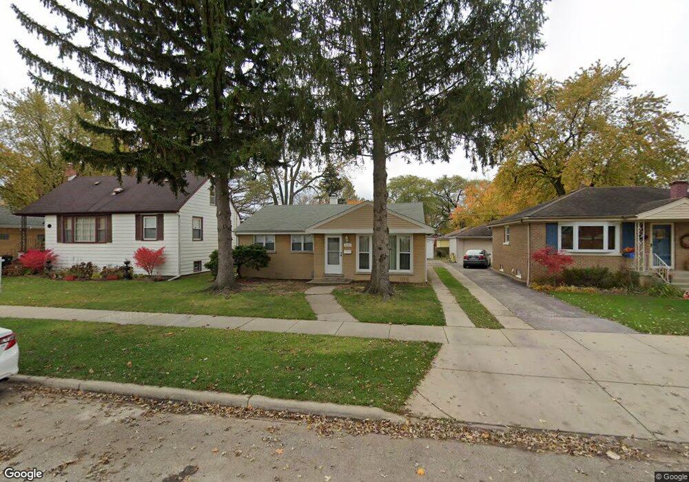
9133 29th St Brookfield, IL 60513
Estimated Value: $249,000 - $344,000
2
Beds
1
Bath
1,042
Sq Ft
$291/Sq Ft
Est. Value
About This Home
This home is located at 9133 29th St, Brookfield, IL 60513 and is currently estimated at $303,261, approximately $291 per square foot. 9133 29th St is a home located in Cook County with nearby schools including S. E. Gross Middle School, Brook Park Elementary School, and Riverside Brookfield High School.
Ownership History
Date
Name
Owned For
Owner Type
Purchase Details
Closed on
Jun 13, 1997
Sold by
Lewis Merle F and Lewis Susan
Bought by
Riordan Kevin M and Riordan Yvonne
Current Estimated Value
Home Financials for this Owner
Home Financials are based on the most recent Mortgage that was taken out on this home.
Original Mortgage
$103,200
Outstanding Balance
$14,135
Interest Rate
8%
Estimated Equity
$289,126
Create a Home Valuation Report for This Property
The Home Valuation Report is an in-depth analysis detailing your home's value as well as a comparison with similar homes in the area
Home Values in the Area
Average Home Value in this Area
Purchase History
| Date | Buyer | Sale Price | Title Company |
|---|---|---|---|
| Riordan Kevin M | $129,000 | -- |
Source: Public Records
Mortgage History
| Date | Status | Borrower | Loan Amount |
|---|---|---|---|
| Open | Riordan Kevin M | $103,200 |
Source: Public Records
Tax History
| Year | Tax Paid | Tax Assessment Tax Assessment Total Assessment is a certain percentage of the fair market value that is determined by local assessors to be the total taxable value of land and additions on the property. | Land | Improvement |
|---|---|---|---|---|
| 2025 | $3,335 | $11,000 | $2,337 | $8,663 |
| 2024 | $3,335 | $11,000 | $2,337 | $8,663 |
| 2023 | $3,250 | $11,000 | $2,337 | $8,663 |
| 2022 | $3,250 | $9,511 | $2,003 | $7,508 |
| 2021 | $3,171 | $9,509 | $2,002 | $7,507 |
| 2020 | $3,134 | $9,509 | $2,002 | $7,507 |
| 2019 | $3,058 | $9,468 | $1,835 | $7,633 |
| 2018 | $2,935 | $9,468 | $1,835 | $7,633 |
| 2017 | $2,716 | $9,468 | $1,835 | $7,633 |
| 2016 | $2,275 | $7,360 | $1,669 | $5,691 |
| 2015 | $2,164 | $7,360 | $1,669 | $5,691 |
| 2014 | $2,142 | $7,360 | $1,669 | $5,691 |
| 2013 | $2,562 | $9,093 | $1,669 | $7,424 |
Source: Public Records
Map
Nearby Homes
- 1220 N Maple Ave
- 1424 N Maple Ave
- 9027 27th St
- 9120 26th Place
- 3108 Oak Ave
- 2945 Vernon Ave
- 8900 31st St Unit 8
- 1127 Morgan Ave
- 3229 Maple Ave
- 1140 Blanchan Ave
- 3321 Harrison Ave
- 2322 S 17th Ave Unit 5
- 3417 Oak Ave
- 2310 S 17th Ave
- 9516 Jackson Ave
- 2263 S 14th Ave
- 1020 Newberry Ave
- 2253 S 15th Ave
- 2334 S 10th Ave
- 9020 W 22nd Place
- 9133 29th St
- 9129 29th St
- 9129 29th St
- 9137 29th St
- 9123 29th St
- 9123 29th St
- 9123 29th St
- 9132 Bartlett Ave
- 9132 Bartlett Ave
- 9128 Bartlett Ave
- 9128 Bartlett Ave
- 9119 29th St
- 9119 29th St
- 9124 Bartlett Ave
- 9124 Bartlett Ave
- 9124 Bartlett Ave
- 9136 Bartlett Ave
- 9136 Bartlett Ave
- 2909 Maple Ave
- 2909 Maple Ave
Your Personal Tour Guide
Ask me questions while you tour the home.