Estimated Value: $138,000 - $286,000
3
Beds
1
Bath
980
Sq Ft
$225/Sq Ft
Est. Value
About This Home
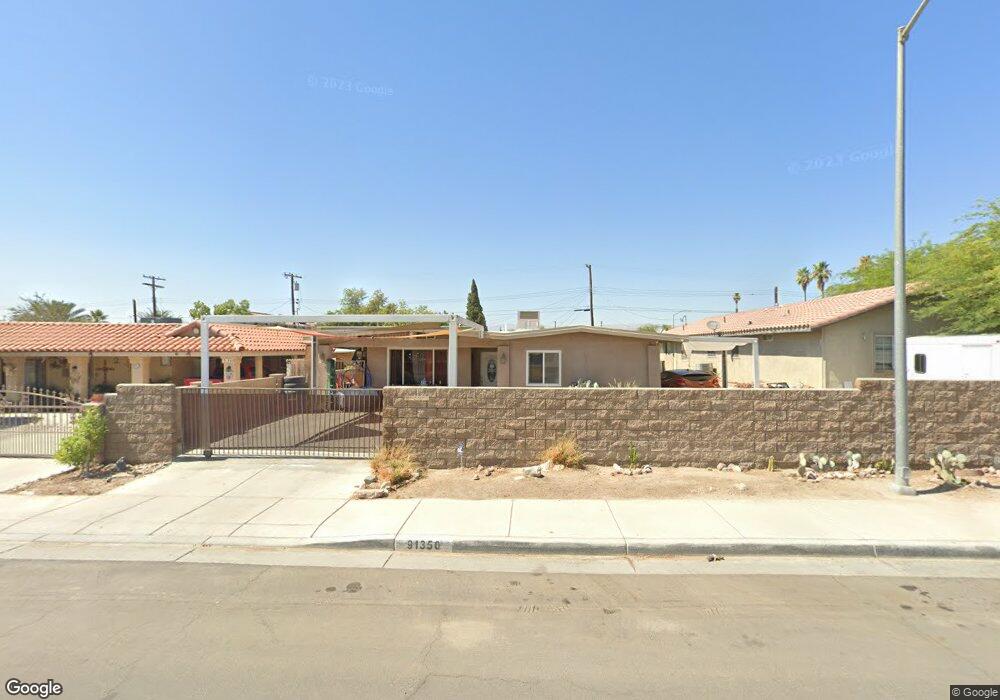
This home is located at 91350 4th St, Mecca, CA 92254 and is currently estimated at $220,456, approximately $224 per square foot. 91350 4th St is a home with nearby schools including Mecca Elementary School, Toro Canyon Middle School, and Desert Mirage High School.
Ownership History
Date
Name
Owned For
Owner Type
Purchase Details
Closed on
Oct 13, 2020
Sold by
Rios Maria E
Bought by
Rios Maria E and Maria E Rios Living Trust
Current Estimated Value
Purchase Details
Closed on
Mar 8, 2007
Sold by
Rios Maria
Bought by
Rios Emilio and Rios Maria E
Home Financials for this Owner
Home Financials are based on the most recent Mortgage that was taken out on this home.
Original Mortgage
$142,000
Interest Rate
6.29%
Mortgage Type
Stand Alone Refi Refinance Of Original Loan
Create a Home Valuation Report for This Property
The Home Valuation Report is an in-depth analysis detailing your home's value as well as a comparison with similar homes in the area
Home Values in the Area
Average Home Value in this Area
Purchase History
| Date | Buyer | Sale Price | Title Company |
|---|---|---|---|
| Rios Maria E | -- | None Available | |
| Rios Emilio | -- | Accommodation | |
| Rios Maria E | -- | Old Republic Title Co Riv |
Source: Public Records
Mortgage History
| Date | Status | Borrower | Loan Amount |
|---|---|---|---|
| Closed | Rios Maria E | $142,000 |
Source: Public Records
Tax History
| Year | Tax Paid | Tax Assessment Tax Assessment Total Assessment is a certain percentage of the fair market value that is determined by local assessors to be the total taxable value of land and additions on the property. | Land | Improvement |
|---|---|---|---|---|
| 2025 | $2,043 | $58,848 | $12,774 | $46,074 |
| 2023 | $2,043 | $56,565 | $12,279 | $44,286 |
| 2022 | $1,894 | $55,457 | $12,039 | $43,418 |
| 2021 | $1,818 | $54,368 | $11,802 | $42,566 |
| 2020 | $1,803 | $53,811 | $11,681 | $42,130 |
| 2019 | $1,783 | $52,756 | $11,452 | $41,304 |
| 2018 | $1,762 | $51,723 | $11,229 | $40,494 |
| 2017 | $1,805 | $50,709 | $11,009 | $39,700 |
| 2016 | $1,626 | $49,716 | $10,794 | $38,922 |
| 2015 | $1,596 | $48,972 | $10,633 | $38,339 |
| 2014 | $1,592 | $48,015 | $10,426 | $37,589 |
Source: Public Records
Map
Nearby Homes
- 00 Grapefruit Blvd
- 0 Dale Kiler Rd
- 024 Hammond Rd
- 0 Grapefruit Blvd
- 0 California 111
- 66th and Lincoln Vacant Land
- 0 Unit 219103508
- 0 Hwy 111 & Ave 68 Unit 219090434
- 70140 Johnson St
- 90575 64th Ave
- 63325 Buchanan St
- 59375 Lincoln St
- 91666 62nd Ave
- 0 Ave 64 Ave Unit 219137040DA
- 0 Grant St & Hammond Rd
- 1 68th Ave
- 0 Unit 219123225DA
- 0 Nwc Pierce St & Ave 64 Unit 219106942
- 88751 64th Ave
- 0 Ave 63 & W Pierce St Unit 219106924
- 91340 4th St
- 65575 Brown St
- 91330 4th St
- 91357 5th St
- 91347 5th St
- 91349 4th St
- 91333 5th St
- 91400 4th St
- 91320 4th St
- 0 Ca Unit 219086179DA
- 0 Ca Unit 219073256DA
- 65681 Brown St
- 91329 5th St
- 91333 4th St
- 0 Unknown Unit 41405075
- 0 Unknown Unit 41435229
- 0 Unknown Unit 41438734
- 0 Unknown Unit 41438733
- 0 Unknown Unit 21235585
- 0 N A Unit 219073010DA
Your Personal Tour Guide
Ask me questions while you tour the home.