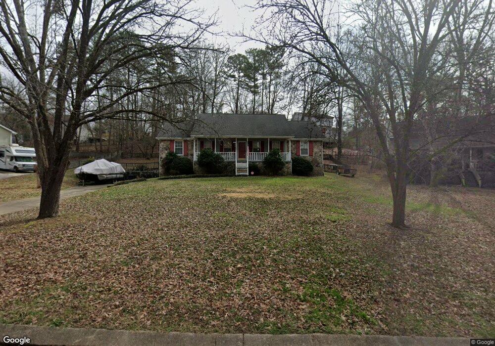
9136 Woodstream Ln Soddy Daisy, TN 37379
Estimated Value: $336,917 - $373,000
3
Beds
2
Baths
1,567
Sq Ft
$227/Sq Ft
Est. Value
About This Home
This home is located at 9136 Woodstream Ln, Soddy Daisy, TN 37379 and is currently estimated at $355,229, approximately $226 per square foot. 9136 Woodstream Ln is a home located in Hamilton County with nearby schools including McConnell Elementary School and Loftis Middle School.
Ownership History
Date
Name
Owned For
Owner Type
Purchase Details
Closed on
Jan 12, 2004
Sold by
Potter Gina Ann
Bought by
Potter Ronald A
Current Estimated Value
Home Financials for this Owner
Home Financials are based on the most recent Mortgage that was taken out on this home.
Original Mortgage
$100,000
Outstanding Balance
$46,149
Interest Rate
5.71%
Mortgage Type
New Conventional
Estimated Equity
$309,080
Purchase Details
Closed on
Apr 5, 2001
Sold by
Edwards Gordon D and Edwards Joan D
Bought by
Potter Ronald A and Potter Gina Ann
Home Financials for this Owner
Home Financials are based on the most recent Mortgage that was taken out on this home.
Original Mortgage
$75,000
Interest Rate
7.01%
Purchase Details
Closed on
Sep 30, 1996
Sold by
Gray John E and Gray Connie L
Bought by
Edwards Gordon D and Edwards Joan D
Home Financials for this Owner
Home Financials are based on the most recent Mortgage that was taken out on this home.
Original Mortgage
$78,800
Interest Rate
7.87%
Create a Home Valuation Report for This Property
The Home Valuation Report is an in-depth analysis detailing your home's value as well as a comparison with similar homes in the area
Home Values in the Area
Average Home Value in this Area
Purchase History
| Date | Buyer | Sale Price | Title Company |
|---|---|---|---|
| Potter Ronald A | -- | -- | |
| Potter Ronald A | $116,000 | Legal Title & Escrow Inc | |
| Edwards Gordon D | $98,500 | Legal Title & Escrow Inc |
Source: Public Records
Mortgage History
| Date | Status | Borrower | Loan Amount |
|---|---|---|---|
| Open | Potter Ronald A | $100,000 | |
| Closed | Potter Ronald A | $75,000 | |
| Previous Owner | Edwards Gordon D | $78,800 |
Source: Public Records
Tax History Compared to Growth
Tax History
| Year | Tax Paid | Tax Assessment Tax Assessment Total Assessment is a certain percentage of the fair market value that is determined by local assessors to be the total taxable value of land and additions on the property. | Land | Improvement |
|---|---|---|---|---|
| 2024 | $1,245 | $55,625 | $0 | $0 |
| 2023 | $1,254 | $55,625 | $0 | $0 |
| 2022 | $1,254 | $55,625 | $0 | $0 |
| 2021 | $1,254 | $55,625 | $0 | $0 |
| 2020 | $1,179 | $42,325 | $0 | $0 |
| 2019 | $1,179 | $42,325 | $0 | $0 |
| 2018 | $1,179 | $42,325 | $0 | $0 |
| 2017 | $1,179 | $42,325 | $0 | $0 |
| 2016 | $1,028 | $0 | $0 | $0 |
| 2015 | $1,028 | $36,850 | $0 | $0 |
| 2014 | $1,028 | $0 | $0 | $0 |
Source: Public Records
Map
Nearby Homes
- 1442 Alex Ln
- 1446 Alex Ln
- 9226 Sugar Pine Dr
- 8979 Hale Rd
- 9068 Polan Ln
- 9051 Mandy Ln
- 1568 Dallas Lake Rd
- 8549 Demars Ln
- 9111 Beranke Ln
- 8602 Kensley Ln
- 1013 Kenny Way
- 8642 Kensley Ln
- 9322 Fremont Way
- 8647 Kensley Ln
- 9378 Chirping Rd
- 9080 Wood Dale Ln
- 8517 Kensley Ln
- 8520 Kensley Ln
- 8725 Walnut Rd
- 318 Fox Gap Ln
- 9140 Woodstream Ln
- 9134 Woodstream Ln
- 1320 Woodsage Ct
- 1321 Woodsage Ct
- 1322 Woodsage Dr
- 9139 Woodstream Ln
- 9130 Woodstream Ln
- 9135 Woodstream Ln
- 1322 Woodsage Ct
- 1323 Woodsage Ct
- 1310 Woodsage Dr Unit 2
- 1330 Woodsage Dr
- 9129 Woodstream Ln
- 1321 Woodsage Dr
- 1340 Woodsage Dr
- 9133 Woodstream Ln
- 1128 Woodsage Dr
- 1315 Woodsage Dr
- 1323 Woodsage Dr
- 1311 Woodsage Dr