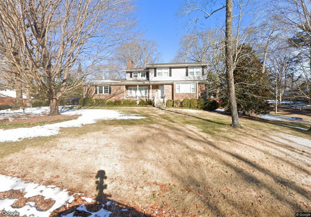
914 Crown Point Rd E Unit 1 Signal Mountain, TN 37377
Estimated Value: $547,000 - $618,481
--
Bed
--
Bath
2,390
Sq Ft
$245/Sq Ft
Est. Value
About This Home
This home is located at 914 Crown Point Rd E Unit 1, Signal Mountain, TN 37377 and is currently estimated at $586,120, approximately $245 per square foot. 914 Crown Point Rd E Unit 1 is a home located in Hamilton County with nearby schools including Thrasher Elementary School, Signal Mountain Middle/High School, and Signal Mountain Christian School.
Ownership History
Date
Name
Owned For
Owner Type
Purchase Details
Closed on
Feb 6, 2024
Sold by
Johnson Joseph T and Join Anne
Bought by
Clarke Lisa N
Current Estimated Value
Home Financials for this Owner
Home Financials are based on the most recent Mortgage that was taken out on this home.
Original Mortgage
$471,200
Outstanding Balance
$462,873
Interest Rate
6.61%
Mortgage Type
Credit Line Revolving
Estimated Equity
$123,247
Purchase Details
Closed on
May 23, 2012
Sold by
Johnson Joseph Thomas and Johnson Anne C
Bought by
Johnson Joseph T and Join Anne C
Create a Home Valuation Report for This Property
The Home Valuation Report is an in-depth analysis detailing your home's value as well as a comparison with similar homes in the area
Home Values in the Area
Average Home Value in this Area
Purchase History
| Date | Buyer | Sale Price | Title Company |
|---|---|---|---|
| Clarke Lisa N | $589,000 | National Title | |
| Johnson Joseph T | -- | None Available |
Source: Public Records
Mortgage History
| Date | Status | Borrower | Loan Amount |
|---|---|---|---|
| Open | Clarke Lisa N | $471,200 |
Source: Public Records
Tax History Compared to Growth
Tax History
| Year | Tax Paid | Tax Assessment Tax Assessment Total Assessment is a certain percentage of the fair market value that is determined by local assessors to be the total taxable value of land and additions on the property. | Land | Improvement |
|---|---|---|---|---|
| 2024 | $1,557 | $69,575 | $0 | $0 |
| 2023 | $1,557 | $69,575 | $0 | $0 |
| 2022 | $1,557 | $69,575 | $0 | $0 |
| 2021 | $1,557 | $69,575 | $0 | $0 |
| 2020 | $1,737 | $62,825 | $0 | $0 |
| 2019 | $1,737 | $62,825 | $0 | $0 |
| 2018 | $1,737 | $62,825 | $0 | $0 |
| 2017 | $1,737 | $62,825 | $0 | $0 |
| 2016 | $1,571 | $0 | $0 | $0 |
| 2015 | $1,571 | $56,800 | $0 | $0 |
| 2014 | $1,571 | $0 | $0 | $0 |
Source: Public Records
Map
Nearby Homes
- 422 Timberlinks Dr
- 102 Sunnybrook Trail
- 421 Timberlinks Dr
- 5734 U S 127
- 907 Kentucky Ave
- 1018 Ridgeway Ave
- 853 Kentucky Ave
- 779 James Blvd
- 958 Signal Rd
- 533 Fern Trail
- 928 Ridgeway Ave
- 185 Woodcliff Cir
- 12 Mountain Orchard Path
- 905 Ridgeway Ave
- 714 Berry Spring Path
- 0 Majestic Oaks Dr Unit 24033570
- 10 Acres Majestic Oaks Dr
- 10 Majestic Oaks Dr
- 1301 E Brow Rd
- 16 Northfield Rd
- 914 Crown Point Rd E
- 914 Crown Point Rd W
- 912 Crown Point Rd E
- 202 Echo Way
- 0 Glamis Cir
- 0 Glamis Cir Unit 1293215
- 0 Glamis Cir Unit 1293212
- 0 Glamis Cir Unit RTC2728476
- 0 Glamis Cir Unit RTC2732553
- 0 Glamis Cir Unit RTC2726769
- 0 Glamis Cir Unit RTC2726773
- 0 Glamis Cir Unit 1152588
- 0 Glamis Cir Unit 1131251
- 0 Glamis Cir Unit 1009387
- 0 Glamis Cir Unit 1006921
- 0 Glamis Cir Unit 1000688
- 999 Crown Point Rd E
- 1000 Crown Point Rd E
- 911 Crown Point Rd W
- 1001 Crown Point Rd W