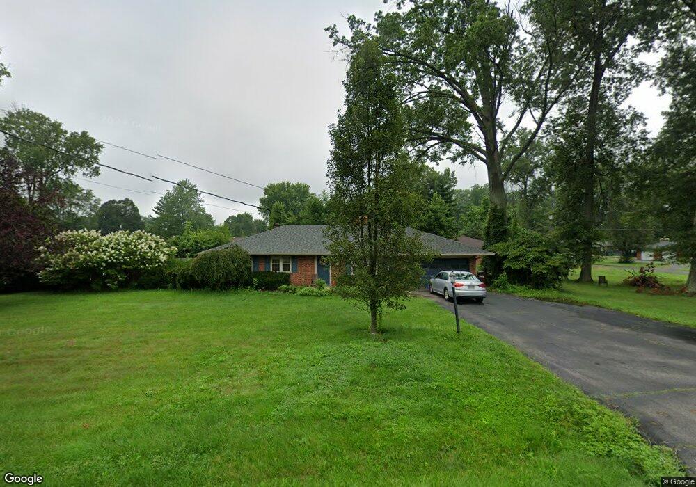
914 Hawthorne Dr Cincinnati, OH 45245
Estimated Value: $242,000 - $268,000
3
Beds
1
Bath
1,295
Sq Ft
$199/Sq Ft
Est. Value
About This Home
This home is located at 914 Hawthorne Dr, Cincinnati, OH 45245 and is currently estimated at $257,073, approximately $198 per square foot. 914 Hawthorne Dr is a home located in Clermont County with nearby schools including Clough Pike Elementary School, West Clermont Middle School, and West Clermont High School.
Ownership History
Date
Name
Owned For
Owner Type
Purchase Details
Closed on
Oct 21, 1999
Sold by
Shearer Richard D
Bought by
Bolger James P and Bolger Charlein M
Current Estimated Value
Home Financials for this Owner
Home Financials are based on the most recent Mortgage that was taken out on this home.
Original Mortgage
$102,600
Outstanding Balance
$31,169
Interest Rate
7.91%
Mortgage Type
New Conventional
Estimated Equity
$225,904
Create a Home Valuation Report for This Property
The Home Valuation Report is an in-depth analysis detailing your home's value as well as a comparison with similar homes in the area
Home Values in the Area
Average Home Value in this Area
Purchase History
| Date | Buyer | Sale Price | Title Company |
|---|---|---|---|
| Bolger James P | $114,000 | -- |
Source: Public Records
Mortgage History
| Date | Status | Borrower | Loan Amount |
|---|---|---|---|
| Open | Bolger James P | $102,600 |
Source: Public Records
Tax History Compared to Growth
Tax History
| Year | Tax Paid | Tax Assessment Tax Assessment Total Assessment is a certain percentage of the fair market value that is determined by local assessors to be the total taxable value of land and additions on the property. | Land | Improvement |
|---|---|---|---|---|
| 2024 | $2,959 | $68,360 | $16,770 | $51,590 |
| 2023 | $2,996 | $68,360 | $16,770 | $51,590 |
| 2022 | $2,336 | $48,720 | $11,550 | $37,170 |
| 2021 | $2,346 | $48,720 | $11,550 | $37,170 |
| 2020 | $2,352 | $48,790 | $11,550 | $37,240 |
| 2019 | $1,574 | $40,110 | $9,100 | $31,010 |
| 2018 | $1,590 | $40,110 | $9,100 | $31,010 |
| 2017 | $1,414 | $40,110 | $9,100 | $31,010 |
| 2016 | $1,414 | $33,990 | $7,700 | $26,290 |
| 2015 | $1,372 | $33,990 | $7,700 | $26,290 |
| 2014 | $1,372 | $33,990 | $7,700 | $26,290 |
| 2013 | $1,686 | $39,450 | $8,750 | $30,700 |
Source: Public Records
Map
Nearby Homes
- 4125 Beamer Ct
- 4165 S Gensen Loop
- 4272 N Gensen Loop
- 4237 N Yorkshire Square
- 985 Crestpoint Ct
- 4279 Larma Ln
- 3963 Pharo Dr
- 3963 Benjamin St
- 4310 Wuebold Ln
- 4129 Forsythia Dr
- 1055 Valley Wood Dr
- 4220 Forsythia Dr
- 4250 English Oaks Ct
- 3927 Youngman Dr
- 738 Clough Pike
- 1097 Stone Oak Blvd
- 1105 Ridgepointe Dr
- 1051 Crisfield Dr
- 1069 Crisfield Dr
- 3921 Randolph Ln
- 910 Hawthorne Dr
- 911 Hawthorne Dr
- 915 Hawthorne Dr
- 907 Hawthorne Dr
- 906 Hawthorne Dr
- 4132 Brookfield Dr
- 924 Hawthorne Dr
- 919 Hawthorne Dr
- 4143 Brookfield Dr
- 4136 Brookfield Dr
- 4147 Brookfield Dr
- 925 Hawthorne Dr
- 4140 Brookfield Dr
- 900 Hawthorne Dr
- 901 Hawthorne Dr
- 906 Baccarat Dr
- 908 Baccarat Dr
- 904 Baccarat Dr
- 910 Baccarat Dr
- 4142 Brookfield Dr