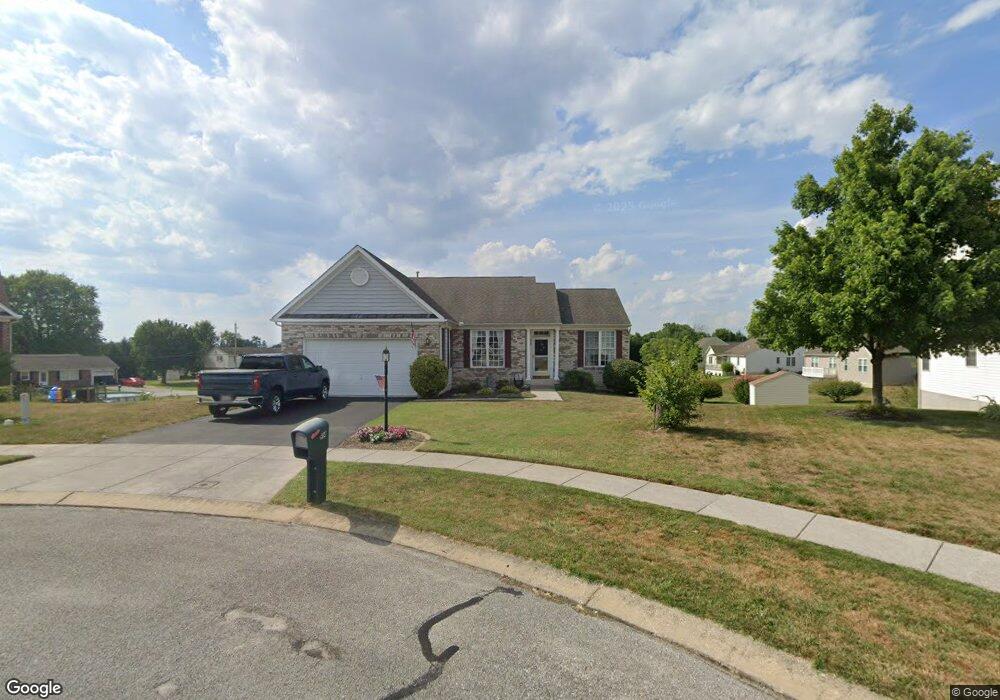
914 Poplar St Unit 12 Hanover, PA 17331
Estimated Value: $380,000 - $449,000
3
Beds
2
Baths
1,780
Sq Ft
$228/Sq Ft
Est. Value
About This Home
This home is located at 914 Poplar St Unit 12, Hanover, PA 17331 and is currently estimated at $406,290, approximately $228 per square foot. 914 Poplar St Unit 12 is a home located in Adams County with nearby schools including New Oxford Senior High School, St. Teresa of Calcutta Catholic School - McSherrystown Campus, and St. Teresa of Calcutta Catholic School - Conewago Campus.
Ownership History
Date
Name
Owned For
Owner Type
Purchase Details
Closed on
Jun 16, 2010
Sold by
Gibson Gary R and Gibson Debbie Ann
Bought by
Whitesell Robert W and Whitesell Victoria H
Current Estimated Value
Home Financials for this Owner
Home Financials are based on the most recent Mortgage that was taken out on this home.
Original Mortgage
$191,974
Outstanding Balance
$129,040
Interest Rate
5.03%
Mortgage Type
New Conventional
Estimated Equity
$277,250
Create a Home Valuation Report for This Property
The Home Valuation Report is an in-depth analysis detailing your home's value as well as a comparison with similar homes in the area
Home Values in the Area
Average Home Value in this Area
Purchase History
| Date | Buyer | Sale Price | Title Company |
|---|---|---|---|
| Whitesell Robert W | $256,000 | -- |
Source: Public Records
Mortgage History
| Date | Status | Borrower | Loan Amount |
|---|---|---|---|
| Open | Whitesell Robert W | $191,974 |
Source: Public Records
Tax History Compared to Growth
Tax History
| Year | Tax Paid | Tax Assessment Tax Assessment Total Assessment is a certain percentage of the fair market value that is determined by local assessors to be the total taxable value of land and additions on the property. | Land | Improvement |
|---|---|---|---|---|
| 2025 | $7,172 | $299,500 | $65,200 | $234,300 |
| 2024 | $6,625 | $299,500 | $65,200 | $234,300 |
| 2023 | $6,380 | $299,500 | $65,200 | $234,300 |
| 2022 | $6,185 | $299,500 | $65,200 | $234,300 |
| 2021 | $6,026 | $299,500 | $65,200 | $234,300 |
| 2020 | $6,035 | $299,500 | $65,200 | $234,300 |
| 2019 | $5,764 | $299,500 | $65,200 | $234,300 |
| 2018 | $5,643 | $299,500 | $65,200 | $234,300 |
| 2017 | $5,410 | $299,500 | $65,200 | $234,300 |
| 2016 | -- | $299,500 | $65,200 | $234,300 |
| 2015 | -- | $299,500 | $65,200 | $234,300 |
| 2014 | -- | $299,500 | $65,200 | $234,300 |
Source: Public Records
Map
Nearby Homes
- 303 Puma Dr Unit 22
- 129 Main St
- 617 N Blettner Ave Unit 120
- 337 2 Main
- 10 Bear Cir Unit 29
- 335 North St
- 417 Main St
- 303 Ridge Ave
- 46 Flint Dr
- 535 South St
- 54 Flint Dr
- 62 Flint Dr
- 65 Flint Dr
- 11 Flint Dr
- 24 Red Stone Ln Unit 47
- 24 Red Stone Ln
- 84 Red Stone Ln Unit 41
- 92 Red Stone Ln Unit 40
- 41 Buckskin
- 11 Shawl Dr
- 920 Poplar St Unit 13
- 908 Poplar St Unit 11
- 902 Poplar St Unit 10
- 140 Panther Dr Unit 8
- 915 Poplar St Unit 14
- 134 Panther Dr Unit 7
- 295 Mount Pleasant Rd
- 909 Poplar St
- 174 Panther Dr
- 307 Mount Pleasant Rd Unit 7
- 271 Mount Pleasant Rd
- 132 Panther Dr Unit 6
- 317 Mount Pleasant Rd
- 180 Panther Dr Unit 17
- 141 Panther Dr Unit 54
- 307 Puma Dr Unit 21
- 165 Panther Dr Unit 51
- 157 Panther Dr Unit 52
- 149 Panther Dr Unit 53
- 135 Panther Dr Unit 55