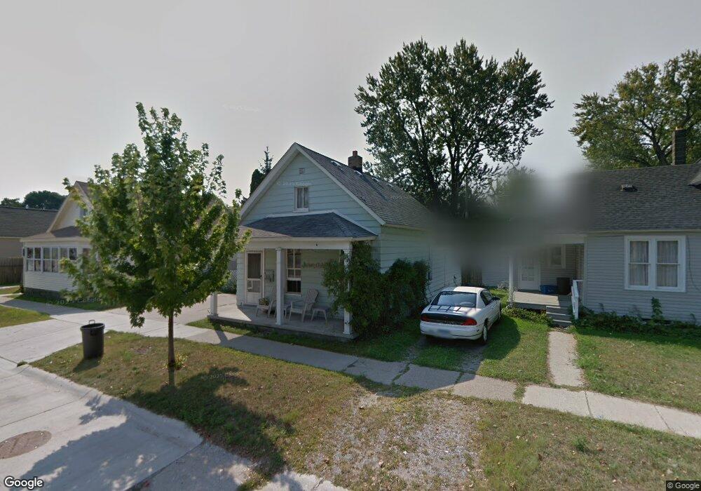
914 Rawlins St Port Huron, MI 48060
Estimated Value: $101,636 - $126,000
2
Beds
1
Bath
913
Sq Ft
$119/Sq Ft
Est. Value
About This Home
This home is located at 914 Rawlins St, Port Huron, MI 48060 and is currently estimated at $108,659, approximately $119 per square foot. 914 Rawlins St is a home located in St. Clair County with nearby schools including H.D. Crull Elementary School, Holland Woods Middle School, and Port Huron Northern High School.
Ownership History
Date
Name
Owned For
Owner Type
Purchase Details
Closed on
May 10, 2012
Sold by
Newton Warren and Newton Shirley
Bought by
Cutler Ronald and Cutler Patricia
Current Estimated Value
Purchase Details
Closed on
Apr 28, 2006
Sold by
Cutler Ronald E and Cutler Patricia L
Bought by
Vanmeter William J and Vanmeter Shelly L
Home Financials for this Owner
Home Financials are based on the most recent Mortgage that was taken out on this home.
Original Mortgage
$55,000
Interest Rate
6.63%
Mortgage Type
Seller Take Back
Create a Home Valuation Report for This Property
The Home Valuation Report is an in-depth analysis detailing your home's value as well as a comparison with similar homes in the area
Home Values in the Area
Average Home Value in this Area
Purchase History
| Date | Buyer | Sale Price | Title Company |
|---|---|---|---|
| Cutler Ronald | $29,000 | None Available | |
| Vanmeter William J | $55,000 | None Available |
Source: Public Records
Mortgage History
| Date | Status | Borrower | Loan Amount |
|---|---|---|---|
| Previous Owner | Vanmeter William J | $55,000 |
Source: Public Records
Tax History Compared to Growth
Tax History
| Year | Tax Paid | Tax Assessment Tax Assessment Total Assessment is a certain percentage of the fair market value that is determined by local assessors to be the total taxable value of land and additions on the property. | Land | Improvement |
|---|---|---|---|---|
| 2025 | $1,184 | $40,400 | $0 | $0 |
| 2024 | $901 | $37,900 | $0 | $0 |
| 2023 | $852 | $32,800 | $0 | $0 |
| 2022 | $823 | $28,400 | $0 | $0 |
| 2021 | $782 | $27,000 | $0 | $0 |
| 2020 | $790 | $24,200 | $24,200 | $0 |
| 2019 | $777 | $16,100 | $0 | $0 |
| 2018 | $738 | $16,100 | $0 | $0 |
| 2017 | $660 | $15,400 | $0 | $0 |
| 2016 | $552 | $15,400 | $0 | $0 |
| 2015 | $579 | $15,900 | $15,900 | $0 |
| 2014 | $579 | $16,200 | $16,200 | $0 |
| 2013 | -- | $15,900 | $0 | $0 |
Source: Public Records
Map
Nearby Homes
- 917 Saint Clair St
- 1002 Erie St
- 711 Stanton St
- 805 Pine Grove Ave
- 1417 Kearney St
- 201 Beers St Unit 32
- 201 Beers St Unit 53
- 201 Beers St Unit 61
- 201 Beers St Unit 44
- 201 Beers St Unit 34
- 1433 Poplar St
- 1013 Miller St
- 443 11th St
- 1109 Wells St
- 1203 Varney St
- 1321 Nelson St
- 1102 Lapeer Ave
- 1227 Lapeer Ave
- 911 9th St
- 1213 Gillett St
- 926 Willow St Unit Bldg-Unit
- 926 Willow St
- 915 Saint Clair St
- 922 Willow St
- 910 Rawlins St
- 902 Rawlins St
- 918 Willow St
- 913 Rawlins St
- 1006 Willow St
- 909 Rawlins St
- 913 Saint Clair St
- 901 Rawlins St
- 927 Willow Unit 2 St
- 914 Willow St
- 1000 Rawlins St
- 1010 Rawlins St
- 919 Willow St
- 1003 Rawlins St
- 1009 Rawlins St
- 820 Rawlins St