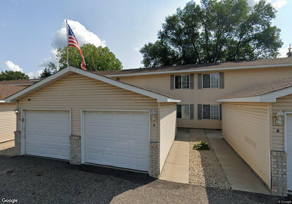
915 7th St Unit 18 Jordan, MN 55352
Estimated Value: $145,000 - $172,000
2
Beds
1
Bath
886
Sq Ft
$177/Sq Ft
Est. Value
About This Home
This home is located at 915 7th St Unit 18, Jordan, MN 55352 and is currently estimated at $156,999, approximately $177 per square foot. 915 7th St Unit 18 is a home located in Scott County with nearby schools including Jordan Elementary School, Hoboken Middle School, and Jordan Middle School.
Ownership History
Date
Name
Owned For
Owner Type
Purchase Details
Closed on
May 8, 2020
Sold by
Kroc Daniel Daniel
Current Estimated Value
Home Financials for this Owner
Home Financials are based on the most recent Mortgage that was taken out on this home.
Interest Rate
3.26%
Purchase Details
Closed on
Sep 4, 2015
Sold by
Eddleston Jeff and Eddleston Vanessa
Bought by
Kroc Daniel
Purchase Details
Closed on
Apr 1, 2005
Sold by
Jordan Greenleaf Properties Llp
Bought by
Not Provided
Create a Home Valuation Report for This Property
The Home Valuation Report is an in-depth analysis detailing your home's value as well as a comparison with similar homes in the area
Home Values in the Area
Average Home Value in this Area
Purchase History
| Date | Buyer | Sale Price | Title Company |
|---|---|---|---|
| -- | $100,000 | -- | |
| Kroc Daniel | $56,751 | Liberty Title Inc | |
| Not Provided | $129,900 | -- |
Source: Public Records
Mortgage History
| Date | Status | Borrower | Loan Amount |
|---|---|---|---|
| Closed | -- | -- |
Source: Public Records
Tax History Compared to Growth
Tax History
| Year | Tax Paid | Tax Assessment Tax Assessment Total Assessment is a certain percentage of the fair market value that is determined by local assessors to be the total taxable value of land and additions on the property. | Land | Improvement |
|---|---|---|---|---|
| 2025 | $1,528 | $131,900 | $34,600 | $97,300 |
| 2024 | $1,308 | $118,100 | $32,300 | $85,800 |
| 2023 | $1,208 | $98,700 | $13,200 | $85,500 |
| 2022 | $1,178 | $98,800 | $13,200 | $85,600 |
| 2021 | $1,144 | $78,500 | $11,000 | $67,500 |
| 2020 | $1,120 | $76,200 | $9,500 | $66,700 |
| 2019 | $994 | $72,500 | $6,300 | $66,200 |
| 2018 | $1,042 | $0 | $0 | $0 |
| 2016 | $782 | $0 | $0 | $0 |
| 2014 | -- | $0 | $0 | $0 |
Source: Public Records
Map
Nearby Homes
- 4X Valley View Dr
- 6X Valley View Dr
- 2X Valley View Dr
- 1X Valley View Dr
- 5X Valley View Dr
- 6305 W 190th Street (7acres)
- 712 Syndicate St
- 1X Highway 169
- 838 Lodge Dr
- 1XX Highway 169
- 6305 W 190th Street (22 Acres)
- 6305 X 15A W 190th St
- 109 2nd St E
- 6851 W 195th St
- 201 Firewatch Dr
- 1258 Beaumont Blvd
- 1262 Beaumont Blvd
- 1266 Beaumont Blvd
- 1268 Edge Way
- 1248 Edge Way