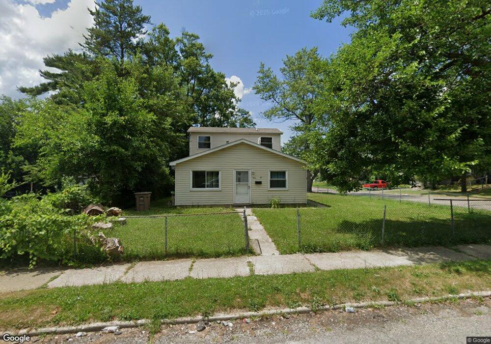
915 Melrose St Pontiac, MI 48340
Estimated Value: $111,000 - $172,000
3
Beds
2
Baths
1,350
Sq Ft
$110/Sq Ft
Est. Value
About This Home
This home is located at 915 Melrose St, Pontiac, MI 48340 and is currently estimated at $147,857, approximately $109 per square foot. 915 Melrose St is a home located in Oakland County with nearby schools including Rogers Elementary, Pontiac Middle School, and Pontiac High School.
Ownership History
Date
Name
Owned For
Owner Type
Purchase Details
Closed on
Apr 2, 2017
Sold by
Tubbs Knstopher
Bought by
Tubbs Kim
Current Estimated Value
Purchase Details
Closed on
Mar 9, 2012
Sold by
Schneider Richard A and Schneider Renee
Bought by
Tubbs Kim M
Purchase Details
Closed on
Jul 15, 2008
Sold by
Robinson Robin and Thomas Evelyn
Bought by
Wachovia Equity Servicing Llc
Create a Home Valuation Report for This Property
The Home Valuation Report is an in-depth analysis detailing your home's value as well as a comparison with similar homes in the area
Home Values in the Area
Average Home Value in this Area
Purchase History
| Date | Buyer | Sale Price | Title Company |
|---|---|---|---|
| Tubbs Kim | -- | None Available | |
| Tubbs Kim M | $35,000 | Sterling Title Agency | |
| Wachovia Equity Servicing Llc | $55,173 | None Available |
Source: Public Records
Tax History Compared to Growth
Tax History
| Year | Tax Paid | Tax Assessment Tax Assessment Total Assessment is a certain percentage of the fair market value that is determined by local assessors to be the total taxable value of land and additions on the property. | Land | Improvement |
|---|---|---|---|---|
| 2024 | $673 | $48,010 | $0 | $0 |
| 2023 | $641 | $44,420 | $0 | $0 |
| 2022 | $686 | $38,270 | $0 | $0 |
| 2021 | $666 | $33,620 | $0 | $0 |
| 2020 | $582 | $30,010 | $0 | $0 |
| 2019 | $641 | $25,340 | $0 | $0 |
| 2018 | $610 | $21,480 | $0 | $0 |
| 2017 | $581 | $20,290 | $0 | $0 |
| 2016 | $608 | $16,960 | $0 | $0 |
| 2015 | -- | $15,350 | $0 | $0 |
| 2014 | -- | $14,870 | $0 | $0 |
| 2011 | -- | $26,850 | $0 | $0 |
Source: Public Records
Map
Nearby Homes
- 821 Robinwood St
- 785 Kenilworth Ave
- 802 Cameron Ave
- 790 Cameron Ave
- 790 Parkwood Ave
- 770 Cameron Ave
- 973 Kettering Ave
- 808 Kettering Ave
- 715 Kenilworth Ave
- 644 Brady Ln
- 663 Lenox Ave
- 731 1st Ave
- 667 Raskob St
- 457 Cameron Ave
- 630 E Madison Ave
- 608 Brady Ln
- 627 Wesbrook St
- 602 Brady Ln
- 620 Wesbrook St
- 778 4th Ave
- 903 Melrose St
- 925 Melrose St
- 912 Melrose St
- 906 Melrose St
- 929 Melrose St
- 902 Melrose St
- 893 Melrose St
- 924 Melrose St
- 896 Stirling St
- 928 Melrose St
- 887 Melrose St
- 932 Melrose St
- 892 Melrose St
- 1268 N Perry St
- 886 Stirling St
- 1232 N Perry St
- 913 Kenilworth Ave
- 936 Melrose St
- 882 Stirling St
- 883 Melrose St