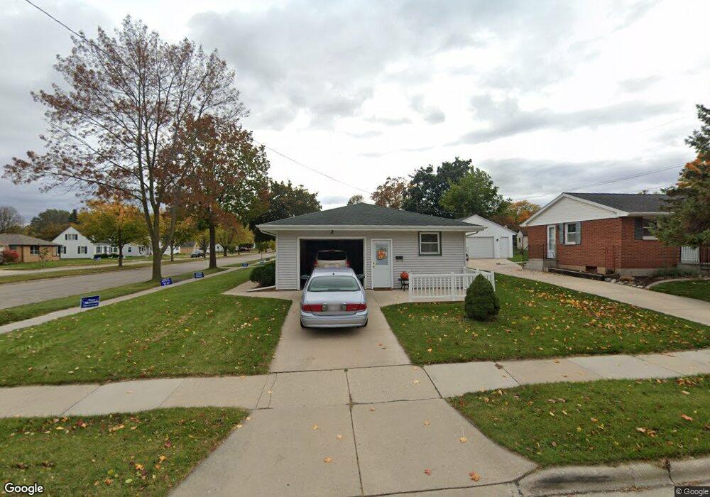
915 Royal Blvd Green Bay, WI 54303
Mather Heights NeighborhoodEstimated Value: $226,024 - $245,000
3
Beds
1
Bath
1,052
Sq Ft
$225/Sq Ft
Est. Value
About This Home
This home is located at 915 Royal Blvd, Green Bay, WI 54303 and is currently estimated at $236,506, approximately $224 per square foot. 915 Royal Blvd is a home located in Brown County with nearby schools including Chappell Elementary School, Franklin Middle School, and West High School.
Ownership History
Date
Name
Owned For
Owner Type
Purchase Details
Closed on
Dec 19, 2016
Sold by
Perez Kenneth R
Bought by
Kenneth Kenneth R and Kenneth Barbara G Perez
Current Estimated Value
Purchase Details
Closed on
Oct 20, 2009
Sold by
Marquette Michael O
Bought by
Perez Kenneth R
Home Financials for this Owner
Home Financials are based on the most recent Mortgage that was taken out on this home.
Original Mortgage
$87,387
Interest Rate
5.07%
Mortgage Type
FHA
Purchase Details
Closed on
Sep 7, 2001
Sold by
Wheaton Gloria J
Bought by
Wheaton Paul J
Create a Home Valuation Report for This Property
The Home Valuation Report is an in-depth analysis detailing your home's value as well as a comparison with similar homes in the area
Home Values in the Area
Average Home Value in this Area
Purchase History
| Date | Buyer | Sale Price | Title Company |
|---|---|---|---|
| Kenneth Kenneth R | $77,500 | -- | |
| Perez Kenneth R | $89,000 | Liberty Title | |
| Wheaton Paul J | -- | -- |
Source: Public Records
Mortgage History
| Date | Status | Borrower | Loan Amount |
|---|---|---|---|
| Previous Owner | Perez Kenneth R | $87,387 |
Source: Public Records
Tax History Compared to Growth
Tax History
| Year | Tax Paid | Tax Assessment Tax Assessment Total Assessment is a certain percentage of the fair market value that is determined by local assessors to be the total taxable value of land and additions on the property. | Land | Improvement |
|---|---|---|---|---|
| 2024 | $2,181 | $124,200 | $18,700 | $105,500 |
| 2023 | $2,051 | $124,200 | $18,700 | $105,500 |
| 2022 | $2,029 | $124,200 | $18,700 | $105,500 |
| 2021 | $1,907 | $89,300 | $14,600 | $74,700 |
| 2020 | $1,959 | $89,300 | $14,600 | $74,700 |
| 2019 | $1,883 | $89,300 | $14,600 | $74,700 |
| 2018 | $1,848 | $89,300 | $14,600 | $74,700 |
| 2017 | $1,846 | $89,300 | $14,600 | $74,700 |
| 2016 | $1,812 | $89,300 | $14,600 | $74,700 |
| 2015 | $1,924 | $89,300 | $14,600 | $74,700 |
| 2014 | $1,944 | $89,300 | $14,600 | $74,700 |
| 2013 | $1,944 | $89,300 | $14,600 | $74,700 |
Source: Public Records
Map
Nearby Homes
- 820 N Platten St
- 1037 Royal Blvd
- 819 N Platten St
- 1037 Park St
- 1013 N Locust St
- 717 Park St
- 710 Royal Blvd
- 709 N Locust St
- 1261 Mather St
- 1036 Neville Ave
- 1193 Bond St
- 412 Saratoga St
- 1280 Division St Unit 1282
- 1095 Minahan St
- 1125 Elmore St
- 1169 Division St
- 1264 Shawano Ave
- 425 Columbia Ave
- 1411 Shawano Ave
- 515 Northern Ave
- 1323 Desnoyers St
- 909 Royal Blvd
- 1325 Desnoyers St
- 905 Royal Blvd
- 908 Thrush St
- 914 Thrush St
- 914 Royal Blvd
- 1318 Desnoyers St
- 1324 Desnoyers St
- 904 Thrush St
- 1328 Desnoyers St
- 908 Royal Blvd
- 901 Royal Blvd
- 1301 Desnoyers St
- 904 Royal Blvd
- 1004 Thrush St
- 1304 Desnoyers St
- 1299 Desnoyers St
- 1013 Royal Blvd
- 900 Royal Blvd