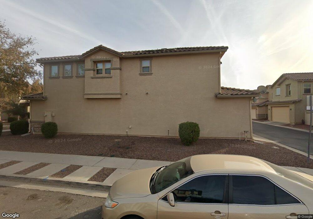
915 S Pheasant Dr Gilbert, AZ 85296
Morrison Ranch NeighborhoodEstimated Value: $408,701 - $502,000
Studio
1
Bath
1,661
Sq Ft
$268/Sq Ft
Est. Value
About This Home
This home is located at 915 S Pheasant Dr, Gilbert, AZ 85296 and is currently estimated at $445,675, approximately $268 per square foot. 915 S Pheasant Dr is a home located in Maricopa County with nearby schools including Gateway Pointe Elementary School, Cooley Middle School, and Williams Field High School.
Ownership History
Date
Name
Owned For
Owner Type
Purchase Details
Closed on
Sep 29, 2023
Sold by
Tinkam I Patrick I and Tinkam Constance A
Bought by
Tinkam Family Living Trust and Tinkam
Current Estimated Value
Purchase Details
Closed on
Aug 27, 2023
Sold by
Tinkam I Patrick I and Tinkam Constance A
Bought by
Tinkam Family Living Trust and Tinkam
Purchase Details
Closed on
May 2, 2011
Sold by
Kb Home Sales Phoenix Inc
Bought by
Tinkam Patrick and Tinkam Constance A
Home Financials for this Owner
Home Financials are based on the most recent Mortgage that was taken out on this home.
Original Mortgage
$146,674
Interest Rate
4.75%
Mortgage Type
FHA
Purchase Details
Closed on
Feb 24, 2006
Sold by
Gmac Model Home Finance Inc
Bought by
Kb Home Phoenix Inc
Create a Home Valuation Report for This Property
The Home Valuation Report is an in-depth analysis detailing your home's value as well as a comparison with similar homes in the area
Home Values in the Area
Average Home Value in this Area
Purchase History
| Date | Buyer | Sale Price | Title Company |
|---|---|---|---|
| Tinkam Family Living Trust | -- | None Listed On Document | |
| Tinkam Family Living Trust | -- | None Listed On Document | |
| Tinkam Patrick | $150,490 | First American Title Ins Co | |
| Kb Home Sales Phoenix Inc | -- | First American Title Ins Co | |
| Kb Home Phoenix Inc | $2,103,719 | First American Title |
Source: Public Records
Mortgage History
| Date | Status | Borrower | Loan Amount |
|---|---|---|---|
| Previous Owner | Tinkam Patrick | $146,674 |
Source: Public Records
Tax History
| Year | Tax Paid | Tax Assessment Tax Assessment Total Assessment is a certain percentage of the fair market value that is determined by local assessors to be the total taxable value of land and additions on the property. | Land | Improvement |
|---|---|---|---|---|
| 2025 | $1,486 | $19,943 | -- | -- |
| 2024 | $1,594 | $18,993 | -- | -- |
| 2023 | $1,594 | $31,420 | $6,280 | $25,140 |
| 2022 | $1,523 | $23,750 | $4,750 | $19,000 |
| 2021 | $1,567 | $21,370 | $4,270 | $17,100 |
| 2020 | $1,596 | $20,400 | $4,080 | $16,320 |
| 2019 | $1,550 | $18,030 | $3,600 | $14,430 |
| 2018 | $1,493 | $16,800 | $3,360 | $13,440 |
| 2017 | $1,438 | $15,720 | $3,140 | $12,580 |
| 2016 | $1,461 | $15,900 | $3,180 | $12,720 |
| 2015 | $1,273 | $15,880 | $3,170 | $12,710 |
Source: Public Records
Map
Nearby Homes
- 883 S Pheasant Dr
- 921 S Swallow Ln
- 867 S Swallow Ln
- 4068 E Ranch Rd
- 1033 S Deerfield Ln
- 1029 S Cheshire Ln
- 4144 E Devon Dr
- 4055 E Amoroso Dr
- 4109 E Devon Dr
- 654 S Beebe St
- 4146 E Appaloosa Rd
- 3843 E Gideon Way
- 838 S Huish Dr
- 907 S Henry Ln
- 4118 E Jasper Dr Unit 23
- 3827 E Sabra Ln
- 849 S Henry Ln
- 4272 E Jasper Dr
- 4310 E Jasper Dr Unit 91
- 4330 E Jasper Dr
- 915 S Pheasant Dr Unit Lot 269
- 917 S Pheasant Dr
- 913 S Pheasant Dr
- 919 S Pheasant Dr Unit Lot 267
- 927 S Pheasant Dr
- 929 S Pheasant Dr
- 925 S Pheasant Dr
- 897 S Pheasant Dr
- 923 S Pheasant Dr
- 899 S Pheasant Dr
- 895 S Pheasant Dr
- 916 S Pheasant Dr
- 893 S Pheasant Dr
- 902 S Pheasant Dr
- 914 S Pheasant Dr
- 929 S Deerfield Ln
- 898 S Pheasant Dr
- 904 S Pheasant Dr
- 943 S Pheasant Dr
- 945 S Pheasant Dr
Your Personal Tour Guide
Ask me questions while you tour the home.