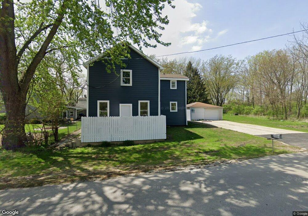
915 S Spencer Rd New Lenox, IL 60451
Estimated Value: $216,421 - $459,000
--
Bed
--
Bath
--
Sq Ft
8,276
Sq Ft Lot
About This Home
This home is located at 915 S Spencer Rd, New Lenox, IL 60451 and is currently estimated at $351,105. 915 S Spencer Rd is a home located in Will County with nearby schools including Spencer Trail, Spencer Crossing Intermediate School, and Spencer Pointe.
Ownership History
Date
Name
Owned For
Owner Type
Purchase Details
Closed on
May 30, 2024
Sold by
Michael L Poteete Trust and Poteete Helen A
Bought by
Wiechec Phillip
Current Estimated Value
Home Financials for this Owner
Home Financials are based on the most recent Mortgage that was taken out on this home.
Original Mortgage
$142,500
Outstanding Balance
$140,541
Interest Rate
6.63%
Mortgage Type
New Conventional
Estimated Equity
$210,564
Purchase Details
Closed on
Sep 8, 2009
Sold by
Conley David P and Conley Sharon A
Bought by
Poteete Helen A
Purchase Details
Closed on
Nov 1, 1994
Sold by
Perry Melvin W and Perry Tammy M
Bought by
Poteete Helen A and Michael L Poteete Trust
Home Financials for this Owner
Home Financials are based on the most recent Mortgage that was taken out on this home.
Original Mortgage
$60,000
Interest Rate
8%
Mortgage Type
Purchase Money Mortgage
Create a Home Valuation Report for This Property
The Home Valuation Report is an in-depth analysis detailing your home's value as well as a comparison with similar homes in the area
Home Values in the Area
Average Home Value in this Area
Purchase History
| Date | Buyer | Sale Price | Title Company |
|---|---|---|---|
| Wiechec Phillip | $150,000 | Fidelity National Title | |
| Poteete Helen A | -- | None Available | |
| Poteete Helen A | $120,000 | -- |
Source: Public Records
Mortgage History
| Date | Status | Borrower | Loan Amount |
|---|---|---|---|
| Open | Wiechec Phillip | $142,500 | |
| Previous Owner | Poteete Helen A | $60,000 |
Source: Public Records
Tax History Compared to Growth
Tax History
| Year | Tax Paid | Tax Assessment Tax Assessment Total Assessment is a certain percentage of the fair market value that is determined by local assessors to be the total taxable value of land and additions on the property. | Land | Improvement |
|---|---|---|---|---|
| 2024 | $5,754 | $81,543 | $22,697 | $58,846 |
| 2023 | $5,754 | $74,333 | $20,690 | $53,643 |
| 2022 | $5,504 | $68,478 | $19,060 | $49,418 |
| 2021 | $4,935 | $64,401 | $17,925 | $46,476 |
| 2020 | $4,786 | $62,103 | $17,285 | $44,818 |
| 2019 | $4,571 | $60,177 | $16,749 | $43,428 |
| 2018 | $4,457 | $58,102 | $16,171 | $41,931 |
| 2017 | $4,224 | $56,432 | $15,706 | $40,726 |
| 2016 | $4,094 | $54,922 | $15,286 | $39,636 |
| 2015 | $3,954 | $53,193 | $14,805 | $38,388 |
| 2014 | $3,954 | $52,536 | $14,622 | $37,914 |
| 2013 | $3,954 | $53,244 | $14,819 | $38,425 |
Source: Public Records
Map
Nearby Homes
- 911 Canongate Ln
- 805 Regent St
- 1535 Glenbrooke Ln
- 203 Tonell Ave
- 701 Bishops Gate
- 117 Walona Ave
- 2019 Royalglen Dr
- 1017 E Lincoln Hwy
- 1851 Glenlake Ct
- 1981 Stapleton Rd
- 1978 Stapleton Rd
- 125 N Anderson Rd
- 1990 Edgeview Dr
- 1351 E Lincoln Hwy
- LOT 8 W Laraway Rd
- 2181 Wellington Ct
- 328 E Lincoln Hwy
- 1000 S Cedar Rd
- 500 E Laraway Rd
- 550 E Laraway Rd
- 1215 E Illinois Hwy
- 1211 E Illinois Hwy
- 1211 E Illinois Hwy
- 1209 E Illinois Hwy
- 845 S Spencer Rd
- 1212 E Illinois Hwy
- 21547 Spencer Rd
- 1205 E Illinois Hwy
- 1208 E Illinois Hwy
- 1302 Terrence Dr
- 450 Terrence Dr
- 800 Terrence Dr
- 400 Terrence Dr
- 300 Terrence Dr
- 100 Terrence Dr
- 808 Longlane Rd
- 1320 Terrence Dr
- 1300 Terrence Dr
- 950 Terrence Dr
- 900 Terrence Dr