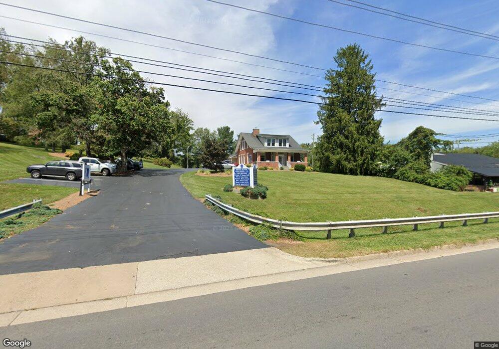
915 W Main St Abingdon, VA 24210
Estimated Value: $1,274,475
1
Bed
1
Bath
5,009
Sq Ft
$254/Sq Ft
Est. Value
About This Home
This home is located at 915 W Main St, Abingdon, VA 24210 and is currently estimated at $1,274,475, approximately $254 per square foot. 915 W Main St is a home located in Washington County with nearby schools including Abingdon Elementary School, E.B. Stanley Middle School, and Abingdon High School.
Ownership History
Date
Name
Owned For
Owner Type
Purchase Details
Closed on
Feb 24, 2025
Sold by
Ronnie L Brown Revocable Trust and Bob L Brown Revocable Trust
Bought by
T & T Of Abingdon Llc
Current Estimated Value
Home Financials for this Owner
Home Financials are based on the most recent Mortgage that was taken out on this home.
Original Mortgage
$170,000
Outstanding Balance
$169,140
Interest Rate
6.93%
Mortgage Type
Credit Line Revolving
Estimated Equity
$1,105,335
Create a Home Valuation Report for This Property
The Home Valuation Report is an in-depth analysis detailing your home's value as well as a comparison with similar homes in the area
Home Values in the Area
Average Home Value in this Area
Purchase History
| Date | Buyer | Sale Price | Title Company |
|---|---|---|---|
| T & T Of Abingdon Llc | $1,235,000 | None Listed On Document |
Source: Public Records
Mortgage History
| Date | Status | Borrower | Loan Amount |
|---|---|---|---|
| Open | T & T Of Abingdon Llc | $170,000 |
Source: Public Records
Tax History Compared to Growth
Tax History
| Year | Tax Paid | Tax Assessment Tax Assessment Total Assessment is a certain percentage of the fair market value that is determined by local assessors to be the total taxable value of land and additions on the property. | Land | Improvement |
|---|---|---|---|---|
| 2025 | $3,917 | $812,200 | $241,200 | $571,000 |
| 2024 | $3,917 | $652,900 | $193,000 | $459,900 |
| 2023 | $3,917 | $652,900 | $193,000 | $459,900 |
| 2022 | $3,917 | $652,900 | $193,000 | $459,900 |
| 2021 | $3,917 | $652,900 | $193,000 | $459,900 |
| 2019 | $4,029 | $639,500 | $193,000 | $446,500 |
| 2018 | $4,029 | $639,500 | $193,000 | $446,500 |
| 2017 | $4,029 | $639,500 | $193,000 | $446,500 |
| 2016 | $4,016 | $637,400 | $193,000 | $444,400 |
| 2015 | $4,016 | $637,400 | $193,000 | $444,400 |
| 2014 | $4,016 | $637,400 | $193,000 | $444,400 |
Source: Public Records
Map
Nearby Homes
- 945 Maiden St
- 213 Campbell St SW
- 1021 W Main St
- 623 Wyndale Rd Unit 6
- 625 Wyndale Rd
- 622 W Main St
- 262 Hallock Dr
- 641 Locust St NW
- 684 Hallock Cir
- 226 Hallock Dr
- lOT121 Meadowbrook Dr
- LOT 89 Cheyenne Trail
- tbd Lot 89 E Cheyenne Trail
- 211 Butt St SW
- 21390 Sheffield Ct
- 20256 Avondale Rd
- 16344 Southwood Dr
- 0 Porterfield Hwy
- TR.#5& 6 Old Jonesboro Rd
- 15590 Piper Spring Ave
- 909 W Main St
- 0 Highway 11
- 914 W Main St
- 863 W Main St
- 931 W Main St
- 906 W Main St
- 867 W Main St
- 859 Colonial Rd SW
- 921, 922 Beverly Dr
- Lot #2 Colonial Square
- 853 Colonial Rd SW
- 853 Colonial Rd SW Unit 1
- 908 Colonial Rd SW
- 910 Colonial Rd SW
- 920 W Main St
- 930 Beverly Dr Unit 10
- 930 Beverly Dr
- 914 Beverly Dr
- 914 Beverly Dr
- 914 Beverly Dr