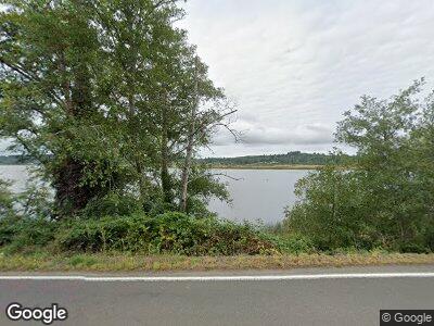
91579 Highway 202 Astoria, OR 97103
River Point NeighborhoodEstimated Value: $415,000 - $513,000
2
Beds
1
Bath
882
Sq Ft
$533/Sq Ft
Est. Value
About This Home
This home is located at 91579 Highway 202, Astoria, OR 97103 and is currently estimated at $470,020, approximately $532 per square foot. 91579 Highway 202 is a home located in Clatsop County with nearby schools including Astor Elementary School, Lewis & Clark Elementary School, and Astoria Middle School.
Ownership History
Date
Name
Owned For
Owner Type
Purchase Details
Closed on
Mar 16, 2016
Sold by
Moore Martha A
Bought by
Mestrich Gregg E
Current Estimated Value
Home Financials for this Owner
Home Financials are based on the most recent Mortgage that was taken out on this home.
Original Mortgage
$152,000
Interest Rate
3.72%
Mortgage Type
New Conventional
Create a Home Valuation Report for This Property
The Home Valuation Report is an in-depth analysis detailing your home's value as well as a comparison with similar homes in the area
Home Values in the Area
Average Home Value in this Area
Purchase History
| Date | Buyer | Sale Price | Title Company |
|---|---|---|---|
| Mestrich Gregg E | $190,000 | Ticor Title Company |
Source: Public Records
Mortgage History
| Date | Status | Borrower | Loan Amount |
|---|---|---|---|
| Open | Mestrich Gregg E | $170,000 | |
| Closed | Mestrich Gregg E | $152,000 | |
| Previous Owner | Moore Martha A | $156,000 | |
| Previous Owner | Moore Martha | $164,823 | |
| Previous Owner | Moore Martha A | $20,000 |
Source: Public Records
Tax History Compared to Growth
Tax History
| Year | Tax Paid | Tax Assessment Tax Assessment Total Assessment is a certain percentage of the fair market value that is determined by local assessors to be the total taxable value of land and additions on the property. | Land | Improvement |
|---|---|---|---|---|
| 2024 | $2,957 | $212,793 | -- | -- |
| 2023 | $2,852 | $206,597 | $0 | $0 |
| 2022 | $2,774 | $200,580 | $0 | $0 |
| 2021 | $2,700 | $194,738 | $0 | $0 |
| 2020 | $2,624 | $189,067 | $0 | $0 |
| 2019 | $2,545 | $183,561 | $0 | $0 |
| 2018 | $2,289 | $178,216 | $0 | $0 |
| 2017 | $2,179 | $173,027 | $0 | $0 |
| 2016 | $1,872 | $146,640 | $82,557 | $64,083 |
| 2015 | $1,844 | $142,370 | $80,153 | $62,217 |
| 2014 | $1,820 | $138,224 | $0 | $0 |
| 2013 | -- | $134,199 | $0 | $0 |
Source: Public Records
Map
Nearby Homes
- 35927 Abbie Ln
- 35567 Dow Ln
- 90605 Oregon 202
- 92277 Youngs River Rd
- 35636 Bella Ridge Loop
- 35634 Bella Ridge Loop
- 35680 Bella Ridge Loop
- 35692 Bella Ridge Loop
- 91627 Walluski Loop
- Lot 36 Bella Ridge Loop
- 36 Bella Ridge Rd
- 16 Bella Ridge Loop
- 0 V L Walluski Loop
- 34985 Hwy 101 Business
- 37285 Towhee Dr
- 35363 Woodland Ln
- 90373 Oregon 202
- 90373 Highway 202
- 0 Wireless Rd
- 92621 Wireless Rd Unit 2
- 91579 Highway 202
- 91579 Hwy 202
- 91579 Highway 202
- 91569 Highway 202 Unit 91567
- 91595 Highway 202
- 91613 Highway 202
- 91615 Highway 202 Unit 91613
- 91609 Highway 202
- 91617 Highway 202
- 91636 Highway 202
- 91641 Highway 202
- 36340 Foxglove Ln
- 36338 Foxglove Ln
- 36476 Cadonau Ln
- 91471 Hwy 202 Hwy
- 91471 Highway 202
- 36506 Cadonau Ln
- 36203 River Point Dr
- 91784 Highway 202
- 36284 Foxglove Ln
