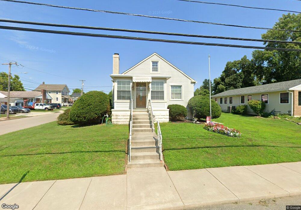
916 Amosland Rd Morton, PA 19070
Estimated Value: $295,000 - $336,355
3
Beds
2
Baths
1,076
Sq Ft
$288/Sq Ft
Est. Value
About This Home
This home is located at 916 Amosland Rd, Morton, PA 19070 and is currently estimated at $309,589, approximately $287 per square foot. 916 Amosland Rd is a home located in Delaware County with nearby schools including Amosland El School, Ridley Middle School, and Ridley High School.
Ownership History
Date
Name
Owned For
Owner Type
Purchase Details
Closed on
Oct 21, 2005
Sold by
Morrison Jean V
Bought by
Callahan Vincent and Callahan Katharine
Current Estimated Value
Home Financials for this Owner
Home Financials are based on the most recent Mortgage that was taken out on this home.
Original Mortgage
$144,000
Outstanding Balance
$76,881
Interest Rate
5.72%
Mortgage Type
Fannie Mae Freddie Mac
Estimated Equity
$232,708
Purchase Details
Closed on
Feb 17, 1994
Sold by
Morrison William H and Morrison Jean V
Bought by
Morrison Jean V
Create a Home Valuation Report for This Property
The Home Valuation Report is an in-depth analysis detailing your home's value as well as a comparison with similar homes in the area
Home Values in the Area
Average Home Value in this Area
Purchase History
| Date | Buyer | Sale Price | Title Company |
|---|---|---|---|
| Callahan Vincent | $180,000 | None Available | |
| Morrison Jean V | -- | -- |
Source: Public Records
Mortgage History
| Date | Status | Borrower | Loan Amount |
|---|---|---|---|
| Open | Callahan Vincent | $144,000 |
Source: Public Records
Tax History Compared to Growth
Tax History
| Year | Tax Paid | Tax Assessment Tax Assessment Total Assessment is a certain percentage of the fair market value that is determined by local assessors to be the total taxable value of land and additions on the property. | Land | Improvement |
|---|---|---|---|---|
| 2025 | $6,531 | $188,100 | $63,090 | $125,010 |
| 2024 | $6,531 | $188,100 | $63,090 | $125,010 |
| 2023 | $6,247 | $188,100 | $63,090 | $125,010 |
| 2022 | $6,047 | $188,100 | $63,090 | $125,010 |
| 2021 | $9,360 | $188,100 | $63,090 | $125,010 |
| 2020 | $5,502 | $97,390 | $37,850 | $59,540 |
| 2019 | $5,401 | $97,390 | $37,850 | $59,540 |
| 2018 | $5,334 | $97,390 | $0 | $0 |
| 2017 | $5,334 | $97,390 | $0 | $0 |
| 2016 | $534 | $97,390 | $0 | $0 |
| 2015 | $534 | $97,390 | $0 | $0 |
| 2014 | $534 | $97,390 | $0 | $0 |
Source: Public Records
Map
Nearby Homes
- 31 Silver Lake Terrace Unit 32
- 916 Brooke Ave
- 1015 Mitchell Ave
- 810 Quince Ln
- 742 Agnes Ave
- 7 & 0 Woodland Ave
- 2 Yale Ave
- 15 Sycamore Ave
- 136 Linden Ave
- 601 Country Ln
- 120 Bridge St
- 2330 Poe Rd
- 111 Broad St
- 115 President Ave
- 216-218 President Ave
- 668 Hutchinson Terrace
- 880 Quaint St
- 226 W Sylvan Ave
- 2379 Mole Rd
- 246 Pennington Ave
- 912 Amosland Rd
- 2104 Highland Ave
- 2101 Highland Ave
- 904 Amosland Rd
- 2108 Highland Ave
- 930 Amosland Rd
- 2105 Highland Ave
- 913 Amosland Rd
- 2103 Haig Ave
- 2112 Highland Ave
- 909 Amosland Rd
- 2109 Highland Ave
- 905 Amosland Rd
- 2111 Haig Ave
- 2116 Highland Ave
- 901 Amosland Rd
- 2115 Haig Ave
- 2100 Haig Ave
- 2115 Highland Ave
- 2120 Highland Ave