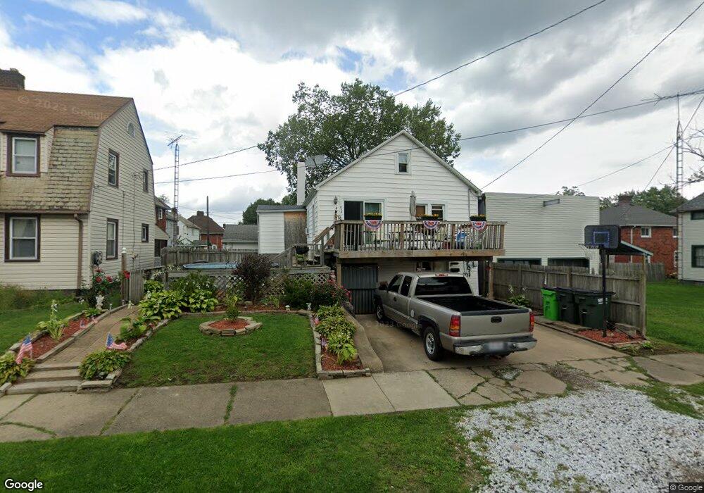
916 Devine St Alliance, OH 44601
Estimated Value: $65,478 - $99,000
2
Beds
2
Baths
1,152
Sq Ft
$71/Sq Ft
Est. Value
About This Home
This home is located at 916 Devine St, Alliance, OH 44601 and is currently estimated at $82,120, approximately $71 per square foot. 916 Devine St is a home located in Stark County with nearby schools including Alliance Elementary School at Rockhill, Alliance Intermediate School at Northside, and Alliance Middle School.
Ownership History
Date
Name
Owned For
Owner Type
Purchase Details
Closed on
Sep 26, 2024
Sold by
Kuntzman Angela Joy
Bought by
Mechanic Realty Ltd
Current Estimated Value
Purchase Details
Closed on
Feb 7, 2020
Sold by
Estate Of Janet E Wuske
Bought by
Kuntzman Angela Jordan and Mckesson Sheryl Ann
Purchase Details
Closed on
Dec 27, 2019
Sold by
Mckesson Sheryl Ann
Bought by
Kuntzman Angela Jordan
Purchase Details
Closed on
Jul 15, 2004
Sold by
Egan Joan M
Bought by
Wuske Janet E
Home Financials for this Owner
Home Financials are based on the most recent Mortgage that was taken out on this home.
Original Mortgage
$40,000
Interest Rate
6.37%
Mortgage Type
Purchase Money Mortgage
Create a Home Valuation Report for This Property
The Home Valuation Report is an in-depth analysis detailing your home's value as well as a comparison with similar homes in the area
Home Values in the Area
Average Home Value in this Area
Purchase History
| Date | Buyer | Sale Price | Title Company |
|---|---|---|---|
| Mechanic Realty Ltd | $35,000 | Heritage Union Title | |
| Kuntzman Angela Jordan | -- | None Available | |
| Kuntzman Angela Jordan | -- | None Available | |
| Wuske Janet E | $50,000 | -- |
Source: Public Records
Mortgage History
| Date | Status | Borrower | Loan Amount |
|---|---|---|---|
| Previous Owner | Wuske Janet E | $40,000 |
Source: Public Records
Tax History
| Year | Tax Paid | Tax Assessment Tax Assessment Total Assessment is a certain percentage of the fair market value that is determined by local assessors to be the total taxable value of land and additions on the property. | Land | Improvement |
|---|---|---|---|---|
| 2025 | $742 | $17,370 | $2,560 | $14,810 |
| 2024 | -- | $17,370 | $2,560 | $14,810 |
| 2023 | $520 | $12,640 | $2,490 | $10,150 |
| 2022 | $524 | $12,640 | $2,490 | $10,150 |
| 2021 | $525 | $12,640 | $2,490 | $10,150 |
| 2020 | $469 | $10,540 | $2,140 | $8,400 |
| 2019 | $462 | $10,540 | $2,140 | $8,400 |
Source: Public Records
Map
Nearby Homes
- 834 Devine St
- 1522 Wade Ave
- 1350 S Freedom Ave
- 390 E College St
- 935 S Morgan Ave
- 233 Shadyside Ct
- 225 Shadyside Ct
- 167 11th St
- 955 E Summit St
- 226 Milner St
- 231 Rosenberry St
- 134 11th St
- 234 Rosenberry St
- 152 E Mill St
- 452 E Summit St
- 2464 S Freedom Ave
- 726 S Arch Ave
- 853 Fairway Dr
- 46 Rosenberry St
- 442 S Liberty Ave
- 1540 S Morgan Ave
- 910 Devine St
- 1530 S Morgan Ave
- 909 Devine St
- 1547 Wade Ave
- 1539 Wade Ave
- 1522 S Morgan Ave
- 929 Devine St
- 1529 Wade Ave
- 939 Devine St
- 1521 Wade Ave
- 1512 S Morgan Ave
- 947 Devine St
- 1548 Wade Ave
- 1540 Wade Ave
- 850 Devine St
- 1504 S Morgan Ave
- 955 Devine St
- 859 Devine St
- 1652 S Morgan Ave
Your Personal Tour Guide
Ask me questions while you tour the home.