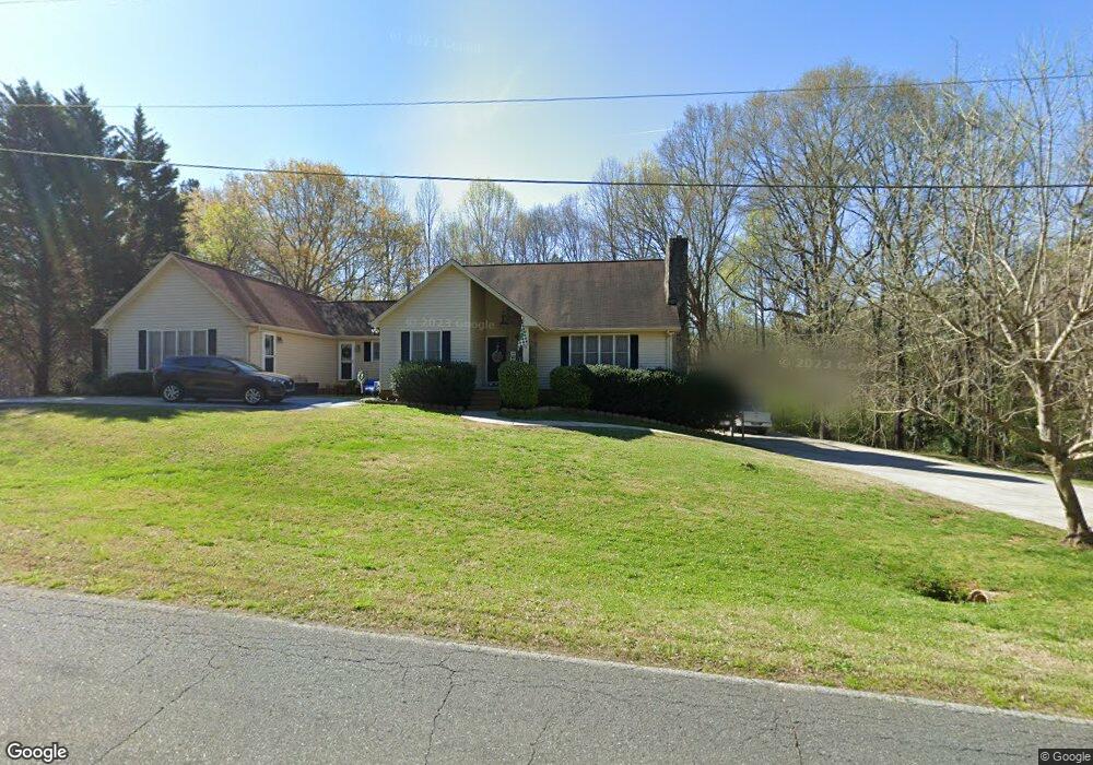
916 Wendover Height Dr Shelby, NC 28150
Estimated Value: $355,000 - $464,000
--
Bed
--
Bath
2,595
Sq Ft
$150/Sq Ft
Est. Value
About This Home
This home is located at 916 Wendover Height Dr, Shelby, NC 28150 and is currently estimated at $388,032, approximately $149 per square foot. 916 Wendover Height Dr is a home located in Cleveland County with nearby schools including Washington Elementary School, Burns Middle, and Burns High School.
Ownership History
Date
Name
Owned For
Owner Type
Purchase Details
Closed on
Feb 26, 2019
Sold by
Pennymac Loan Services Llc
Bought by
Mcentyre Cantrell Lisa
Current Estimated Value
Home Financials for this Owner
Home Financials are based on the most recent Mortgage that was taken out on this home.
Original Mortgage
$138,446
Outstanding Balance
$124,536
Interest Rate
5.62%
Mortgage Type
FHA
Estimated Equity
$263,496
Purchase Details
Closed on
Aug 2, 2012
Sold by
Carver Earl Randy and Carver Lula Jones
Bought by
Shirah Ashley Dale and Shirah Phillip
Home Financials for this Owner
Home Financials are based on the most recent Mortgage that was taken out on this home.
Original Mortgage
$134,693
Interest Rate
3.68%
Mortgage Type
New Conventional
Create a Home Valuation Report for This Property
The Home Valuation Report is an in-depth analysis detailing your home's value as well as a comparison with similar homes in the area
Home Values in the Area
Average Home Value in this Area
Purchase History
| Date | Buyer | Sale Price | Title Company |
|---|---|---|---|
| Mcentyre Cantrell Lisa | $141,000 | None Available | |
| Shirah Ashley Dale | $142,000 | None Available |
Source: Public Records
Mortgage History
| Date | Status | Borrower | Loan Amount |
|---|---|---|---|
| Open | Mcentyre Cantrell Lisa | $138,446 | |
| Previous Owner | Shirah Ashley Dale | $134,693 |
Source: Public Records
Tax History Compared to Growth
Tax History
| Year | Tax Paid | Tax Assessment Tax Assessment Total Assessment is a certain percentage of the fair market value that is determined by local assessors to be the total taxable value of land and additions on the property. | Land | Improvement |
|---|---|---|---|---|
| 2025 | $3,063 | $307,880 | $21,956 | $285,924 |
| 2024 | $3,164 | $260,527 | $18,297 | $242,230 |
| 2023 | $3,061 | $253,208 | $10,978 | $242,230 |
| 2022 | $3,061 | $253,208 | $10,978 | $242,230 |
| 2021 | $3,076 | $253,208 | $10,978 | $242,230 |
| 2020 | $2,088 | $166,281 | $10,978 | $155,303 |
| 2019 | $2,088 | $166,281 | $10,978 | $155,303 |
| 2018 | $2,087 | $166,281 | $10,978 | $155,303 |
| 2017 | $2,035 | $166,281 | $10,978 | $155,303 |
| 2016 | $2,043 | $166,281 | $10,978 | $155,303 |
| 2015 | $2,136 | $183,361 | $8,782 | $174,579 |
| 2014 | $2,136 | $183,361 | $8,782 | $174,579 |
Source: Public Records
Map
Nearby Homes
- 1010 Fallston Rd
- 953 Hardin Dr
- 951 Hardin Dr
- 1105 Stanton Dr
- 1146 Buffalo St
- 1109 Hemlock Dr
- 788 Kenmore St
- 1121 Airport Rd
- 1416 Airport Rd
- 1209 Frederick St
- 194 T R Harris Dr
- 8 Bolt Dr
- 406 Floyd St
- 507 Crawford St
- 1000 Castlewood Dr
- 4245 Fallston Rd
- 4241-1 Fallston Rd
- 4243 Fallston Rd
- 911 Earl St
- 921 Logan St
- 916 Wendover Heights Dr
- 924 Wendover Heights Dr
- 920 Wendover Heights Dr
- 912 Wendover Height Dr
- 0 Berryhill Dr Unit 3321142
- 0 Berryhill Dr Unit 3713082
- 0 Berryhill Dr Unit 3442605
- 910 Wendover Height Dr
- 1018 Hardin Dr
- 907 Wendover Height Dr
- 1020 Hardin Dr
- 1016 Hardin Dr
- 1014 Hardin Dr
- 00 Sanford Dr
- 00 Sanford Dr Unit 11/12
- 1104 Hardin Dr
- 1012 Hardin Dr
- 000 Hardin Dr
- 1010 Hardin Dr
- 1008 Hardin Dr