Estimated Value: $626,000 - $791,000
4
Beds
4
Baths
3,359
Sq Ft
$214/Sq Ft
Est. Value
About This Home
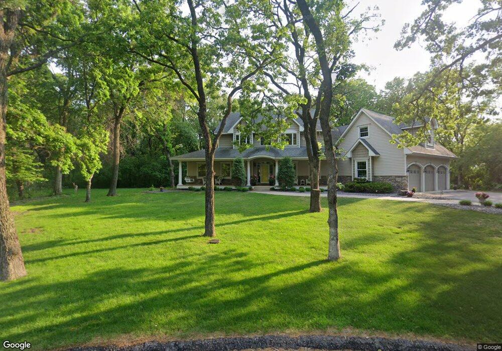
This home is located at 9160 Muirfield Cir, Anoka, MN 55303 and is currently estimated at $719,210, approximately $214 per square foot. 9160 Muirfield Cir is a home located in Anoka County with nearby schools including Brookside Elementary School, Anoka Middle School for the Arts - Fred Moor Campus, and Anoka Senior High School.
Ownership History
Date
Name
Owned For
Owner Type
Purchase Details
Closed on
Aug 14, 1998
Sold by
Peter Luanne M
Bought by
Bertsch Patricia A and Bertsch Jay P
Current Estimated Value
Purchase Details
Closed on
Aug 5, 1997
Sold by
Peter Luanne M
Bought by
Bertsch Jay P and Bertsch Patricia A
Purchase Details
Closed on
Jan 6, 1997
Sold by
Knutson Jeffrey L and Knutson Lois J
Bought by
Peter Luanne M
Create a Home Valuation Report for This Property
The Home Valuation Report is an in-depth analysis detailing your home's value as well as a comparison with similar homes in the area
Home Values in the Area
Average Home Value in this Area
Purchase History
| Date | Buyer | Sale Price | Title Company |
|---|---|---|---|
| Bertsch Patricia A | $74,682 | -- | |
| Bertsch Jay P | $74,682 | -- | |
| Peter Luanne M | $73,500 | -- |
Source: Public Records
Mortgage History
| Date | Status | Borrower | Loan Amount |
|---|---|---|---|
| Closed | Bertsch Jay P | -- |
Source: Public Records
Tax History Compared to Growth
Tax History
| Year | Tax Paid | Tax Assessment Tax Assessment Total Assessment is a certain percentage of the fair market value that is determined by local assessors to be the total taxable value of land and additions on the property. | Land | Improvement |
|---|---|---|---|---|
| 2025 | $7,851 | $695,200 | $123,800 | $571,400 |
| 2024 | $7,851 | $658,200 | $101,800 | $556,400 |
| 2023 | $7,382 | $646,800 | $97,200 | $549,600 |
| 2022 | $6,421 | $668,300 | $108,000 | $560,300 |
| 2021 | $6,203 | $546,900 | $93,900 | $453,000 |
| 2020 | $6,279 | $520,100 | $92,100 | $428,000 |
| 2019 | $6,555 | $522,300 | $92,100 | $430,200 |
| 2018 | $6,481 | $524,400 | $0 | $0 |
| 2017 | $5,680 | $503,400 | $0 | $0 |
| 2016 | $5,957 | $452,600 | $0 | $0 |
| 2015 | -- | $452,600 | $81,500 | $371,100 |
| 2014 | -- | $406,500 | $81,500 | $325,000 |
Source: Public Records
Map
Nearby Homes
- 9160 164th Ln NW
- 15250 Tiger St NW
- 15211 Nutria NW
- 15183 Nutria St NW
- 8306 155th Ln NW
- 15005 Tiger St NW
- 8524 151st Ln NW
- Sinclair Plan at Northfork Meadows
- McKinley Plan at Northfork Meadows
- Bristol Plan at Northfork Meadows
- Clearwater Plan at Northfork Meadows
- Vanderbilt Plan at Northfork Meadows
- Washburn Plan at Northfork Meadows
- Lewis Plan at Northfork Meadows
- Springfield Plan at Northfork Meadows
- 9080 168th Ave NW
- 15240 Kangaroo St NW
- 15230 Kangaroo St NW
- 15721 Hedgehog St NW
- 8630 167th Ln NW
- 15800 Andrie St NW
- 9131 Muirfield Cir
- 9161 Muirfield Cir
- 15830 Andrie St NW
- 9111 Muirfield Cir
- 15780 Andrie St NW
- 15717 Saint Andrews Ln
- 15920 Andrie St NW
- 15821 Andrie St NW
- 15760 Andrie St NW
- 15760 Andrie St NW
- 15851 Andrie St NW
- 15950 Andrie St NW
- 15801 Andrie St NW
- 15881 Andrie St NW
- 15990 Andrie St NW
- 15941 Saint Andrews Ct
- 15931 Saint Andrews Ct
- 15781 Andrie St NW
- 15737 Saint Andrews Ln