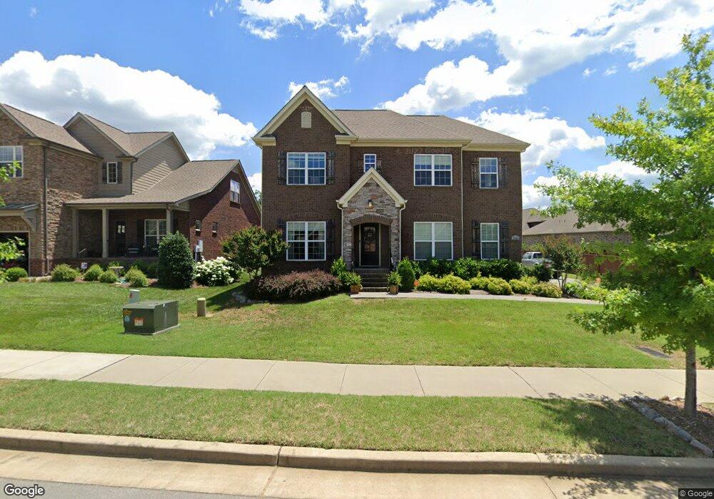
9169 Macauley Ln Nolensville, TN 37135
Estimated Value: $785,000 - $829,000
--
Bed
1
Bath
3,033
Sq Ft
$267/Sq Ft
Est. Value
About This Home
This home is located at 9169 Macauley Ln, Nolensville, TN 37135 and is currently estimated at $810,203, approximately $267 per square foot. 9169 Macauley Ln is a home with nearby schools including Henry Maxwell Elementary School, Thurgood Marshall Middle School, and Cane Ridge High School.
Ownership History
Date
Name
Owned For
Owner Type
Purchase Details
Closed on
Apr 17, 2014
Sold by
Regent Homes Llc
Bought by
Hutcherson Paul T and Hutcherson Kathryn H
Current Estimated Value
Home Financials for this Owner
Home Financials are based on the most recent Mortgage that was taken out on this home.
Original Mortgage
$258,790
Outstanding Balance
$137,490
Interest Rate
4.33%
Mortgage Type
New Conventional
Estimated Equity
$672,713
Create a Home Valuation Report for This Property
The Home Valuation Report is an in-depth analysis detailing your home's value as well as a comparison with similar homes in the area
Home Values in the Area
Average Home Value in this Area
Purchase History
| Date | Buyer | Sale Price | Title Company |
|---|---|---|---|
| Hutcherson Paul T | $388,790 | None Available |
Source: Public Records
Mortgage History
| Date | Status | Borrower | Loan Amount |
|---|---|---|---|
| Open | Hutcherson Paul T | $258,790 |
Source: Public Records
Tax History Compared to Growth
Tax History
| Year | Tax Paid | Tax Assessment Tax Assessment Total Assessment is a certain percentage of the fair market value that is determined by local assessors to be the total taxable value of land and additions on the property. | Land | Improvement |
|---|---|---|---|---|
| 2025 | $2,802 | $202,950 | $53,750 | $149,200 |
| 2024 | $2,802 | $129,125 | $30,000 | $99,125 |
| 2023 | $2,802 | $129,125 | $30,000 | $99,125 |
| 2021 | $2,802 | $129,125 | $30,000 | $99,125 |
| 2020 | $2,548 | $107,500 | $21,250 | $86,250 |
| 2019 | $2,548 | $107,500 | $21,250 | $86,250 |
| 2018 | $2,472 | $107,500 | $21,250 | $86,250 |
| 2017 | $2,451 | $107,500 | $21,250 | $86,250 |
| 2016 | $2,419 | $107,500 | $21,250 | $86,250 |
| 2015 | -- | $94,975 | $18,750 | $76,225 |
| 2014 | -- | $71,050 | $18,750 | $52,300 |
Source: Public Records
Map
Nearby Homes
- 2186 Kirkwall Dr
- 413 Marlowe Ct
- 1012 Sinatra Dr
- 1047 Sinatra Dr
- 620 Westcott Ln
- 3108 Celt Alley
- 301 Whitman Ct
- 4149 Alva Ln
- 625 Westcott Ln
- 4088 Liberton Way
- 4082 Liberton Way
- 2138 Kirkwall Dr
- 1341 Duns Ln
- 2126 Kirkwall Dr
- 4806 Kintore Dr
- 1113 Frewin St
- 208 Foxley Ct
- 4811 Kintore Dr
- 4807 Kintore Dr
- 4805 Kintore Dr
- 9165 Macauley Ln
- 9161 Macauley Ln
- 8265 Middlewick Ln
- 8269 Middlewick Ln
- 9164 Macauley Ln
- 8273 Middlewick Ln
- 8273 Middlewick Ln
- 504 Wilcox Ct
- 9157 Macauley Ln
- 9156 Macauley Ln
- 8257 Middlewick Ln
- 368 Wilcox Ct
- 9172 Macauley Ln
- 508 Wilcox Ct Unit 361
- 508 Wilcox Ct
- 500 Wilcox Ct
- 500 Wilcox Ct
- 8266 Middlewick Ln
- 504 Wilcox Ct
- 9152 Macauley Ln