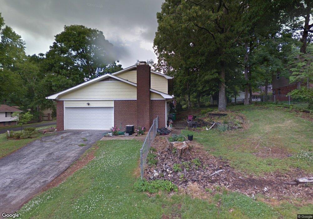
917 Carrie Ln Hixson, TN 37343
Estimated Value: $322,000 - $332,000
4
Beds
3
Baths
2,217
Sq Ft
$148/Sq Ft
Est. Value
About This Home
This home is located at 917 Carrie Ln, Hixson, TN 37343 and is currently estimated at $328,459, approximately $148 per square foot. 917 Carrie Ln is a home located in Hamilton County with nearby schools including Ganns Middle Valley Elementary School, Hixson Middle School, and Hixson High School.
Ownership History
Date
Name
Owned For
Owner Type
Purchase Details
Closed on
Jun 26, 2008
Sold by
Cross Wanda L
Bought by
Dubsky Michael R and Dubsky Valerie L
Current Estimated Value
Home Financials for this Owner
Home Financials are based on the most recent Mortgage that was taken out on this home.
Original Mortgage
$137,837
Outstanding Balance
$88,425
Interest Rate
5.96%
Mortgage Type
FHA
Estimated Equity
$240,034
Purchase Details
Closed on
Jun 22, 2000
Sold by
Buchanan Shirley West and West Shirley M
Bought by
Daughtrey Beatrice L and Cross Wanda L
Create a Home Valuation Report for This Property
The Home Valuation Report is an in-depth analysis detailing your home's value as well as a comparison with similar homes in the area
Home Values in the Area
Average Home Value in this Area
Purchase History
| Date | Buyer | Sale Price | Title Company |
|---|---|---|---|
| Dubsky Michael R | $140,000 | Realty Title & Escrow Servic | |
| Daughtrey Beatrice L | $108,000 | -- |
Source: Public Records
Mortgage History
| Date | Status | Borrower | Loan Amount |
|---|---|---|---|
| Open | Dubsky Michael R | $137,837 |
Source: Public Records
Tax History Compared to Growth
Tax History
| Year | Tax Paid | Tax Assessment Tax Assessment Total Assessment is a certain percentage of the fair market value that is determined by local assessors to be the total taxable value of land and additions on the property. | Land | Improvement |
|---|---|---|---|---|
| 2024 | $1,115 | $49,825 | $0 | $0 |
| 2023 | $1,124 | $49,825 | $0 | $0 |
| 2022 | $1,124 | $49,825 | $0 | $0 |
| 2021 | $1,124 | $49,825 | $0 | $0 |
| 2020 | $1,012 | $36,275 | $0 | $0 |
| 2019 | $1,012 | $36,275 | $0 | $0 |
| 2018 | $1,012 | $36,275 | $0 | $0 |
| 2017 | $1,012 | $36,275 | $0 | $0 |
| 2016 | $1,009 | $0 | $0 | $0 |
| 2015 | $1,009 | $36,175 | $0 | $0 |
| 2014 | $1,009 | $0 | $0 | $0 |
Source: Public Records
Map
Nearby Homes
- 920 Carrie Ln
- 7812 Huntington Forest Dr
- 7770 Lenox Trace Dr
- 7626 Wynhill Ln
- 999 Wyndsor Dr
- 6506 Middle Valley Rd
- 1343 Thrasher Pike
- 1640 Thrasher Pike
- 8665 Reba Ln
- 1861 Abington Farms Way
- 1948 Abington Farms Way
- 1713 Thrasher Pike
- 1705 Longview St
- 8692 Arbutus Dr
- 8706 Arbutus Dr
- 7433 Paxton Cir
- 1732 Longview St
- 7489 Paxton Cir
- 7392 Paxton Cir
- Ivy Springs Plan at Paxton Pointe
- 913 Huntington Cir
- 919 Carrie Ln
- 919 Huntington Cir
- 7855 Huntington Forest Dr
- 914 Huntington Cir
- 916 Huntington Cir
- 923 Carrie Ln
- 912 Huntington Cir
- 920 Huntington Cir
- 921 Huntington Cir
- 922 Carrie Ln
- 7853 Huntington Forest Dr
- 7856 Huntington Forest Dr
- 904 Huntington Cir
- 922 Huntington Cir
- 7624 Gann Rd
- 7622 Gann Rd
- 7823 Huntington Forest Dr
- 7827 Huntington Forest Dr
- 7626 Gann Rd