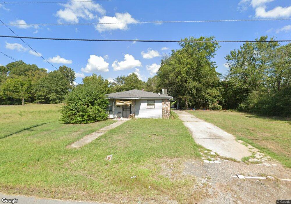
917 E 21st Ave Pine Bluff, AR 71601
Estimated Value: $71,020 - $76,000
Studio
2
Baths
1,380
Sq Ft
$53/Sq Ft
Est. Value
About This Home
This home is located at 917 E 21st Ave, Pine Bluff, AR 71601 and is currently estimated at $73,755, approximately $53 per square foot. 917 E 21st Ave is a home located in Jefferson County with nearby schools including Matthews Elementary School, Dollarway High School, and Pine Bluff Lighthouse Academy.
Ownership History
Date
Name
Owned For
Owner Type
Purchase Details
Closed on
Jan 9, 2020
Bought by
Cook Paula
Current Estimated Value
Purchase Details
Closed on
Sep 19, 1997
Bought by
Pennington Jerry Et Al Trustee and 7111 Jeffcoat Rd
Purchase Details
Closed on
Feb 11, 1992
Bought by
Pennington Jerry and Pennington Wf
Purchase Details
Closed on
Jan 21, 1992
Bought by
K & K Construction Co
Purchase Details
Closed on
Feb 28, 1982
Bought by
First South Federal Sav & Loan
Create a Home Valuation Report for This Property
The Home Valuation Report is an in-depth analysis detailing your home's value as well as a comparison with similar homes in the area
Purchase History
| Date | Buyer | Sale Price | Title Company |
|---|---|---|---|
| Cook Paula | $32,000 | -- | |
| Pennington Jerry Et Al Trustee | -- | -- | |
| Pennington Jerry | -- | -- | |
| K & K Construction Co | -- | -- | |
| First South Federal Sav & Loan | $31,000 | -- |
Source: Public Records
Tax History
| Year | Tax Paid | Tax Assessment Tax Assessment Total Assessment is a certain percentage of the fair market value that is determined by local assessors to be the total taxable value of land and additions on the property. | Land | Improvement |
|---|---|---|---|---|
| 2025 | $676 | $11,170 | $600 | $10,570 |
| 2024 | $625 | $11,170 | $600 | $10,570 |
| 2023 | $573 | $11,170 | $600 | $10,570 |
| 2022 | $475 | $7,730 | $300 | $7,430 |
| 2021 | $475 | $7,730 | $300 | $7,430 |
| 2020 | $475 | $7,730 | $300 | $7,430 |
| 2019 | $475 | $7,730 | $300 | $7,430 |
| 2018 | $474 | $7,730 | $300 | $7,430 |
| 2017 | $456 | $7,420 | $300 | $7,120 |
| 2016 | $456 | $7,420 | $300 | $7,120 |
| 2015 | $434 | $7,420 | $300 | $7,120 |
| 2014 | -- | $7,420 | $300 | $7,120 |
Source: Public Records
Map
Nearby Homes
- 00 E 24th Ave
- 517 E 17th Ave
- 208 Rutherford Place
- 820 S Ohio St
- 215 E 26th Ave
- 00
- 000 S 65 Hwy
- 0 NE Corner Hwy 65 425-81
- 210 W 18th Ave
- 2505 S Main St
- 999 S Missouri and E 30th
- 1603 Belmoor Dr
- 1307 S Dakota St
- 310 W 24th Ave
- 202 W 27th Ave
- 1509 S Walnut St
- 315 W 15th Ave
- 919 S Nebraska St
- 2103 S Beech St
- 1200 S Walnut St Unit 1202
- 912 E 21st Ave
- 1002 E 20th Ave
- 910 E 21st Ave
- 920 E 21st Ave
- 2101 S Indiana St
- 903 E 21st Ave
- 2004 S Indiana St
- 21006 S Kentucky St
- 900 E 19th Ave
- 516 Talbot St
- 1008 E 19th Ave
- 514 Talbot St
- 1105 E 21st Ave
- 1100 E 19th Ave
- 519 E 19th Ave
- 1909 S Virginia St
- 518 Talbot St
- 1102 E 20th Ave
- 913 E 19th Ave
- 1104 E 19th Ave
Your Personal Tour Guide
Ask me questions while you tour the home.