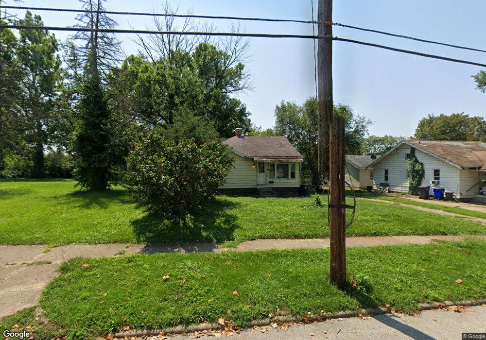
917 E Henderson Ave Decatur, IL 62521
Mueller Park NeighborhoodEstimated Value: $33,000 - $43,000
Studio
--
Bath
--
Sq Ft
9,017
Sq Ft Lot
About This Home
This home is located at 917 E Henderson Ave, Decatur, IL 62521 and is currently estimated at $39,555. 917 E Henderson Ave is a home located in Macon County with nearby schools including South Shores Elementary School, Stephen Decatur Middle School, and St. Patrick School.
Ownership History
Date
Name
Owned For
Owner Type
Purchase Details
Closed on
Apr 1, 2015
Current Estimated Value
Purchase Details
Closed on
Jul 25, 2013
Sold by
Beasley Edward E
Bought by
Henson Properties Incorporated
Purchase Details
Closed on
Aug 15, 2006
Sold by
Durbin Jeremy W and Durbin Tonya S
Bought by
Beasley Edward E
Purchase Details
Closed on
Nov 11, 2005
Sold by
Champion Robert H and Champion Patsy L
Bought by
Durbin Jeremy W and Durbin Tonya S
Purchase Details
Closed on
Jun 1, 2002
Create a Home Valuation Report for This Property
The Home Valuation Report is an in-depth analysis detailing your home's value as well as a comparison with similar homes in the area
Home Values in the Area
Average Home Value in this Area
Purchase History
| Date | Buyer | Sale Price | Title Company |
|---|---|---|---|
| -- | $1,000 | -- | |
| Henson Properties Incorporated | $10,000 | None Available | |
| Beasley Edward E | -- | None Available | |
| Durbin Jeremy W | $9,000 | None Available | |
| -- | $8,000 | -- |
Source: Public Records
Tax History
| Year | Tax Paid | Tax Assessment Tax Assessment Total Assessment is a certain percentage of the fair market value that is determined by local assessors to be the total taxable value of land and additions on the property. | Land | Improvement |
|---|---|---|---|---|
| 2024 | -- | $6,921 | $1,582 | $5,339 |
| 2023 | -- | $6,676 | $1,526 | $5,150 |
| 2022 | $639 | $6,250 | $1,412 | $4,838 |
| 2021 | $601 | $5,837 | $1,319 | $4,518 |
| 2020 | $592 | $5,565 | $1,257 | $4,308 |
| 2019 | $592 | $5,565 | $1,257 | $4,308 |
| 2018 | $555 | $5,286 | $272 | $5,014 |
| 2017 | $568 | $5,427 | $279 | $5,148 |
| 2016 | $579 | $5,483 | $282 | $5,201 |
| 2015 | $551 | $5,386 | $277 | $5,109 |
| 2014 | $515 | $5,332 | $274 | $5,058 |
| 2013 | $528 | $5,532 | $284 | $5,248 |
Source: Public Records
Map
Nearby Homes
- 1225 S Silas St
- 1283 S Illinois St
- 90 Webster Ct
- 936 E Moore St
- 409 Southmoreland Place
- 855 S Stone St
- 228 Southmoreland Place
- 246 Southmoreland Place
- 0 S Water St
- 612 S Jackson St
- 602 E Decatur St
- 910 S Main St
- 1422 Sedgwick St
- 1872 Shady Crest St
- 632 S 17th St
- 66 Eastmoreland Dr
- 1901 Indiana Ct
- 1202 Florida Ave
- 2 4th Dr
- 1135 S 21st St
- 905 E Henderson Ave
- 1220 S Maffit St
- 920 E Henderson Ave
- 904 E Henderson Ave
- 1228 S Maffit St
- 965 E Henderson Ave
- 1244 S Maffit St
- 930 E Henderson Ave
- 944 E Henderson Ave
- 1140 S Maffit St
- 1201 S Maffit St
- 1248 S Maffit St
- 1141 S Maffit St
- 1217 S Maffit St
- 952 E Henderson Ave
- 1227 S Maffit St
- 1255 S Silas St
- 1235 S Silas St
- 1205 S Silas St
- 1117 S Maffit St
Your Personal Tour Guide
Ask me questions while you tour the home.