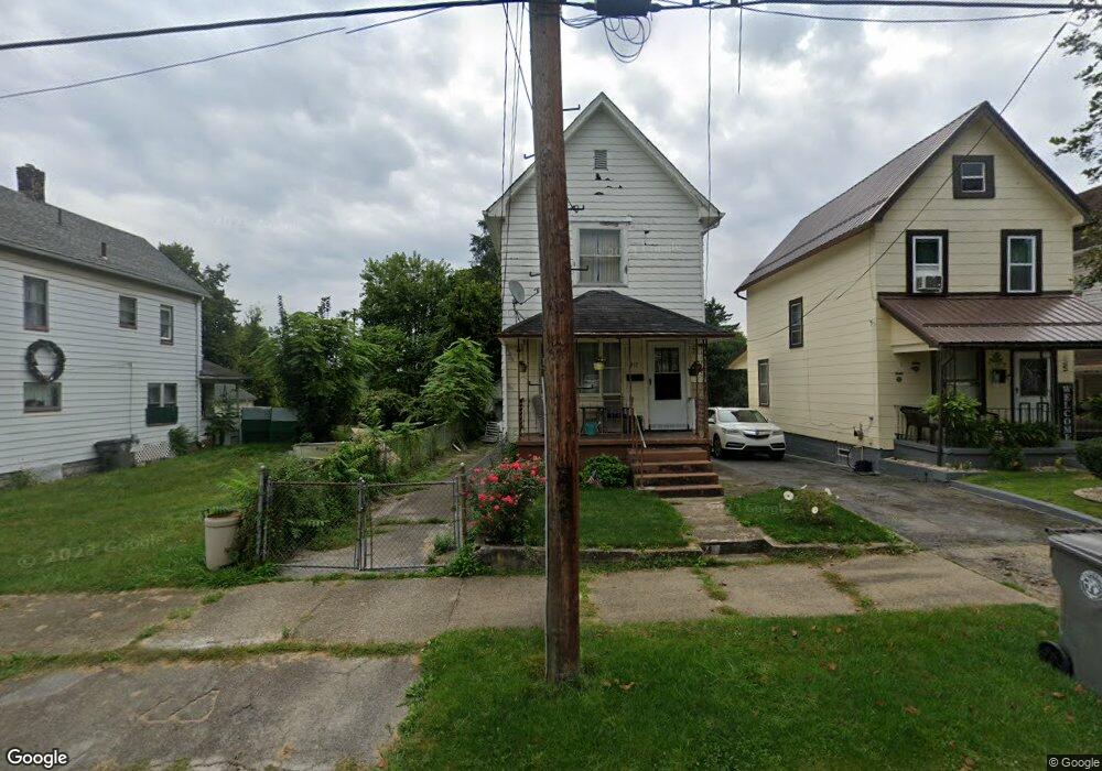
917 Franklin Ave Youngstown, OH 44502
Lower Gibson NeighborhoodEstimated Value: $42,000 - $56,000
2
Beds
2
Baths
1,136
Sq Ft
$42/Sq Ft
Est. Value
About This Home
This home is located at 917 Franklin Ave, Youngstown, OH 44502 and is currently estimated at $48,023, approximately $42 per square foot. 917 Franklin Ave is a home located in Mahoning County with nearby schools including Taft Elementary School, East High School, and South Side Academy.
Ownership History
Date
Name
Owned For
Owner Type
Purchase Details
Closed on
Jun 30, 2010
Sold by
Bonilla Angel and Bonilla Yolanda
Bought by
Radmore Ronald
Current Estimated Value
Home Financials for this Owner
Home Financials are based on the most recent Mortgage that was taken out on this home.
Original Mortgage
$7,500
Outstanding Balance
$5,006
Interest Rate
4.81%
Mortgage Type
Seller Take Back
Estimated Equity
$43,017
Purchase Details
Closed on
May 5, 1998
Sold by
Vazquez Agustin Velazquez and Vazquez Gladi Velazquez
Bought by
Hernandez Fortunato N and Hernandez Consuelo M
Purchase Details
Closed on
Apr 1, 1991
Bought by
Vazquez A V and G V
Create a Home Valuation Report for This Property
The Home Valuation Report is an in-depth analysis detailing your home's value as well as a comparison with similar homes in the area
Home Values in the Area
Average Home Value in this Area
Purchase History
| Date | Buyer | Sale Price | Title Company |
|---|---|---|---|
| Radmore Ronald | $7,500 | Attorney | |
| Hernandez Fortunato N | $11,000 | -- | |
| Vazquez A V | $4,000 | -- |
Source: Public Records
Mortgage History
| Date | Status | Borrower | Loan Amount |
|---|---|---|---|
| Open | Radmore Ronald | $7,500 |
Source: Public Records
Tax History Compared to Growth
Tax History
| Year | Tax Paid | Tax Assessment Tax Assessment Total Assessment is a certain percentage of the fair market value that is determined by local assessors to be the total taxable value of land and additions on the property. | Land | Improvement |
|---|---|---|---|---|
| 2024 | $175 | $3,620 | $290 | $3,330 |
| 2023 | $174 | $3,620 | $290 | $3,330 |
| 2022 | $130 | $2,070 | $290 | $1,780 |
| 2021 | $130 | $2,070 | $290 | $1,780 |
| 2020 | $130 | $2,070 | $290 | $1,780 |
| 2019 | $148 | $2,070 | $290 | $1,780 |
| 2018 | $172 | $2,070 | $290 | $1,780 |
| 2017 | $151 | $2,070 | $290 | $1,780 |
| 2016 | $156 | $2,380 | $290 | $2,090 |
| 2015 | $153 | $2,380 | $290 | $2,090 |
| 2014 | -- | $2,380 | $290 | $2,090 |
| 2013 | $150 | $2,380 | $290 | $2,090 |
Source: Public Records
Map
Nearby Homes
- 702 Dickson St
- 708 Dickson St
- 632 Samuel Ave
- 427 Knox St
- 537 Samuel Ave
- 525 Samuel Ave
- 0 South Ave Unit 5125788
- 444 Emery Ave
- 968 Cameron Ave
- 718 E Laclede Ave
- 724 E Laclede Ave
- 884 E Dewey Ave
- 0000 S Ave
- 834 Compton Ln
- 919 E Dewey Ave
- 240 E Laclede Ave
- 941 E Dewey Ave
- 152 Regent St
- 153 W Warren Ave
- 196 W Delason Ave
- 919 Franklin Ave
- 913 Franklin Ave
- 921 Franklin Ave
- 911 Franklin Ave
- 909 Franklin Ave
- 616 Gibson St
- 612 Gibson St
- 916 Franklin Ave
- 922 Franklin Ave
- 926 Franklin Ave
- 932 Franklin Ave
- 1009 Franklin Ave
- 1002 Franklin Ave
- 630 Gibson St
- 1011 Franklin Ave
- 1004 Franklin Ave
- 806 Franklin Ave
- 636 Gibson St
- 1008 Franklin Ave
- 1015 Franklin Ave