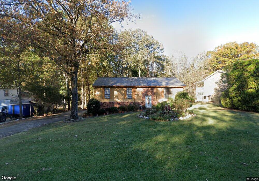
917 Independence Dr Alabaster, AL 35007
Estimated Value: $260,000 - $315,000
Studio
2
Baths
1,690
Sq Ft
$165/Sq Ft
Est. Value
About This Home
This home is located at 917 Independence Dr, Alabaster, AL 35007 and is currently estimated at $278,941, approximately $165 per square foot. 917 Independence Dr is a home located in Shelby County with nearby schools including Thompson Intermediate School, Thompson Middle School, and Thompson High School.
Ownership History
Date
Name
Owned For
Owner Type
Purchase Details
Closed on
May 23, 2007
Sold by
Hud
Bought by
Walker Shelia
Current Estimated Value
Home Financials for this Owner
Home Financials are based on the most recent Mortgage that was taken out on this home.
Original Mortgage
$125,000
Outstanding Balance
$100,636
Interest Rate
6.17%
Mortgage Type
Unknown
Estimated Equity
$178,305
Purchase Details
Closed on
Feb 1, 2007
Sold by
Wells Fargo Bank Na
Bought by
Hud
Purchase Details
Closed on
Nov 28, 2006
Sold by
Riles James M and Riles Benae E
Bought by
Wells Fargo Bank Na
Purchase Details
Closed on
Jul 15, 1999
Sold by
Gaddis Willie E and Gaddis Meddra R
Bought by
Riles James M and Riles Benae E
Home Financials for this Owner
Home Financials are based on the most recent Mortgage that was taken out on this home.
Original Mortgage
$110,443
Interest Rate
7.43%
Mortgage Type
FHA
Create a Home Valuation Report for This Property
The Home Valuation Report is an in-depth analysis detailing your home's value as well as a comparison with similar homes in the area
Home Values in the Area
Average Home Value in this Area
Purchase History
| Date | Buyer | Sale Price | Title Company |
|---|---|---|---|
| Walker Shelia | $125,000 | None Available | |
| Hud | -- | None Available | |
| Wells Fargo Bank Na | $109,583 | None Available | |
| Riles James M | $110,500 | -- |
Source: Public Records
Mortgage History
| Date | Status | Borrower | Loan Amount |
|---|---|---|---|
| Open | Walker Shelia | $125,000 | |
| Previous Owner | Riles James M | $110,443 |
Source: Public Records
Tax History
| Year | Tax Paid | Tax Assessment Tax Assessment Total Assessment is a certain percentage of the fair market value that is determined by local assessors to be the total taxable value of land and additions on the property. | Land | Improvement |
|---|---|---|---|---|
| 2024 | $1,224 | $22,660 | $0 | $0 |
| 2023 | $1,085 | $20,860 | $0 | $0 |
| 2022 | $1,040 | $20,020 | $0 | $0 |
| 2021 | $914 | $17,680 | $0 | $0 |
| 2020 | $844 | $16,380 | $0 | $0 |
| 2019 | $777 | $15,140 | $0 | $0 |
| 2017 | $632 | $12,460 | $0 | $0 |
| 2015 | $604 | $11,940 | $0 | $0 |
| 2014 | $591 | $11,700 | $0 | $0 |
Source: Public Records
Map
Nearby Homes
- 1349 Old Boston Rd
- 1317 Old Boston Rd
- 1317 W Navajo Dr
- 1805 Mohawk Dr
- 1222 Falling Star Ln
- 542 Navajo Trail
- 2001 1st Ave W
- 834 Burning Tree Trail
- 109 Longfeather Cir
- 1125 Independence Dr
- 2026 Amberley Woods Trail
- 124 Kingsley Rd
- 1509 Sequoia Trail
- 000 9th St NW
- 0001 9th St NW
- 335 10th St NW
- 1208 Siskin Dr
- 955 3rd Ave NW
- 112 Portsouth Ln
- 1307 3rd Ave SW
- 913 Independence Dr
- 921 Independence Dr
- 909 Independence Dr
- 912 Independence Dr
- 916 Independence Dr
- 908 Independence Dr
- 920 Independence Dr
- 925 Independence Dr
- 905 Independence Dr
- 909 Colonial Dr
- 924 Independence Dr
- 904 Independence Dr
- 913 Colonial Dr
- 905 Colonial Dr
- 821 Independence Dr
- 917 Colonial Dr
- 1508 W Navajo Dr
- 921 Colonial Dr
- 929 Independence Dr
- 817 Independence Dr
Your Personal Tour Guide
Ask me questions while you tour the home.