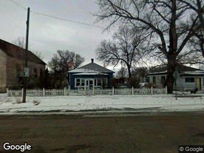
917 Main St Carlin, NV 89822
Estimated Value: $154,000 - $191,000
2
Beds
1
Bath
1,040
Sq Ft
$166/Sq Ft
Est. Value
About This Home
This home is located at 917 Main St, Carlin, NV 89822 and is currently estimated at $172,703, approximately $166 per square foot. 917 Main St is a home with nearby schools including Carlin Elementary School, Carlin Junior High School, and Carlin High School.
Ownership History
Date
Name
Owned For
Owner Type
Purchase Details
Closed on
Aug 15, 2008
Sold by
Belsey April C and Belsey Robert
Bought by
Belsey Robert and Belsey April C
Current Estimated Value
Home Financials for this Owner
Home Financials are based on the most recent Mortgage that was taken out on this home.
Original Mortgage
$87,000
Interest Rate
6.16%
Mortgage Type
Stand Alone Refi Refinance Of Original Loan
Purchase Details
Closed on
Aug 11, 2008
Sold by
Meinen John and Belsey April C
Bought by
Belsey April C
Home Financials for this Owner
Home Financials are based on the most recent Mortgage that was taken out on this home.
Original Mortgage
$87,000
Interest Rate
6.16%
Mortgage Type
Stand Alone Refi Refinance Of Original Loan
Create a Home Valuation Report for This Property
The Home Valuation Report is an in-depth analysis detailing your home's value as well as a comparison with similar homes in the area
Home Values in the Area
Average Home Value in this Area
Purchase History
| Date | Buyer | Sale Price | Title Company |
|---|---|---|---|
| Belsey Robert | -- | None Available | |
| Belsey April C | -- | None Available |
Source: Public Records
Mortgage History
| Date | Status | Borrower | Loan Amount |
|---|---|---|---|
| Closed | Belsey Robert | $87,000 |
Source: Public Records
Tax History Compared to Growth
Tax History
| Year | Tax Paid | Tax Assessment Tax Assessment Total Assessment is a certain percentage of the fair market value that is determined by local assessors to be the total taxable value of land and additions on the property. | Land | Improvement |
|---|---|---|---|---|
| 2024 | $801 | $25,138 | $1,100 | $24,038 |
| 2023 | $729 | $23,223 | $1,100 | $22,123 |
| 2022 | $708 | $19,739 | $1,100 | $18,639 |
| 2021 | $687 | $18,835 | $1,100 | $17,735 |
| 2020 | $667 | $18,727 | $1,100 | $17,627 |
| 2019 | $647 | $17,664 | $1,100 | $16,564 |
| 2018 | $640 | $17,462 | $1,100 | $16,362 |
| 2017 | $642 | $17,682 | $1,100 | $16,582 |
| 2016 | $624 | $17,886 | $1,100 | $16,786 |
| 2015 | $619 | $17,566 | $1,100 | $16,466 |
| 2014 | $601 | $16,585 | $1,100 | $15,485 |
Source: Public Records
Map
Nearby Homes
- 914 Hamilton St
- 1215 Railroad St
- 710 Cedar St
- 408 Hamilton St
- 416 Cedar St
- TBD 4th St
- 305 School St
- 514 Peters St
- 0 Elm St
- 0 Cathedral St
- TBD Bighorn St
- 0 Bighorn St
- TBD Blue Ridge St
- 0 Gravelly St Unit 3626123
- TBD Laramie St
- 6720 Cabinet St
- TBD Amargosa St
- 0 066030015 Amargosa St Unit 3625552
- 0 1 Acre Cassiar St Unit 3625378
- 0 1 Acre Cassiar St Unit 3625379