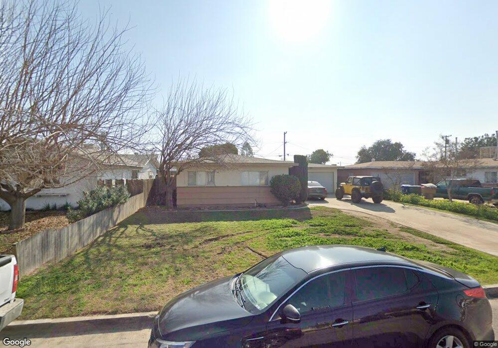
917 Mammoth Ave Bakersfield, CA 93308
Estimated Value: $262,087 - $299,000
2
Beds
2
Baths
1,182
Sq Ft
$236/Sq Ft
Est. Value
About This Home
This home is located at 917 Mammoth Ave, Bakersfield, CA 93308 and is currently estimated at $278,772, approximately $235 per square foot. 917 Mammoth Ave is a home located in Kern County with nearby schools including Beardsley Elementary School, Beardsley Junior High School, and North High School.
Ownership History
Date
Name
Owned For
Owner Type
Purchase Details
Closed on
May 1, 2017
Sold by
Dorr Rick and Dorr Sandra Kay
Bought by
Group Xiii Properties Lp
Current Estimated Value
Purchase Details
Closed on
Aug 31, 2005
Sold by
Dorr Sandra Kay
Bought by
Dorr Rick and Dorr Sandra Kay
Home Financials for this Owner
Home Financials are based on the most recent Mortgage that was taken out on this home.
Original Mortgage
$126,100
Interest Rate
8.77%
Mortgage Type
Purchase Money Mortgage
Purchase Details
Closed on
Oct 10, 2002
Sold by
Gable Clarence M and Gable Eleanore
Bought by
Dorr Sandra Kay
Create a Home Valuation Report for This Property
The Home Valuation Report is an in-depth analysis detailing your home's value as well as a comparison with similar homes in the area
Home Values in the Area
Average Home Value in this Area
Purchase History
| Date | Buyer | Sale Price | Title Company |
|---|---|---|---|
| Group Xiii Properties Lp | $118,100 | None Available | |
| Dorr Rick | -- | Chicago Title Company | |
| Dorr Sandra Kay | -- | -- |
Source: Public Records
Mortgage History
| Date | Status | Borrower | Loan Amount |
|---|---|---|---|
| Previous Owner | Dorr Rick | $126,100 |
Source: Public Records
Tax History Compared to Growth
Tax History
| Year | Tax Paid | Tax Assessment Tax Assessment Total Assessment is a certain percentage of the fair market value that is determined by local assessors to be the total taxable value of land and additions on the property. | Land | Improvement |
|---|---|---|---|---|
| 2025 | $2,821 | $157,834 | $34,815 | $123,019 |
| 2024 | $2,752 | $154,740 | $34,133 | $120,607 |
| 2023 | $2,752 | $151,707 | $33,464 | $118,243 |
| 2022 | $2,656 | $148,733 | $32,808 | $115,925 |
| 2021 | $2,564 | $145,817 | $32,165 | $113,652 |
| 2020 | $2,483 | $144,323 | $31,836 | $112,487 |
| 2019 | $2,460 | $144,323 | $31,836 | $112,487 |
| 2018 | $2,383 | $138,720 | $30,600 | $108,120 |
| 2017 | $1,251 | $47,420 | $8,093 | $39,327 |
| 2016 | $1,195 | $46,491 | $7,935 | $38,556 |
| 2015 | $1,171 | $45,793 | $7,816 | $37,977 |
| 2014 | $1,147 | $44,897 | $7,663 | $37,234 |
Source: Public Records
Map
Nearby Homes
- 1000 Redwood Dr
- 604 Teakwood Dr
- 216 Vivian Ln
- 210 Dogwood Ln
- 501 Belmont Ave Unit 16
- 324 Belmont Ave
- 1000 Olive Dr Unit 4
- 1000 Olive Dr Unit 9
- 258 Mary Kay Ln
- 818 Decatur St
- 267 Teakwood Ln
- 4 Dogwood Ln
- 256 Mary Kay Ln
- 613 Belmont Ave
- 48 Cedarwood Ln
- 144 Torrey Pines Ln
- 5000 Pierce Rd Unit 17
- 5000 Pierce Rd Unit 30
- 306 Kings Ln
- 63 Cinnamon Ln
- 913 Mammoth Ave
- 921 Mammoth Ave
- 909 Mammoth Ave
- 925 Mammoth Ave
- 916 Roberts Ln
- 920 Roberts Ln
- 912 Roberts Ln
- 924 Roberts Ln
- 908 Roberts Ln
- 905 Mammoth Ave
- 929 Mammoth Ave
- 916 Mammoth Ave
- 920 Mammoth Ave
- 912 Mammoth Ave
- 908 Mammoth Ave
- 928 Roberts Ln
- 924 Mammoth Ave
- 904 Roberts Ln
- 931 Mammoth Ave
- 901 Mammoth Ave