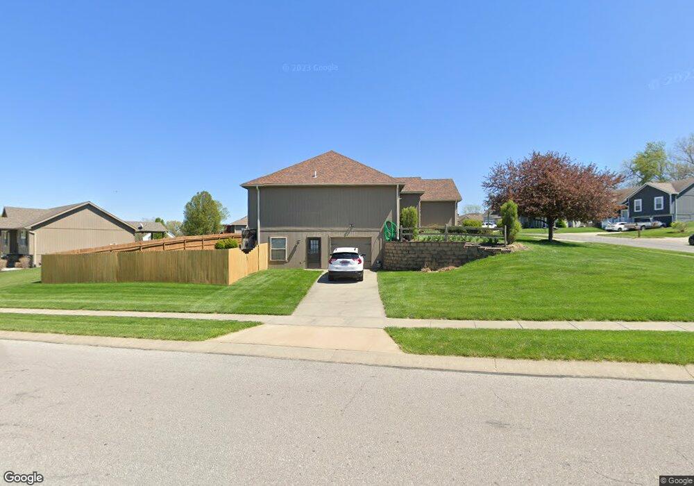
917 Porter Ridge Rd Kearney, MO 64060
Estimated Value: $378,000 - $402,000
2
Beds
3
Baths
1,648
Sq Ft
$236/Sq Ft
Est. Value
About This Home
This home is located at 917 Porter Ridge Rd, Kearney, MO 64060 and is currently estimated at $389,707, approximately $236 per square foot. 917 Porter Ridge Rd is a home located in Clay County with nearby schools including Kearney Junior High School, Kearney High School, and Northern Hills Christian Academy.
Ownership History
Date
Name
Owned For
Owner Type
Purchase Details
Closed on
Jul 22, 2008
Sold by
Kearney Trust Co
Bought by
Setser Lee D and Setser Lori K
Current Estimated Value
Home Financials for this Owner
Home Financials are based on the most recent Mortgage that was taken out on this home.
Original Mortgage
$204,000
Outstanding Balance
$133,528
Interest Rate
6.36%
Mortgage Type
Purchase Money Mortgage
Estimated Equity
$256,179
Create a Home Valuation Report for This Property
The Home Valuation Report is an in-depth analysis detailing your home's value as well as a comparison with similar homes in the area
Home Values in the Area
Average Home Value in this Area
Purchase History
| Date | Buyer | Sale Price | Title Company |
|---|---|---|---|
| Setser Lee D | -- | United Title Company Inc |
Source: Public Records
Mortgage History
| Date | Status | Borrower | Loan Amount |
|---|---|---|---|
| Open | Setser Lee D | $204,000 |
Source: Public Records
Tax History Compared to Growth
Tax History
| Year | Tax Paid | Tax Assessment Tax Assessment Total Assessment is a certain percentage of the fair market value that is determined by local assessors to be the total taxable value of land and additions on the property. | Land | Improvement |
|---|---|---|---|---|
| 2025 | $3,926 | $64,320 | -- | -- |
| 2024 | $3,926 | $57,290 | -- | -- |
| 2023 | $3,913 | $57,290 | $0 | $0 |
| 2022 | $3,501 | $49,570 | $0 | $0 |
| 2021 | $3,432 | $49,571 | $4,180 | $45,391 |
| 2020 | $3,251 | $42,710 | $0 | $0 |
| 2019 | $3,234 | $42,710 | $0 | $0 |
| 2018 | $3,138 | $40,030 | $0 | $0 |
| 2017 | $2,985 | $40,030 | $4,180 | $35,850 |
| 2016 | $2,985 | $38,490 | $4,180 | $34,310 |
| 2015 | $2,986 | $38,490 | $4,180 | $34,310 |
| 2014 | $2,882 | $36,970 | $4,370 | $32,600 |
Source: Public Records
Map
Nearby Homes
- 820 Susan St
- 817 Porter Ridge Rd
- 1204 Susan St
- 1102 Noah's Ln
- 1205 Noah's Ln
- 1200 Noah's Ln
- 1207 Noah's Ln
- 1202 Noah's Ln
- 1305 Stonecrest Dr
- 1307 Stonecrest Dr
- 625 E 13th St
- 1300 Melissa Ct
- 902 Walnut St
- 1302 Melissa Ct
- 1043 E 14th St
- 804 Southbrook Pkwy
- 401 E 9th St
- 1210 E 15th St
- 15025 Jesse James Farm Rd
- 806 E 18th St
- 903 Stonecrest Dr
- 914 Porter Ridge Rd
- 921 Porter Ridge Rd
- 809 Susan St
- 915 Porter Ridge Rd
- 901 Stonecrest Dr
- 916 Porter Ridge Rd
- 918 Porter Ridge Rd
- 923 Porter Ridge Rd
- 906 Stonecrest Dr
- 911 Stonecrest Dr
- 920 Porter Ridge Rd
- 811 Stonecrest Dr
- 913 Porter Ridge Rd
- 900 Stonecrest Dr
- 808 Susan St
- 908 Stonecrest Dr
- 1001 Stonecrest Dr
- 814 Stonecrest Dr
- 813 Susan St