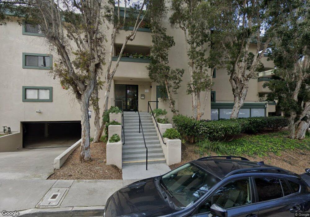
917 Torrance St Unit 1 San Diego, CA 92103
Middletown NeighborhoodEstimated Value: $630,097 - $703,000
2
Beds
2
Baths
1,052
Sq Ft
$631/Sq Ft
Est. Value
About This Home
This home is located at 917 Torrance St Unit 1, San Diego, CA 92103 and is currently estimated at $664,274, approximately $631 per square foot. 917 Torrance St Unit 1 is a home located in San Diego County with nearby schools including Grant K-8, Richard Henry Dana Middle School, and Roosevelt International Middle School.
Ownership History
Date
Name
Owned For
Owner Type
Purchase Details
Closed on
Aug 22, 2014
Sold by
Carter Mrgaret A
Bought by
Carter Margaret A
Current Estimated Value
Purchase Details
Closed on
Sep 30, 2013
Sold by
Skip Carter Llc
Bought by
Carter Margaret A
Purchase Details
Closed on
Dec 14, 2004
Sold by
Carter Charles J and Carter Margaret A
Bought by
Skip Carter Llc
Purchase Details
Closed on
Oct 5, 1987
Purchase Details
Closed on
Dec 8, 1986
Purchase Details
Closed on
May 12, 1986
Create a Home Valuation Report for This Property
The Home Valuation Report is an in-depth analysis detailing your home's value as well as a comparison with similar homes in the area
Home Values in the Area
Average Home Value in this Area
Purchase History
| Date | Buyer | Sale Price | Title Company |
|---|---|---|---|
| Carter Margaret A | -- | None Available | |
| Carter Margaret A | -- | None Available | |
| Skip Carter Llc | -- | -- | |
| -- | $85,000 | -- | |
| -- | $98,000 | -- | |
| -- | $98,000 | -- |
Source: Public Records
Tax History Compared to Growth
Tax History
| Year | Tax Paid | Tax Assessment Tax Assessment Total Assessment is a certain percentage of the fair market value that is determined by local assessors to be the total taxable value of land and additions on the property. | Land | Improvement |
|---|---|---|---|---|
| 2025 | $1,990 | $162,661 | $65,059 | $97,602 |
| 2024 | $1,990 | $159,473 | $63,784 | $95,689 |
| 2023 | $1,946 | $156,347 | $62,534 | $93,813 |
| 2022 | $1,895 | $153,282 | $61,308 | $91,974 |
| 2021 | $1,882 | $150,277 | $60,106 | $90,171 |
| 2020 | $1,860 | $148,737 | $59,490 | $89,247 |
| 2019 | $1,827 | $145,822 | $58,324 | $87,498 |
| 2018 | $1,709 | $142,964 | $57,181 | $85,783 |
| 2017 | $1,669 | $140,161 | $56,060 | $84,101 |
| 2016 | $1,642 | $137,413 | $54,961 | $82,452 |
| 2015 | $1,618 | $135,350 | $54,136 | $81,214 |
| 2014 | $1,593 | $132,700 | $53,076 | $79,624 |
Source: Public Records
Map
Nearby Homes
- 3505 Ibis St
- 1235 1239 Lincoln Ave
- 3635 Kite St
- 3448 Goldfinch St
- 3354 Hawk St
- 0 Bush St Unit (35-38) 240005385
- 3467 Reynard Way Unit A
- 301 W Brookes Ave
- 3320 Horton Ave
- 3566 Albatross St
- 1570 Linwood St
- 3206-16 Reynard Way
- 3535 Columbia St
- 3531 Columbia St
- 1695 Neale St
- 3963 Eagle St Unit 8
- 3109 Hawk St
- 3972 Jackdaw St
- 3972 Jackdaw St Unit 109
- 1617 Chalmers St
- 917 Torrance St Unit 14
- 917 Torrance St Unit 18
- 917 Torrance St Unit 17
- 917 Torrance St Unit 16
- 917 Torrance St Unit 15
- 917 Torrance St Unit 13
- 917 Torrance St Unit 12
- 917 Torrance St Unit 11
- 917 Torrance St Unit 10
- 917 Torrance St Unit 9
- 917 Torrance St Unit 8
- 917 Torrance St Unit 7
- 917 Torrance St Unit 6
- 917 Torrance St Unit 5
- 917 Torrance St Unit 4
- 917 Torrance St Unit 3
- 917 Torrance St Unit 2
- 917 Torrance St Unit 24
- 917 Torrance St Unit 23
- 917 Torrance St Unit 22