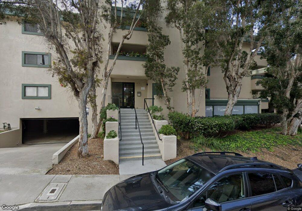
917 Torrance St Unit 12 San Diego, CA 92103
Middletown NeighborhoodEstimated Value: $653,000 - $681,789
2
Beds
2
Baths
1,052
Sq Ft
$636/Sq Ft
Est. Value
About This Home
This home is located at 917 Torrance St Unit 12, San Diego, CA 92103 and is currently estimated at $668,596, approximately $635 per square foot. 917 Torrance St Unit 12 is a home located in San Diego County with nearby schools including Grant K-8, Richard Henry Dana Middle School, and Roosevelt International Middle School.
Ownership History
Date
Name
Owned For
Owner Type
Purchase Details
Closed on
Aug 6, 2024
Sold by
Lullo William J and Garcia-Lullo Carlos
Bought by
Lullo Family Trust and Lullo
Current Estimated Value
Purchase Details
Closed on
Jun 8, 2015
Sold by
Lullo William J
Bought by
Lullo William J and Garcia Carlos Lopez
Purchase Details
Closed on
Apr 7, 1997
Sold by
Mcintire Robin A and Barr Robin Barr
Bought by
Lullo William J
Home Financials for this Owner
Home Financials are based on the most recent Mortgage that was taken out on this home.
Original Mortgage
$105,450
Interest Rate
7.86%
Purchase Details
Closed on
Jul 15, 1994
Sold by
Mcintire Robin A
Bought by
Mcintire Robin A
Home Financials for this Owner
Home Financials are based on the most recent Mortgage that was taken out on this home.
Original Mortgage
$105,400
Interest Rate
8.25%
Mortgage Type
FHA
Purchase Details
Closed on
Aug 1, 1986
Create a Home Valuation Report for This Property
The Home Valuation Report is an in-depth analysis detailing your home's value as well as a comparison with similar homes in the area
Home Values in the Area
Average Home Value in this Area
Purchase History
| Date | Buyer | Sale Price | Title Company |
|---|---|---|---|
| Lullo Family Trust | -- | None Listed On Document | |
| Lullo William J | -- | None Listed On Document | |
| Lullo William J | -- | None Available | |
| Lullo William J | $111,000 | Fidelity National Title | |
| Oswald Robin Barr | -- | Fidelity National Title | |
| Mcintire Robin A | -- | Union Land Title Company | |
| -- | $99,000 | -- |
Source: Public Records
Mortgage History
| Date | Status | Borrower | Loan Amount |
|---|---|---|---|
| Previous Owner | Lullo William J | $105,450 | |
| Previous Owner | Mcintire Robin A | $105,400 |
Source: Public Records
Tax History Compared to Growth
Tax History
| Year | Tax Paid | Tax Assessment Tax Assessment Total Assessment is a certain percentage of the fair market value that is determined by local assessors to be the total taxable value of land and additions on the property. | Land | Improvement |
|---|---|---|---|---|
| 2025 | $2,122 | $180,753 | $63,265 | $117,488 |
| 2024 | $2,122 | $177,210 | $62,025 | $115,185 |
| 2023 | $2,074 | $173,736 | $60,809 | $112,927 |
| 2022 | $2,017 | $170,330 | $59,617 | $110,713 |
| 2021 | $2,002 | $166,992 | $58,449 | $108,543 |
| 2020 | $1,977 | $165,281 | $57,850 | $107,431 |
| 2019 | $1,940 | $162,041 | $56,716 | $105,325 |
| 2018 | $1,814 | $158,864 | $55,604 | $103,260 |
| 2017 | $1,769 | $155,750 | $54,514 | $101,236 |
| 2016 | $1,739 | $152,697 | $53,446 | $99,251 |
| 2015 | $1,795 | $150,405 | $52,644 | $97,761 |
| 2014 | -- | $147,459 | $51,613 | $95,846 |
Source: Public Records
Map
Nearby Homes
- 1235 1239 Lincoln Ave
- 3505 Ibis St
- 3635 Kite St
- 3448 Goldfinch St
- 0 Bush St Unit (35-38) 240005385
- 3467 Reynard Way Unit A
- 3354 Hawk St
- 301 W Brookes Ave
- 3566 Albatross St
- 1570 Linwood St
- 3963 Eagle St Unit 8
- 3320 Horton Ave
- 3972 Jackdaw St
- 3972 Jackdaw St Unit 109
- 1695 Neale St
- 3206-16 Reynard Way
- 3568 Front St Unit D
- 1694 Torrance St
- 3535 Columbia St
- 1617 Chalmers St
- 917 Torrance St Unit 14
- 917 Torrance St Unit 18
- 917 Torrance St Unit 17
- 917 Torrance St Unit 16
- 917 Torrance St Unit 15
- 917 Torrance St Unit 13
- 917 Torrance St Unit 11
- 917 Torrance St Unit 10
- 917 Torrance St Unit 9
- 917 Torrance St Unit 8
- 917 Torrance St Unit 7
- 917 Torrance St Unit 6
- 917 Torrance St Unit 5
- 917 Torrance St Unit 4
- 917 Torrance St Unit 3
- 917 Torrance St Unit 2
- 917 Torrance St Unit 1
- 917 Torrance St Unit 24
- 917 Torrance St Unit 23
- 917 Torrance St Unit 22