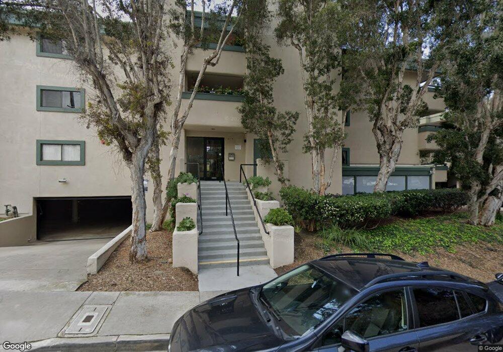
917 Torrance St Unit 15 San Diego, CA 92103
Middletown NeighborhoodEstimated Value: $631,000 - $698,000
2
Beds
2
Baths
1,052
Sq Ft
$630/Sq Ft
Est. Value
About This Home
This home is located at 917 Torrance St Unit 15, San Diego, CA 92103 and is currently estimated at $662,505, approximately $629 per square foot. 917 Torrance St Unit 15 is a home located in San Diego County with nearby schools including Grant K-8, Richard Henry Dana Middle School, and Roosevelt International Middle School.
Ownership History
Date
Name
Owned For
Owner Type
Purchase Details
Closed on
Sep 15, 2020
Sold by
Eller Charles G and Declaration Of Trust
Bought by
Eller Charles G and Trust C Declaration Of Trust
Current Estimated Value
Purchase Details
Closed on
Feb 20, 1996
Sold by
Eller Charles G and Eller Gloria C
Bought by
Eller Charles G and Eller Gloria C
Purchase Details
Closed on
Jun 23, 1995
Sold by
Bement Kristi Sue and Eller Rhondi Sue
Bought by
Eller Charles G and Eller Gloria C
Create a Home Valuation Report for This Property
The Home Valuation Report is an in-depth analysis detailing your home's value as well as a comparison with similar homes in the area
Home Values in the Area
Average Home Value in this Area
Purchase History
| Date | Buyer | Sale Price | Title Company |
|---|---|---|---|
| Eller Charles G | -- | None Available | |
| Eller Charles G | -- | -- | |
| Eller Charles G | -- | -- |
Source: Public Records
Tax History Compared to Growth
Tax History
| Year | Tax Paid | Tax Assessment Tax Assessment Total Assessment is a certain percentage of the fair market value that is determined by local assessors to be the total taxable value of land and additions on the property. | Land | Improvement |
|---|---|---|---|---|
| 2025 | $2,395 | $196,279 | $73,943 | $122,336 |
| 2024 | $2,395 | $192,432 | $72,494 | $119,938 |
| 2023 | $2,342 | $188,660 | $71,073 | $117,587 |
| 2022 | $2,280 | $184,962 | $69,680 | $115,282 |
| 2021 | $2,265 | $181,336 | $68,314 | $113,022 |
| 2020 | $2,238 | $179,478 | $67,614 | $111,864 |
| 2019 | $2,198 | $175,960 | $66,289 | $109,671 |
| 2018 | $2,056 | $172,511 | $64,990 | $107,521 |
| 2017 | $2,008 | $169,129 | $63,716 | $105,413 |
| 2016 | $1,975 | $165,814 | $62,467 | $103,347 |
| 2015 | $1,946 | $163,324 | $61,529 | $101,795 |
| 2014 | $1,916 | $160,125 | $60,324 | $99,801 |
Source: Public Records
Map
Nearby Homes
- 3505 Ibis St
- 1235 1239 Lincoln Ave
- 3635 Kite St
- 3448 Goldfinch St
- 3354 Hawk St
- 0 Bush St Unit (35-38) 240005385
- 3467 Reynard Way Unit A
- 301 W Brookes Ave
- 3320 Horton Ave
- 3566 Albatross St
- 1570 Linwood St
- 3206-16 Reynard Way
- 3318-20 Union St
- 3535 Columbia St
- 3531 Columbia St
- 1695 Neale St
- 3963 Eagle St Unit 8
- 3109 Hawk St
- 3972 Jackdaw St
- 3972 Jackdaw St Unit 109
- 917 Torrance St Unit 14
- 917 Torrance St Unit 18
- 917 Torrance St Unit 17
- 917 Torrance St Unit 16
- 917 Torrance St Unit 13
- 917 Torrance St Unit 12
- 917 Torrance St Unit 11
- 917 Torrance St Unit 10
- 917 Torrance St Unit 9
- 917 Torrance St Unit 8
- 917 Torrance St Unit 7
- 917 Torrance St Unit 6
- 917 Torrance St Unit 5
- 917 Torrance St Unit 4
- 917 Torrance St Unit 3
- 917 Torrance St Unit 2
- 917 Torrance St Unit 1
- 917 Torrance St Unit 24
- 917 Torrance St Unit 23
- 917 Torrance St Unit 22