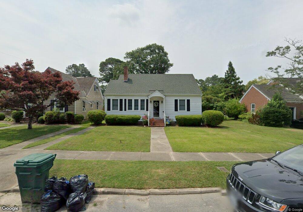
917 Virginia Ave Suffolk, VA 23434
Holy Neck NeighborhoodEstimated Value: $240,093 - $252,000
2
Beds
2
Baths
1,300
Sq Ft
$190/Sq Ft
Est. Value
About This Home
This home is located at 917 Virginia Ave, Suffolk, VA 23434 and is currently estimated at $247,023, approximately $190 per square foot. 917 Virginia Ave is a home located in Suffolk City with nearby schools including Elephant's Fork Elementary School, King's Fork Middle School, and King's Fork High School.
Ownership History
Date
Name
Owned For
Owner Type
Purchase Details
Closed on
Nov 29, 2023
Sold by
Sherard Samuel H and Sherard Mary Virginia
Bought by
Ringer Megan
Current Estimated Value
Home Financials for this Owner
Home Financials are based on the most recent Mortgage that was taken out on this home.
Original Mortgage
$222,888
Outstanding Balance
$218,724
Interest Rate
7.63%
Mortgage Type
FHA
Estimated Equity
$28,299
Create a Home Valuation Report for This Property
The Home Valuation Report is an in-depth analysis detailing your home's value as well as a comparison with similar homes in the area
Home Values in the Area
Average Home Value in this Area
Purchase History
| Date | Buyer | Sale Price | Title Company |
|---|---|---|---|
| Ringer Megan | $227,000 | Fidelity National Title | |
| Ringer Megan | $227,000 | Fidelity National Title |
Source: Public Records
Mortgage History
| Date | Status | Borrower | Loan Amount |
|---|---|---|---|
| Open | Ringer Megan | $222,888 | |
| Closed | Ringer Megan | $222,888 |
Source: Public Records
Tax History
| Year | Tax Paid | Tax Assessment Tax Assessment Total Assessment is a certain percentage of the fair market value that is determined by local assessors to be the total taxable value of land and additions on the property. | Land | Improvement |
|---|---|---|---|---|
| 2025 | $2,566 | $197,800 | $58,400 | $139,400 |
| 2024 | $2,566 | $183,700 | $58,400 | $125,300 |
| 2023 | $2,359 | $172,500 | $58,400 | $114,100 |
| 2022 | $1,918 | $176,000 | $53,100 | $122,900 |
| 2021 | $1,836 | $165,400 | $42,500 | $122,900 |
| 2020 | $1,648 | $148,500 | $42,500 | $106,000 |
| 2019 | $1,648 | $148,500 | $42,500 | $106,000 |
| 2018 | $1,697 | $143,300 | $42,500 | $100,800 |
| 2017 | $1,533 | $143,300 | $42,500 | $100,800 |
| 2016 | $1,533 | $143,300 | $42,500 | $100,800 |
| 2015 | $831 | $143,300 | $42,500 | $100,800 |
| 2014 | $831 | $143,300 | $42,500 | $100,800 |
Source: Public Records
Map
Nearby Homes
- 909 Howard Place
- 921 Howard Place
- 721 Ashley Ave Unit A
- 812 Battery Ave
- 814 Battery Ave
- 309 Linden Ave
- 603 Mason Ave
- 314 Linden Ave
- 730 Brook Ave
- 731 Brook Ave
- 608 Battery Ave
- 630 Brook Ave
- 711 Brook Ave
- 207 Saint James Ave
- LOT 18 Brook Ave
- 117 Bute St
- 203 Saint James Ave
- 532 Battery Ave
- 212 Saint James Ave
- 112 Linden Ave
- 915 Virginia Ave
- 919 Virginia Ave
- 913 Virginia Ave
- 914 Pennsylvania Ave
- 918 Pennsylvania Ave
- 406 Park Rd
- 912 Pennsylvania Ave
- 914 Virginia Ave
- 912 Virginia Ave
- 909 Virginia Ave
- 408 Park Rd
- 916 Virginia Ave
- 910 Pennsylvania Ave
- 910 Virginia Ave
- 908 Pennsylvania Ave
- 905 Virginia Ave
- 915 Pennsylvania Ave
- 908 Virginia Ave
- 917 Maryland Ave
- 405 Park Rd
Your Personal Tour Guide
Ask me questions while you tour the home.