Estimated Value: $303,000 - $313,000
3
Beds
2
Baths
1,632
Sq Ft
$188/Sq Ft
Est. Value
About This Home
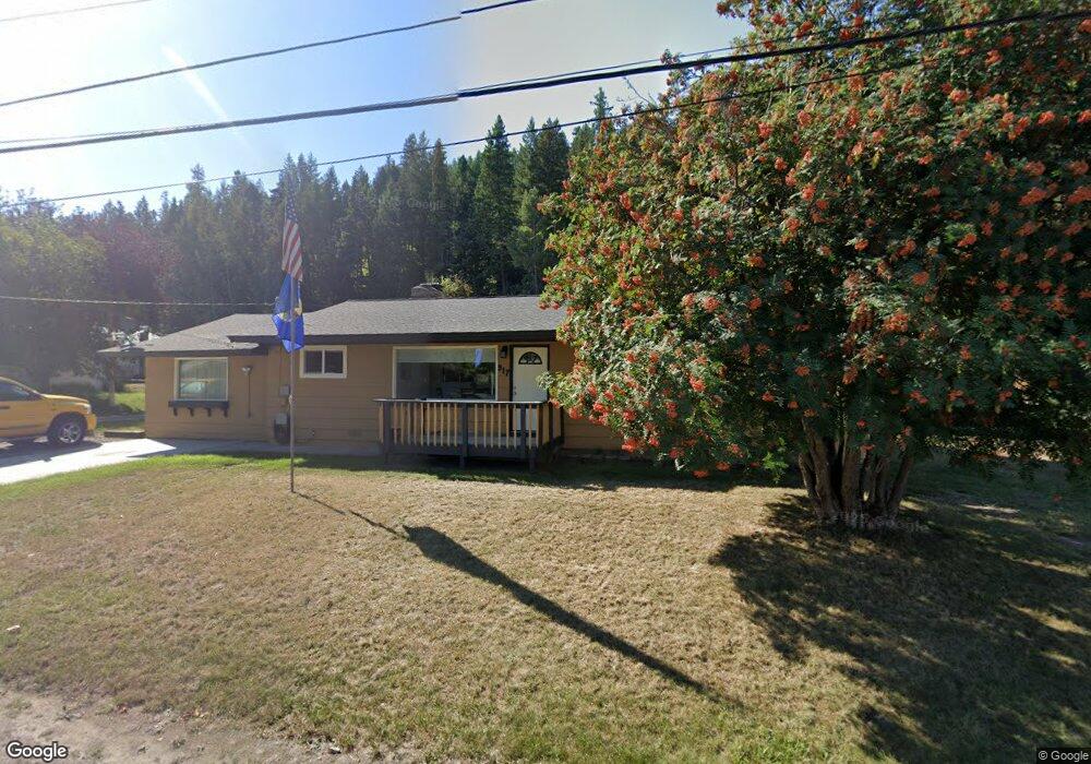
This home is located at 917 W Balsam St, Libby, MT 59923 and is currently estimated at $307,489, approximately $188 per square foot. 917 W Balsam St is a home located in Lincoln County with nearby schools including Libby Elementary School, Libby High School, and Kootenai Valley Christian School.
Ownership History
Date
Name
Owned For
Owner Type
Purchase Details
Closed on
Aug 29, 2023
Sold by
Lutsko Marc J and Lutsko Tama J
Bought by
Mohr Robinson Sperry and Stewart Cernick Johnathan
Current Estimated Value
Purchase Details
Closed on
Sep 28, 2015
Sold by
Anderson Carol Ann
Bought by
Guss Darrell
Home Financials for this Owner
Home Financials are based on the most recent Mortgage that was taken out on this home.
Original Mortgage
$90,387
Interest Rate
3.9%
Mortgage Type
VA
Create a Home Valuation Report for This Property
The Home Valuation Report is an in-depth analysis detailing your home's value as well as a comparison with similar homes in the area
Home Values in the Area
Average Home Value in this Area
Purchase History
| Date | Buyer | Sale Price | Title Company |
|---|---|---|---|
| Mohr Robinson Sperry | -- | Flying S Title & Escrow | |
| Guss Darrell | -- | First American Title Company |
Source: Public Records
Mortgage History
| Date | Status | Borrower | Loan Amount |
|---|---|---|---|
| Previous Owner | Guss Darrell | $90,387 |
Source: Public Records
Tax History Compared to Growth
Tax History
| Year | Tax Paid | Tax Assessment Tax Assessment Total Assessment is a certain percentage of the fair market value that is determined by local assessors to be the total taxable value of land and additions on the property. | Land | Improvement |
|---|---|---|---|---|
| 2025 | $1,052 | $281,700 | $0 | $0 |
| 2024 | $1,511 | $231,500 | $0 | $0 |
| 2023 | $1,918 | $231,500 | $0 | $0 |
| 2022 | $1,048 | $135,800 | $0 | $0 |
| 2021 | $1,277 | $135,800 | $0 | $0 |
| 2020 | $1,325 | $115,500 | $0 | $0 |
| 2019 | $1,310 | $115,500 | $0 | $0 |
| 2018 | $1,291 | $106,500 | $0 | $0 |
| 2017 | $1,003 | $106,500 | $0 | $0 |
| 2016 | $1,128 | $94,500 | $0 | $0 |
| 2015 | $705 | $94,400 | $0 | $0 |
| 2014 | $994 | $68,370 | $0 | $0 |
Source: Public Records
Map
Nearby Homes
- 917 Croteau Rd
- 1511 Main Ave
- 205 W Poplar St
- 1009 Idaho Ave
- 52 Avenue A
- Tbd, Lot 5 Parmenter Dr
- Tbd, Lot 1 Parmenter Dr
- 36811 U S Highway 2
- 1111 Montana Ave
- Nhn Montana 37
- 919 Mineral Ave
- 211 E Cedar St
- Tbd, Lot 3 Parmenter Rd
- Tbd, Lot 2 Parmenter Rd
- Tbd, Lot 4 Parmenter Rd
- 712 Main Ave
- 1403 Louisiana Ave
- 808 Mineral Ave
- 804 Mineral Ave
- 1221 Utah Ave
- 1511 Gallatin Ave
- 907 W Balsam St
- 1510 Custer Ave
- 1009 W Balsam St
- 906 W Balsam St
- 817 W Balsam St
- 1507 Custer Ave
- 1017 W Balsam St
- 812 W Balsam St
- 1105 W Balsam St
- 1508 Kaniksu Ave
- 1504 Kaniksu Ave
- 1514 Kaniksu Ave
- 802 W Balsam St
- 601 W Haschke St
- 1117 W Balsam St
- 1503 Kaniksu Ave
- 1507 Kaniksu Ave
- 1513 Kaniksu Ave
- 1519 Kaniksu Ave