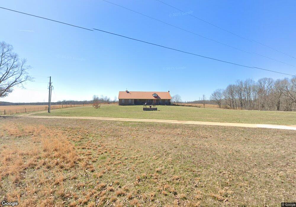
9173 Ella Gallaher Rd Westpoint, TN 38486
Estimated Value: $408,000 - $731,058
--
Bed
3
Baths
3,104
Sq Ft
$183/Sq Ft
Est. Value
About This Home
This home is located at 9173 Ella Gallaher Rd, Westpoint, TN 38486 and is currently estimated at $569,529, approximately $183 per square foot. 9173 Ella Gallaher Rd is a home located in Wayne County.
Ownership History
Date
Name
Owned For
Owner Type
Purchase Details
Closed on
Aug 21, 2023
Sold by
Bradley Joan and Bradley Travis
Bought by
Bradley Jared and Bradley Samantha
Current Estimated Value
Purchase Details
Closed on
Aug 8, 2012
Sold by
Bradley Jared Lance
Bought by
Bradley Samantha Elizabeth
Purchase Details
Closed on
May 27, 2004
Bought by
Jones Particia Ann
Purchase Details
Closed on
Jul 6, 1965
Bought by
Edith Bradley J and Edith Bradley
Create a Home Valuation Report for This Property
The Home Valuation Report is an in-depth analysis detailing your home's value as well as a comparison with similar homes in the area
Home Values in the Area
Average Home Value in this Area
Purchase History
| Date | Buyer | Sale Price | Title Company |
|---|---|---|---|
| Bradley Jared | -- | None Listed On Document | |
| Bradley Samantha Elizabeth | -- | -- | |
| Jones Particia Ann | $10,000 | -- | |
| Edith Bradley J | -- | -- |
Source: Public Records
Tax History Compared to Growth
Tax History
| Year | Tax Paid | Tax Assessment Tax Assessment Total Assessment is a certain percentage of the fair market value that is determined by local assessors to be the total taxable value of land and additions on the property. | Land | Improvement |
|---|---|---|---|---|
| 2024 | $2,414 | $111,375 | $15,675 | $95,700 |
| 2023 | $2,135 | $111,375 | $15,675 | $95,700 |
| 2022 | $2,135 | $111,375 | $15,675 | $95,700 |
| 2021 | $2,349 | $111,375 | $15,675 | $95,700 |
| 2020 | $2,517 | $102,150 | $14,125 | $88,025 |
| 2019 | $2,517 | $109,450 | $14,125 | $95,325 |
| 2018 | $2,517 | $109,450 | $14,125 | $95,325 |
| 2017 | $2,517 | $109,450 | $14,125 | $95,325 |
| 2016 | $2,244 | $109,450 | $14,125 | $95,325 |
| 2014 | $2,169 | $104,779 | $0 | $0 |
Source: Public Records
Map
Nearby Homes
- 0 California Branch Rd
- 4013 Andrews Grocery Rd
- 366 Ridge Rd
- 2732 Railroad Bed Rd
- 0 Double Branch Rd Unit 10203942
- 139 Water Tower Rd
- 130 Water Tower Rd
- 109 W Cherry St
- 2034 Tennessee St
- 322 Creekside Ln
- 2016 Tennessee St
- 0 Factory Creek Rd
- 437 S Ore Rd
- 2 Hardin Loop
- 7 Hardin Loop
- 2 Canaan Rd
- 8276 Middle Butler Rd
- 3795 Wayland Springs Rd
- 0 S Randall Rd
- 3065 Bucksnort Ridge Rd
- 5199 Nelson Rd
- 1099 Couch Branch Rd
- 0 Couch Branch Rd
- 0 Todd Rd Unit RTC2360130
- 0 Todd Rd Unit RTC2360128
- 5143 Nelson Rd
- 7587 Todd Rd
- 7522 Todd Rd
- 1241 Factors Fork Rd
- 1265 Factors Fork Rd
- 117 Calton Ln
- 7593 Todd Rd
- 1155 Factors Fork Rd
- 2015 Fred Todd Rd
- 8609 California Branch Rd
- 8621 California Branch Rd