Estimated Value: $1,486,000 - $2,043,114
3
Beds
5
Baths
3,564
Sq Ft
$468/Sq Ft
Est. Value
About This Home
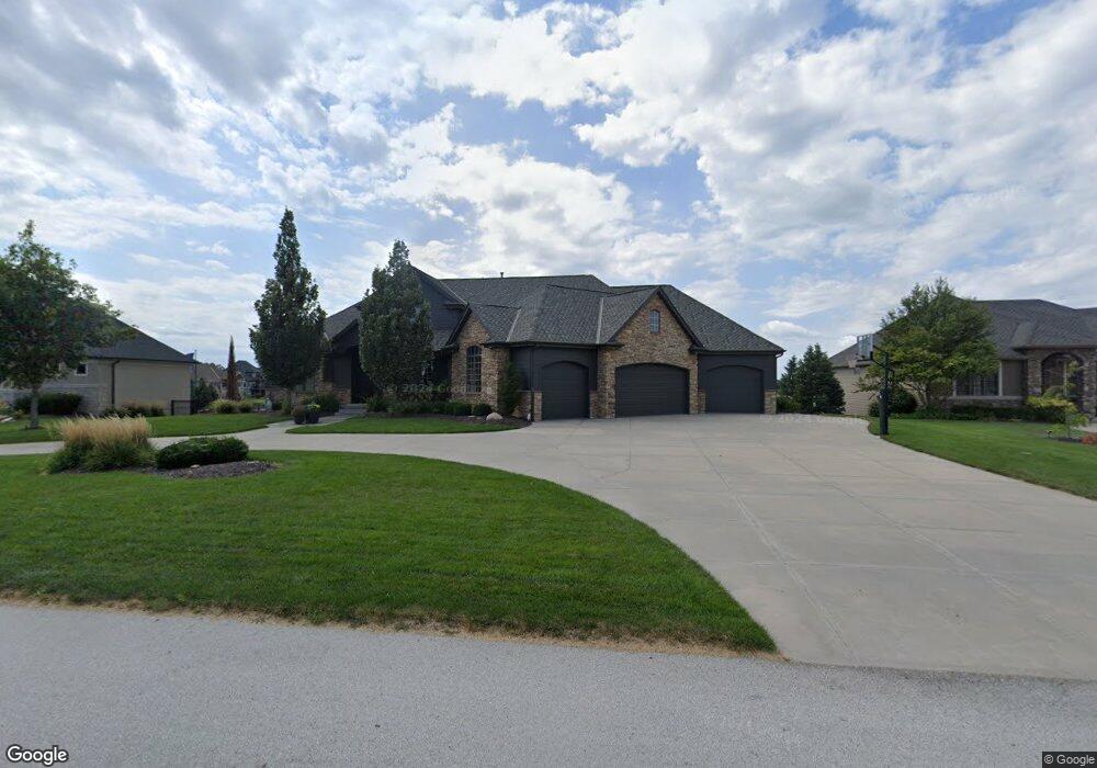
This home is located at 918 249, Omaha, NE 68069 and is currently estimated at $1,668,279, approximately $468 per square foot. 918 249 is a home located in Douglas County with nearby schools including Douglas County West Elementary School, Douglas County West Middle School, and Douglas County West High School.
Ownership History
Date
Name
Owned For
Owner Type
Purchase Details
Closed on
Jul 26, 2016
Sold by
Windingstad Anthony J and Windingstad Brigitte M
Bought by
Schembari John E and Schembari Melissa A
Current Estimated Value
Home Financials for this Owner
Home Financials are based on the most recent Mortgage that was taken out on this home.
Original Mortgage
$500,000
Outstanding Balance
$388,128
Interest Rate
2.75%
Mortgage Type
Adjustable Rate Mortgage/ARM
Estimated Equity
$1,280,151
Purchase Details
Closed on
Jan 11, 2006
Sold by
Century Development Co Llc
Bought by
Anthony J Windingstad
Create a Home Valuation Report for This Property
The Home Valuation Report is an in-depth analysis detailing your home's value as well as a comparison with similar homes in the area
Purchase History
| Date | Buyer | Sale Price | Title Company |
|---|---|---|---|
| Schembari John E | $1,125,000 | Missouri River Title | |
| Anthony J Windingstad | $135,000 | -- |
Source: Public Records
Mortgage History
| Date | Status | Borrower | Loan Amount |
|---|---|---|---|
| Open | Schembari John E | $500,000 |
Source: Public Records
Tax History
| Year | Tax Paid | Tax Assessment Tax Assessment Total Assessment is a certain percentage of the fair market value that is determined by local assessors to be the total taxable value of land and additions on the property. | Land | Improvement |
|---|---|---|---|---|
| 2025 | $16,952 | $1,369,700 | $246,400 | $1,123,300 |
| 2024 | $17,823 | $1,369,700 | $246,400 | $1,123,300 |
| 2023 | $17,823 | $1,104,800 | $246,400 | $858,400 |
| 2022 | $19,824 | $1,104,800 | $246,400 | $858,400 |
| 2021 | $18,520 | $1,000,700 | $246,400 | $754,300 |
| 2020 | $18,998 | $1,000,700 | $246,400 | $754,300 |
| 2019 | $19,449 | $934,000 | $196,700 | $737,300 |
| 2018 | $19,590 | $934,000 | $196,700 | $737,300 |
| 2017 | $18,215 | $865,800 | $196,700 | $669,100 |
| 2016 | $16,310 | $750,000 | $140,000 | $610,000 |
Source: Public Records
Map
Nearby Homes
- 25016 Emile Cir
- 612 S 249th Cir
- 519 S 249th Cir
- 24920 Farnam Cir
- 917 S 243rd St
- 909 S 243rd St
- 23720 Mary Jo Ln
- 22722 S Shore Dr
- 460 Lakehurst Dr
- 3202 S 229th St
- 22715 Sanctuary Ridge Dr
- 22607 Sanctuary Ridge Dr
- 22718 Sanctuary Ridge Dr
- 22513 Sanctuary Ridge Dr
- 22711 Sanctuary Ridge Dr
- 23715 Mary Jo Ln
- 23708 Mary Jo Ln
- 23721 Mary Jo Ln
- 23714 Mary Jo Ln
- 22714 Sanctuary Ridge Dr
- 918 S 249th St
- 918 S 249th Cir
- 910 S 249th Cir
- 926 S 249th St
- 926 S 249th Cir
- 902 S 249th Cir
- 902 S 249th St
- 915 S 249th Cir
- 927 S 249th Cir
- 24910 Mason St
- 840 S 249th St
- 840 S 249th Cir
- 24819 Jones Cir
- 931 S 249th Cir
- 24918 Mason St
- 832 S 249th Cir
- 832 S 249th St
- 24811 Jones Cir
- 24926 Mason St
- 824 S 249th Cir
Your Personal Tour Guide
Ask me questions while you tour the home.