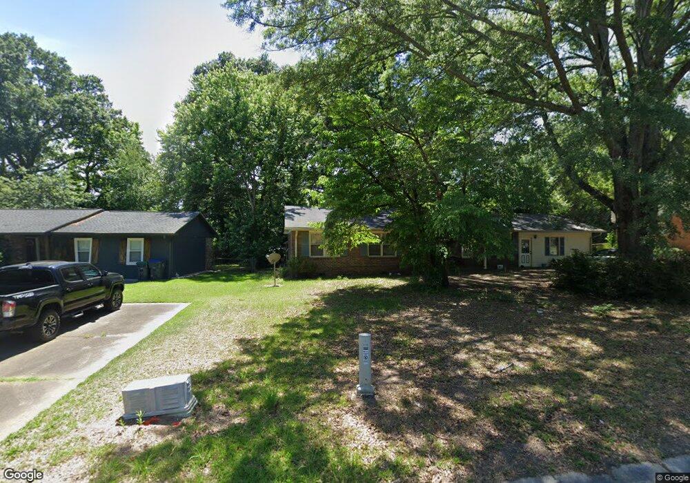
918 Forest Ridge Dr SE Unit 2 Marietta, GA 30067
Powers Park NeighborhoodEstimated Value: $325,339 - $374,000
3
Beds
2
Baths
1,367
Sq Ft
$254/Sq Ft
Est. Value
About This Home
This home is located at 918 Forest Ridge Dr SE Unit 2, Marietta, GA 30067 and is currently estimated at $347,835, approximately $254 per square foot. 918 Forest Ridge Dr SE Unit 2 is a home located in Cobb County with nearby schools including Powers Ferry Elementary School, East Cobb Middle School, and Wheeler High School.
Ownership History
Date
Name
Owned For
Owner Type
Purchase Details
Closed on
Aug 20, 1999
Sold by
Powers Ferry United Methodist
Bought by
Morris David W
Current Estimated Value
Home Financials for this Owner
Home Financials are based on the most recent Mortgage that was taken out on this home.
Original Mortgage
$104,500
Outstanding Balance
$29,480
Interest Rate
7.65%
Mortgage Type
New Conventional
Estimated Equity
$318,355
Create a Home Valuation Report for This Property
The Home Valuation Report is an in-depth analysis detailing your home's value as well as a comparison with similar homes in the area
Home Values in the Area
Average Home Value in this Area
Purchase History
| Date | Buyer | Sale Price | Title Company |
|---|---|---|---|
| Morris David W | $101,500 | -- |
Source: Public Records
Mortgage History
| Date | Status | Borrower | Loan Amount |
|---|---|---|---|
| Open | Morris David W | $104,500 |
Source: Public Records
Tax History Compared to Growth
Tax History
| Year | Tax Paid | Tax Assessment Tax Assessment Total Assessment is a certain percentage of the fair market value that is determined by local assessors to be the total taxable value of land and additions on the property. | Land | Improvement |
|---|---|---|---|---|
| 2025 | $589 | $120,264 | $40,000 | $80,264 |
| 2024 | $591 | $120,264 | $40,000 | $80,264 |
| 2023 | $385 | $120,264 | $40,000 | $80,264 |
| 2022 | $2,517 | $113,048 | $18,000 | $95,048 |
| 2021 | $1,862 | $83,120 | $18,000 | $65,120 |
| 2020 | $1,862 | $83,120 | $18,000 | $65,120 |
| 2019 | $1,664 | $74,040 | $18,000 | $56,040 |
| 2018 | $1,606 | $71,412 | $18,000 | $53,412 |
| 2017 | $1,567 | $71,412 | $18,000 | $53,412 |
| 2016 | $1,274 | $57,988 | $20,000 | $37,988 |
| 2015 | $1,055 | $46,968 | $17,480 | $29,488 |
| 2014 | $1,063 | $46,968 | $0 | $0 |
Source: Public Records
Map
Nearby Homes
- 2409 Powers Ferry Dr SE
- 2330 Trellis Ln SE
- 1051 Oriole Ln SE
- 830 Bonnie Glen Dr SE
- 2238 Surrey Ct SE
- 789 Gardenside Cir SE
- 2160 Palmyra Dr SE
- 2223 Runnymead Ridge SE
- 2240 Runnymead Ridge SE
- 1189 Ashborough Dr SE Unit L
- 2471 Cedar Brook W
- 2484 Cedar Canyon Rd SE
- 708 Hanover Ln SE
- 1804 Ashborough Way SE Unit L
- 2497 Cedar Canyon Place SE
- 1818 Ashborough Cir SE Unit E
- 558 Lullingstone Dr SE
- 1819 Ashborough Cir SE Unit F
- 1820 Ashborough Rd SE Unit B
- 567 Boyds Dr SE
- 926 Forest Ridge Dr SE
- 910 Forest Ridge Dr SE
- 921 Forest Ridge Dr SE
- 936 Forest Ridge Dr SE
- 917 Forest Ridge Dr SE Unit 2
- 902 Forest Ridge Dr SE
- 907 Forest Ridge Dr SE Unit 2
- 937 Forest Ridge Dr SE
- 946 Forest Ridge Dr SE
- 894 Forest Ridge Dr SE
- 897 Forest Ridge Dr SE Unit 2
- 947 Forest Ridge Dr SE Unit 2
- 2272 Powers Ferry Dr SE
- 886 Forest Ridge Dr SE Unit 2
- 2278 Powers Ferry Dr SE Unit 2
- 889 Forest Ridge Dr SE
- 2260 Powers Ferry Dr SE
- 876 Forest Ridge Dr SE
- 2258 Powers Ferry Dr SE
- 879 Forest Ridge Dr SE