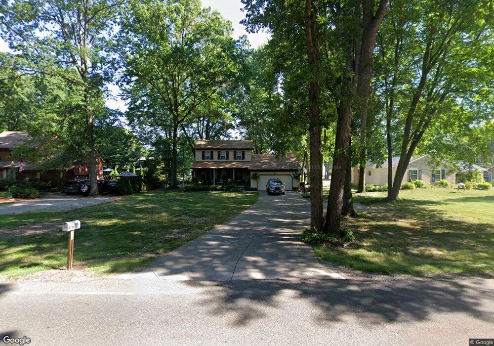
918 Shields Rd Youngstown, OH 44511
Estimated Value: $233,016 - $291,000
3
Beds
2
Baths
1,638
Sq Ft
$154/Sq Ft
Est. Value
About This Home
This home is located at 918 Shields Rd, Youngstown, OH 44511 and is currently estimated at $252,754, approximately $154 per square foot. 918 Shields Rd is a home located in Mahoning County with nearby schools including West Boulevard Elementary School, Boardman Center Middle School, and Boardman High School.
Ownership History
Date
Name
Owned For
Owner Type
Purchase Details
Closed on
Apr 4, 2002
Sold by
Lipka William C
Bought by
Testa Michael A and Sicilia Angela B
Current Estimated Value
Home Financials for this Owner
Home Financials are based on the most recent Mortgage that was taken out on this home.
Original Mortgage
$124,019
Outstanding Balance
$51,448
Interest Rate
6.82%
Mortgage Type
FHA
Estimated Equity
$201,306
Purchase Details
Closed on
Mar 20, 1995
Sold by
Moulin Frank
Bought by
Lipka William C
Home Financials for this Owner
Home Financials are based on the most recent Mortgage that was taken out on this home.
Original Mortgage
$57,000
Interest Rate
8.66%
Mortgage Type
New Conventional
Purchase Details
Closed on
Oct 30, 1979
Bought by
Moulin Frank and Moulin Cynthia
Create a Home Valuation Report for This Property
The Home Valuation Report is an in-depth analysis detailing your home's value as well as a comparison with similar homes in the area
Home Values in the Area
Average Home Value in this Area
Purchase History
| Date | Buyer | Sale Price | Title Company |
|---|---|---|---|
| Testa Michael A | $125,000 | -- | |
| Lipka William C | $107,000 | -- | |
| Moulin Frank | -- | -- |
Source: Public Records
Mortgage History
| Date | Status | Borrower | Loan Amount |
|---|---|---|---|
| Open | Testa Michael A | $124,019 | |
| Closed | Lipka William C | $57,000 |
Source: Public Records
Tax History Compared to Growth
Tax History
| Year | Tax Paid | Tax Assessment Tax Assessment Total Assessment is a certain percentage of the fair market value that is determined by local assessors to be the total taxable value of land and additions on the property. | Land | Improvement |
|---|---|---|---|---|
| 2024 | $3,267 | $64,570 | $11,740 | $52,830 |
| 2023 | $3,223 | $64,570 | $11,740 | $52,830 |
| 2022 | $3,138 | $48,090 | $10,660 | $37,430 |
| 2021 | $3,140 | $48,090 | $10,660 | $37,430 |
| 2020 | $3,156 | $48,090 | $10,660 | $37,430 |
| 2019 | $3,384 | $46,240 | $10,250 | $35,990 |
| 2018 | $2,929 | $46,240 | $10,250 | $35,990 |
| 2017 | $2,763 | $46,240 | $10,250 | $35,990 |
| 2016 | $2,600 | $40,670 | $10,250 | $30,420 |
| 2015 | $2,548 | $40,670 | $10,250 | $30,420 |
| 2014 | $2,555 | $40,670 | $10,250 | $30,420 |
| 2013 | $2,522 | $40,670 | $10,250 | $30,420 |
Source: Public Records
Map
Nearby Homes
- 990 Westport Dr
- 21.19 acres Truesdale and Lockwood Rd
- 29 Gillian Ln
- 537 W Glen Dr
- 5200 West Blvd Unit 505
- 5670 Tracy Dr
- 1342 Shields Rd
- 138 Robinhood Way
- 4042 Baymar Dr
- 715 Crestview Dr
- 3927 Hopkins Rd
- 5097 Tippwood Ct
- 772 Ewing Rd
- 4478 Devonshire Dr Unit 1B
- 272 Shields Rd
- 5020 Friendship Ave
- 4506 Green Glen Dr
- 813 Brookfield Ave
- 4096 Bob o Link Dr
- 1422 Turnberry Dr
- 900 Shields Rd
- 936 Shields Rd
- 923 Greyledge Place
- 917 Greyledge Place
- 880 Shields Rd
- 950 Shields Rd
- 867 Westport Dr
- 5231 Winged Foot Dr
- 5221 Winged Foot Dr
- 881 Westport Dr
- 868 Shields Rd
- 5211 Oyster Bay Dr
- 853 Westport Dr
- 929 Greyledge Place
- 970 Shields Rd
- 911 Westport Dr
- 849 Westport Dr
- 854 Shields Rd
- 935 Greyledge Place
- 5211 Winged Foot Dr