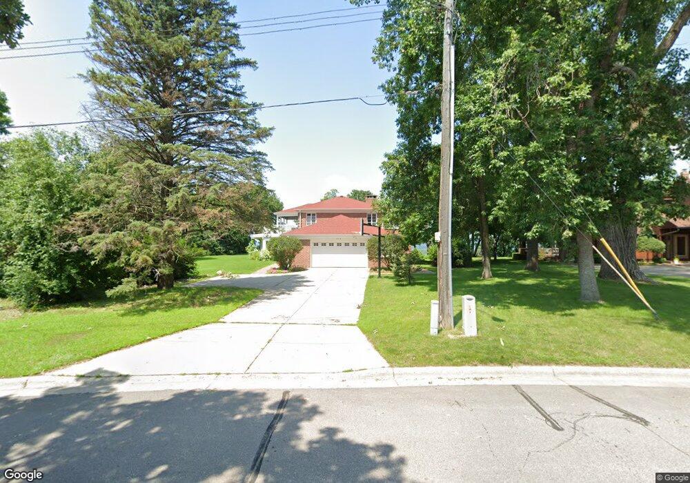
918 W 6th St Red Wing, MN 55066
Estimated Value: $442,000 - $902,589
6
Beds
2
Baths
4,062
Sq Ft
$176/Sq Ft
Est. Value
About This Home
This home is located at 918 W 6th St, Red Wing, MN 55066 and is currently estimated at $714,530, approximately $175 per square foot. 918 W 6th St is a home located in Goodhue County with nearby schools including Sunnyside Elementary School, Burnside Elementary School, and Twin Bluff Middle School.
Ownership History
Date
Name
Owned For
Owner Type
Purchase Details
Closed on
Jun 26, 2025
Sold by
Robert A Desutter Qualified Personal Res and Desutter Robert A
Bought by
Robert A Desutter Red Wing Residence Trust and Hines
Current Estimated Value
Purchase Details
Closed on
May 15, 2020
Sold by
Desutter Ann C and Desutter Robert A
Bought by
Desutter Ann C and Desutter Robert A
Create a Home Valuation Report for This Property
The Home Valuation Report is an in-depth analysis detailing your home's value as well as a comparison with similar homes in the area
Home Values in the Area
Average Home Value in this Area
Purchase History
| Date | Buyer | Sale Price | Title Company |
|---|---|---|---|
| Robert A Desutter Red Wing Residence Trust | $500 | None Listed On Document | |
| Ann C Desutter Red Wing Residence Trust | $500 | None Listed On Document | |
| Desutter Ann C | -- | None Available | |
| Desutter Robert A | -- | None Available | |
| Desutter Robert A | -- | None Available |
Source: Public Records
Tax History Compared to Growth
Tax History
| Year | Tax Paid | Tax Assessment Tax Assessment Total Assessment is a certain percentage of the fair market value that is determined by local assessors to be the total taxable value of land and additions on the property. | Land | Improvement |
|---|---|---|---|---|
| 2025 | $11,958 | $827,600 | $155,900 | $671,700 |
| 2024 | -- | $814,400 | $155,800 | $658,600 |
| 2023 | $11,586 | $800,700 | $155,800 | $644,900 |
| 2022 | $10,726 | $792,400 | $152,500 | $639,900 |
| 2021 | $9,972 | $679,300 | $152,500 | $526,800 |
| 2020 | $9,832 | $645,200 | $152,500 | $492,700 |
| 2019 | $9,868 | $600,400 | $152,500 | $447,900 |
| 2018 | $8,396 | $608,400 | $152,500 | $455,900 |
| 2017 | $7,768 | $555,800 | $152,500 | $403,300 |
| 2016 | $7,164 | $526,400 | $152,500 | $373,900 |
| 2015 | $6,900 | $511,600 | $152,500 | $359,100 |
| 2014 | -- | $491,600 | $152,500 | $339,100 |
Source: Public Records
Map
Nearby Homes
- 815 W 4th St
- 1062 Putnam Ave
- 802 West Ave
- 1029 Putnam Ave
- 1012 West Ave
- 1130 W 4th St
- 716 Central Ave
- 523 East Ave Unit 211
- 523 East Ave Unit 213
- 924 Central Ave
- 642 Grace St
- 222 Bush St Unit 402
- 222 Bush St Unit 302
- 222 Bush St Unit 404
- 222 Bush St Unit 303
- 222 Bush St Unit 301
- 222 Bush St Unit 304
- 222 Bush St Unit 401
- 1108 Hawthorne St
- 1109 East Ave