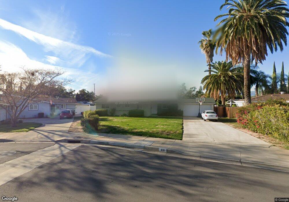
918 W Clark St Redlands, CA 92373
South Redlands NeighborhoodEstimated Value: $545,845 - $603,000
4
Beds
2
Baths
1,296
Sq Ft
$438/Sq Ft
Est. Value
About This Home
This home is located at 918 W Clark St, Redlands, CA 92373 and is currently estimated at $567,711, approximately $438 per square foot. 918 W Clark St is a home located in San Bernardino County with nearby schools including McKinley Elementary School, Cope Middle School, and Redlands Senior High School.
Ownership History
Date
Name
Owned For
Owner Type
Purchase Details
Closed on
Dec 18, 2023
Sold by
Templeton Richard and Templeton Maria A
Bought by
Templeton Family Trust and Templeton
Current Estimated Value
Purchase Details
Closed on
Apr 12, 2013
Sold by
Richards Timothy M and Richards Christine E
Bought by
Templeton Richard and Templeton Eva
Purchase Details
Closed on
Jul 22, 2005
Sold by
Frey James L
Bought by
Richards Jean A
Purchase Details
Closed on
Jul 21, 2005
Sold by
Richards Jean A
Bought by
Prope Richards Jean A and Prope Jean A Richards Separate
Purchase Details
Closed on
Mar 7, 1996
Sold by
Richards Jean A and Richards Jean A
Bought by
Richards Jean A
Home Financials for this Owner
Home Financials are based on the most recent Mortgage that was taken out on this home.
Original Mortgage
$31,000
Interest Rate
7.01%
Create a Home Valuation Report for This Property
The Home Valuation Report is an in-depth analysis detailing your home's value as well as a comparison with similar homes in the area
Home Values in the Area
Average Home Value in this Area
Purchase History
| Date | Buyer | Sale Price | Title Company |
|---|---|---|---|
| Templeton Family Trust | -- | None Listed On Document | |
| Templeton Richard | $175,000 | Lawyers Title | |
| Richards Jean A | -- | -- | |
| Prope Richards Jean A | -- | -- | |
| Richards Jean A | -- | Commonwealth Land Title Co |
Source: Public Records
Mortgage History
| Date | Status | Borrower | Loan Amount |
|---|---|---|---|
| Previous Owner | Richards Jean A | $31,000 |
Source: Public Records
Tax History Compared to Growth
Tax History
| Year | Tax Paid | Tax Assessment Tax Assessment Total Assessment is a certain percentage of the fair market value that is determined by local assessors to be the total taxable value of land and additions on the property. | Land | Improvement |
|---|---|---|---|---|
| 2025 | $2,527 | $215,501 | $64,649 | $150,852 |
| 2024 | $2,527 | $211,275 | $63,381 | $147,894 |
| 2023 | $2,525 | $207,132 | $62,138 | $144,994 |
| 2022 | $2,488 | $203,071 | $60,920 | $142,151 |
| 2021 | $2,533 | $199,089 | $59,725 | $139,364 |
| 2020 | $2,496 | $197,048 | $59,113 | $137,935 |
| 2019 | $2,427 | $193,184 | $57,954 | $135,230 |
| 2018 | $2,367 | $189,396 | $56,818 | $132,578 |
| 2017 | $2,347 | $185,682 | $55,704 | $129,978 |
| 2016 | $2,321 | $182,041 | $54,612 | $127,429 |
| 2015 | $2,304 | $179,307 | $53,792 | $125,515 |
| 2014 | $2,263 | $175,794 | $52,738 | $123,056 |
Source: Public Records
Map
Nearby Homes
- 628 W Fern Ave
- 521 Bond St
- 230 S Buena Vista St
- 133 S San Mateo St
- 975 Brookside Ave
- 9440 Hollie Dr
- 1044 W Cypress Ave
- 1110 W Cypress Ave
- 305 W Olive Ave
- 1239 Fulbright Ave
- 24 Grant St
- 636 Harding Dr
- 622 Esther Way
- 325 Lakeside Ave
- 24 N Buena Vista St
- 1302 San Pablo Ave
- 162 Lakeside Ave
- 120 W Olive Ave
- 101 W Fern Ave
- 527 Nottingham Dr