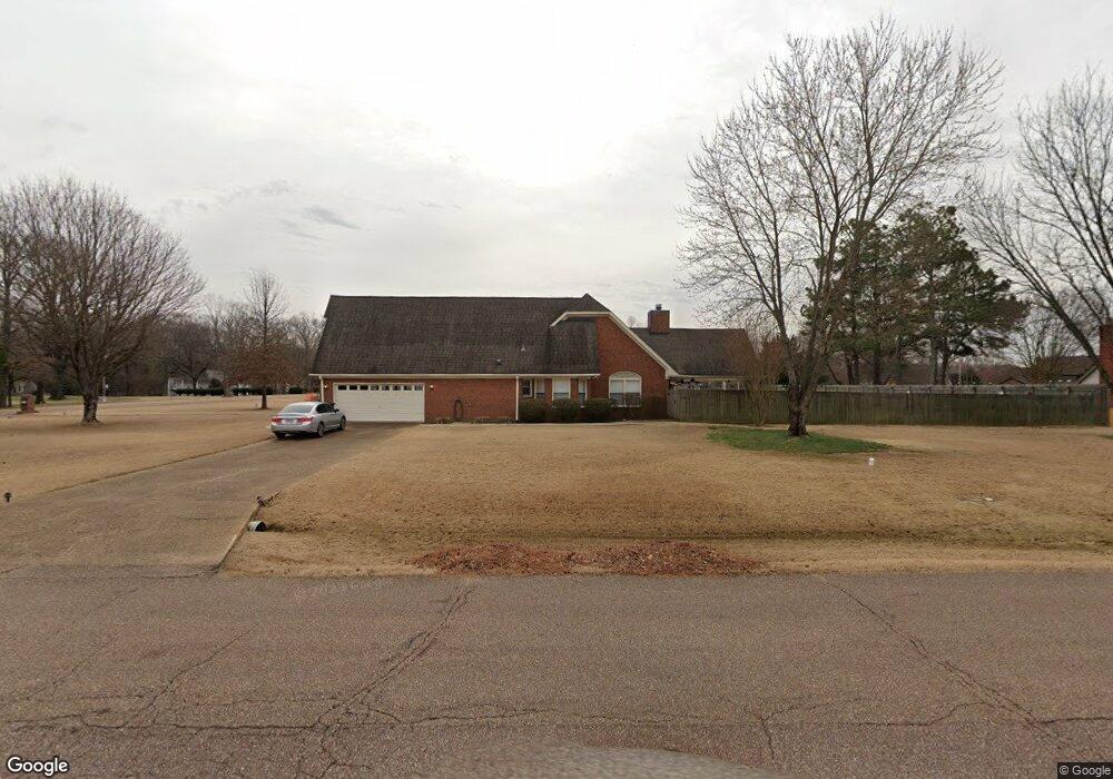
9181 Davies Plantation Rd Memphis, TN 38133
Estimated Value: $432,000 - $554,000
5
Beds
3
Baths
2,595
Sq Ft
$189/Sq Ft
Est. Value
About This Home
This home is located at 9181 Davies Plantation Rd, Memphis, TN 38133 and is currently estimated at $489,946, approximately $188 per square foot. 9181 Davies Plantation Rd is a home located in Shelby County with nearby schools including Bon Lin Elementary School, Bon Lin Middle School, and Bartlett High School.
Ownership History
Date
Name
Owned For
Owner Type
Purchase Details
Closed on
Nov 4, 2024
Sold by
Brown Michael N and Brown Angela G
Bought by
The Michael & Angela Brown Revocable Living T and Brown
Current Estimated Value
Purchase Details
Closed on
Jul 30, 2008
Sold by
Birmingham D Vincent
Bought by
Brown Michael N and Brown Angela G
Home Financials for this Owner
Home Financials are based on the most recent Mortgage that was taken out on this home.
Original Mortgage
$120,000
Interest Rate
6.31%
Mortgage Type
Unknown
Purchase Details
Closed on
May 2, 2007
Sold by
Ashley Wendy Michelle
Bought by
Birmingham D Vincent
Purchase Details
Closed on
Feb 14, 2007
Sold by
Tidwell Kari Lynn
Bought by
Birmingham D Vincent
Purchase Details
Closed on
Apr 3, 2000
Sold by
Vincent Birmingham D
Bought by
Birmingham D Vincent and Ashley Wendy Michelle
Create a Home Valuation Report for This Property
The Home Valuation Report is an in-depth analysis detailing your home's value as well as a comparison with similar homes in the area
Home Values in the Area
Average Home Value in this Area
Purchase History
| Date | Buyer | Sale Price | Title Company |
|---|---|---|---|
| The Michael & Angela Brown Revocable Living T | -- | None Listed On Document | |
| Brown Michael N | $277,000 | None Available | |
| Birmingham D Vincent | -- | Tri State Title & Escrow Inc | |
| Birmingham D Vincent | -- | Tri State Title & Escrow Inc | |
| Birmingham D Vincent | -- | -- |
Source: Public Records
Mortgage History
| Date | Status | Borrower | Loan Amount |
|---|---|---|---|
| Previous Owner | Brown Michael N | $120,000 |
Source: Public Records
Tax History Compared to Growth
Tax History
| Year | Tax Paid | Tax Assessment Tax Assessment Total Assessment is a certain percentage of the fair market value that is determined by local assessors to be the total taxable value of land and additions on the property. | Land | Improvement |
|---|---|---|---|---|
| 2025 | $2,510 | $111,600 | $25,100 | $86,500 |
| 2024 | $2,510 | $74,050 | $18,475 | $55,575 |
| 2023 | $3,791 | $74,050 | $18,475 | $55,575 |
| 2022 | $3,791 | $74,050 | $18,475 | $55,575 |
| 2021 | $3,851 | $74,050 | $18,475 | $55,575 |
| 2020 | $3,747 | $63,725 | $18,475 | $45,250 |
| 2019 | $3,747 | $63,725 | $18,475 | $45,250 |
| 2018 | $3,747 | $63,725 | $18,475 | $45,250 |
| 2017 | $2,619 | $63,725 | $18,475 | $45,250 |
| 2016 | $2,738 | $62,650 | $0 | $0 |
| 2014 | $2,738 | $62,650 | $0 | $0 |
Source: Public Records
Map
Nearby Homes
- 9202 Davies Plantation Rd
- 9005 Pembroke Ellis Dr
- 3510 Sara Woods Dr
- 9245 Ellen Davies Dr
- 9280 Ellen Davies Dr
- 9390 Zachariah Cove
- 9442 Club Walk Ct
- 0 Davies Plantation Rd E Unit 10191976
- 3825 Planters View Rd
- 9200 Fletcher Trace Pkwy
- 3339 Pembroke Ellis Cove
- 3266 Patches Dr
- 3107 Knob Hill Rd Unit 89
- 3066 Barley Mills Cir Unit 26
- 3068 Barley Mills Cir Unit 25
- 3098 Brandon Way Ln
- 3031 Gainsborough Cove
- 3837 Canada Rd
- 9066 Valkrie Ln
- 4041 Hadley Dr
- 3470 Alfred Dr
- 9199 Davies Plantation Rd
- 9155 Davies Plantation Rd
- 3467 Alfred Dr
- 9223 Davies Plantation Rd
- 3511 Davieshire Dr
- 9135 Davies Plantation Rd
- 9164 Gunther Cove
- 3440 Alfred Dr
- 3461 Alfred Dr
- 9233 Davies Plantation Rd
- 3445 Alfred Dr
- 3500 Davieshire Dr
- 3510 Davieshire Dr
- 9170 Gunther Cove
- 9115 Davies Plantation Rd
- 3515 Davieshire Dr
- 3431 Alfred Dr
- 9145 Gunther Cove
- 9159 Gunther Cove